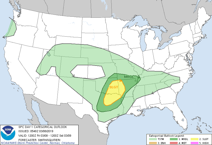
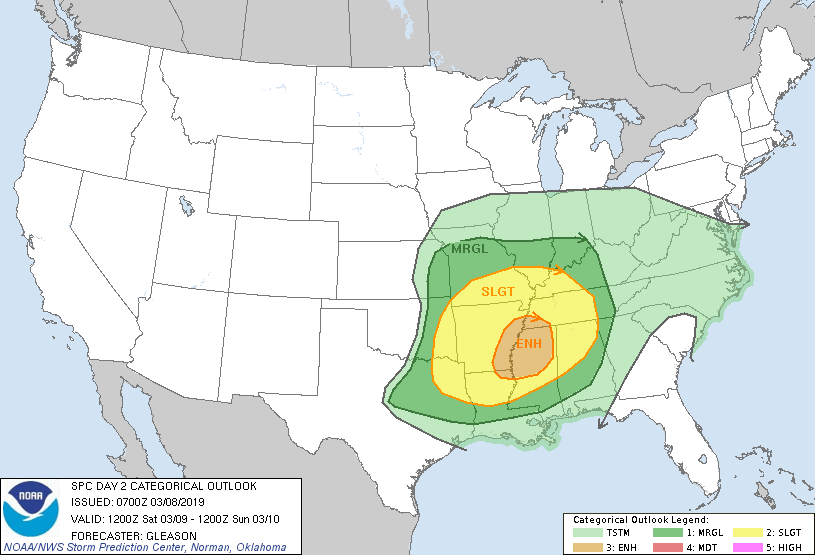
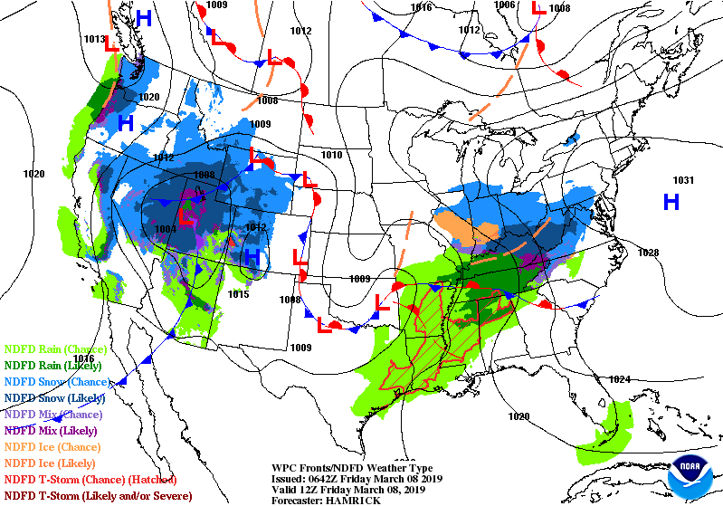
Above...severe threat today in dark green and yellow....below...severe threat for Saturday.....which is a bigger threat and in same area that was hit over last weekend.
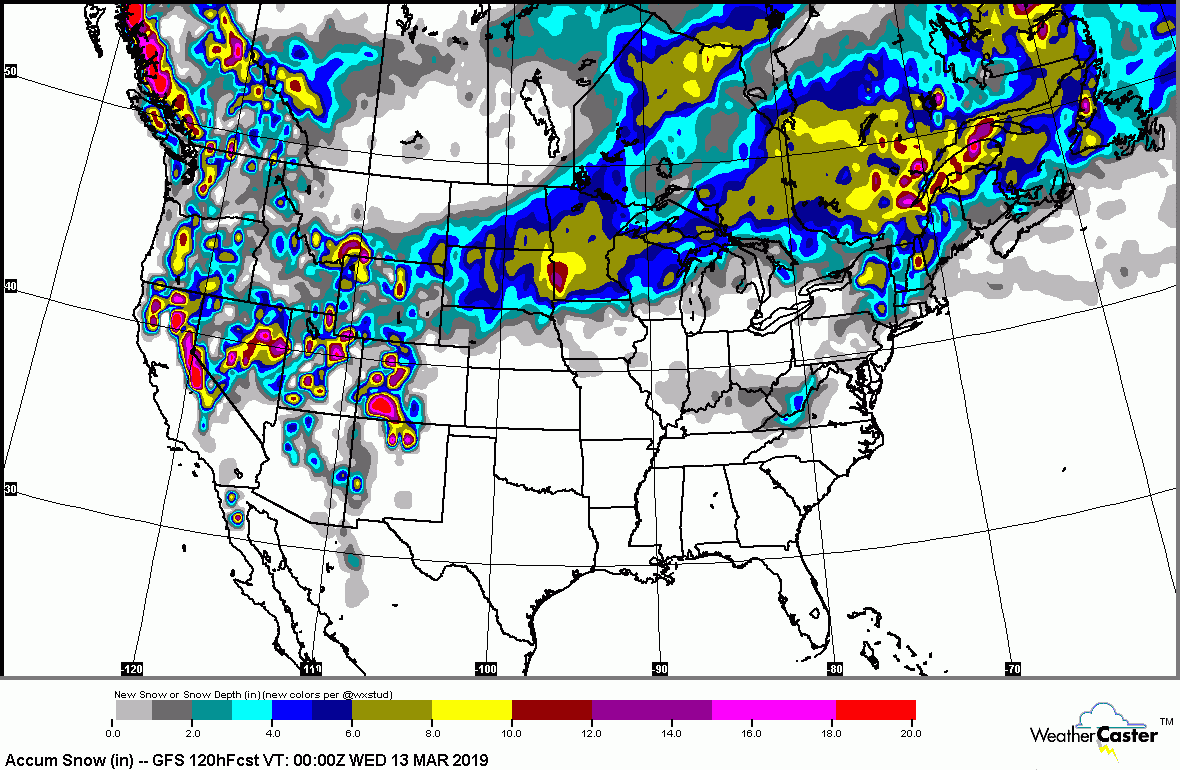
Below- satellite-radar shows storm # 1 moving across Tenn. Valley to Mid Atlantic...weakening with time. 2nd storm comes out of Rockies to Great Lakes and produces near blizzard conditions in No. Plains..with severe weather in south on Saturday.

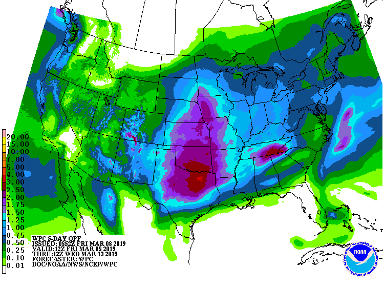
Below- projected snowfall and rainfall into Tuesday......followed by animated maps thru weekend.
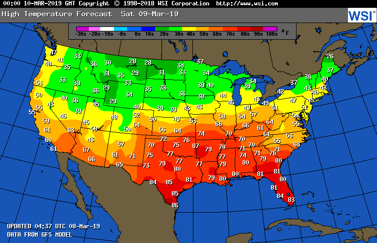
Lastly - high temperatures for Saturday. Be safe.

 RSS Feed
