
Residents from Southern New England to Northern mid Atlantic can breathe a bit easier as the heaviest snowfall will extend from DC into Virginia. The NY Metro area will see an inch or two...while north..little.
The deep colors on the satellite indicate the heaviest snow..staying south of I80. Notice the stream of moisture off the Pacific. This will make for an active southern stream as we move through the week. It may result in wet weather for MardiGra in New Orleans.
The deep colors on the satellite indicate the heaviest snow..staying south of I80. Notice the stream of moisture off the Pacific. This will make for an active southern stream as we move through the week. It may result in wet weather for MardiGra in New Orleans.
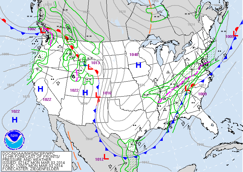
Above.....notice the sharp cut off line of snow from Kentucky to NYC. This is because of that cold high in Minnesota shoving the snow further south. (click on images to enlarge). That high will bring near record cold to the eastern half of the Nation next couple of days.
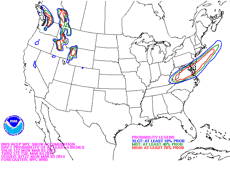
Above.... probabilities of snow......4" or more.
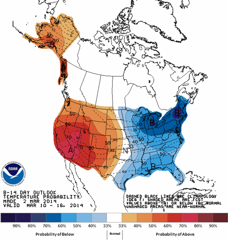
Long range temperature outlook - March 10-16 - 2014.....shows a divided Nation: cold from Mississippi Valley east.... warm west. So as they say....."Go West young man", until tomorrow...be safe.

 RSS Feed
