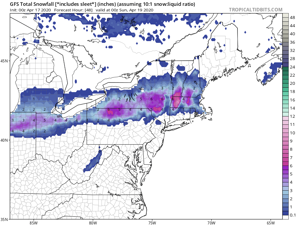
Above...snowfall predictions by GFS Model for Friday night into Saturday. Thinking is that it may be a bit too much...nevertheless...Saturday could be a "white" morning in these places. Below - satellite and radar showing storm moving into Ohio Valley...it will east to affect Northeast and Mid Atlantic tonight and Saturday.

Below - animated maps for next 2 days + total rainfall through Tuesday.


Below- snapshot weather. Please continue to stick to the rules...we are slowly overtaking this virus.

 RSS Feed
