
The plume of moisture from Texas to New England will run up over cold air on the ground and produce heavy snow today from NYC to Washington DC & Baltimore. Quiet weather is back of this system for a while.
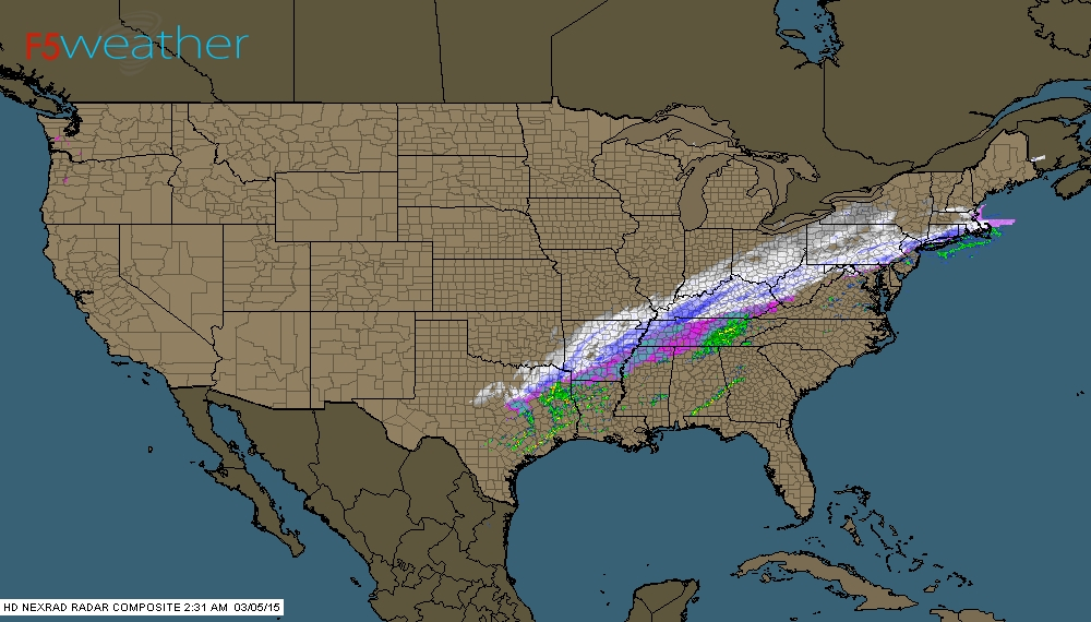
Early morning radar coinciding with satellite picture above.
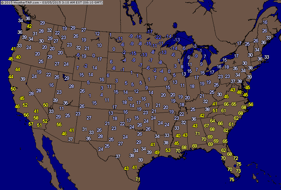
Early morning temperatures showing cold wave moving into The East.
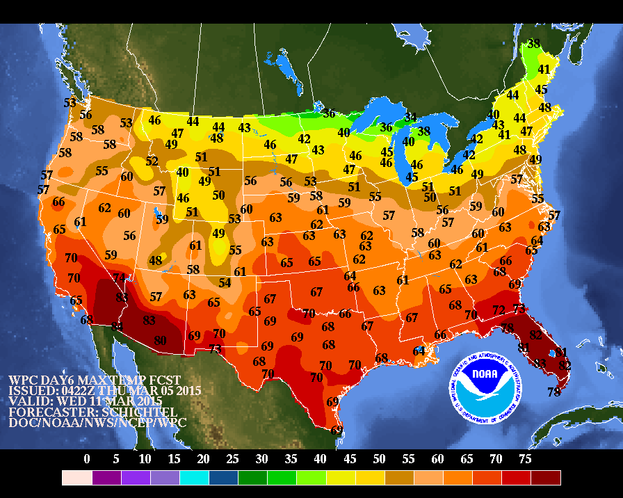
Daytime high temperatures expected next Wednesday....finally looking more like spring.....even summer in the south.
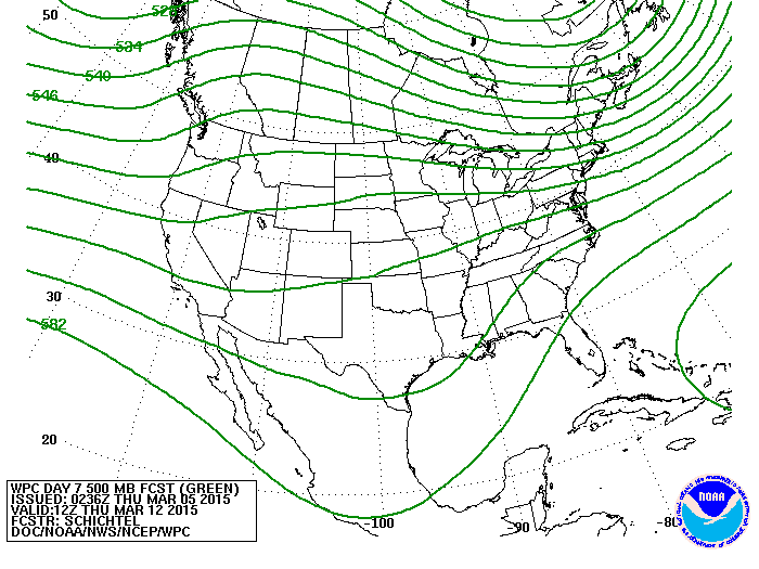
Upper air flow and jet stream for next Thursday. The presence of a strong ridge is absent....so cold air will not be as notable or prevalent. This should lead for more seasonable weather next week. Until then...be safe.

 RSS Feed
