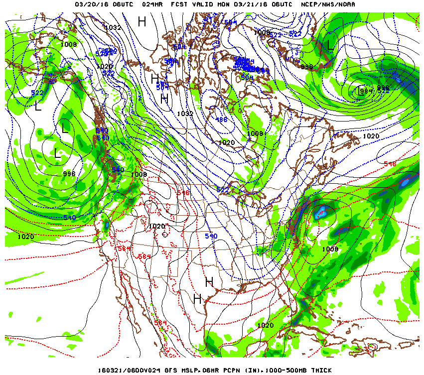
For the fourth model in a row the start time has been delayed. They have also agreed it will start as mixed precipitation before turning to all snow around 9PM for NYC, 7PM for Long Island.
They've also finally agreed that there will be almost no precipitation to start but primary at night, then tapering off again towards the morning. The end time has been extended by an hour, however temperatures will already increase well above freezing and will be a mix of rain/snow.
At the onset, temperatures will be around 37-39°F causing the mixed precip. Around sundown around 9PM temps will still be around 34-36°, and temperatures won't be dipping to the freezing mark around 3-5AM for NYC, 1AM for Long Island.
Unpaved surfaces will have slightly less accumulations, paved surfaces will retain the higher temperatures longer so they'll have less accumulations shown below.
Our current estimate for snowfall and actual accumulation, and start/end times:
NY metro area: 1-2" falling, .50-1" less accumulating 8PM - 8AM
Inland Northern NJ, Lower Hudson Valley .50-1.5" falling, .50" less accumulating 7PM - 8AM
West/Central Connecticut: 1-2" falling, most accumulating 7PM - 8AM
Eastern Connecticut: 4-7" falling, .50-1" less accumulating 8PM - 11AM
Nassau: 3-4" falling, 1-2" less accumulating 7PM - 10AM
Suffolk: 4-5" falling, 1-3" less accumulating 7PM - 10AM
East Suffolk/Montauk: 5-7" falling, 1-3" less accumulating 7PM - 11AM
NYC Snowfall Timeline (again, less will accumulate with temps above freezing):
9PM to 12AM: .50-1" possible, mainly on unpaved surfaces, will be slushy
12AM to 8AM: .50-1" possible, most accumulations happening after 3AM when temps drop to the freezing mark
Sunday temps 37-39°, Sunday night temps 34-36° before 3AM, down to 32° around 5AM
Monday morning: up to 35°F around sunrise at 7AM, then gradually up to 48°F, snow should be all gone by Monday night for NYC, for accumulations above 3" possibly Tuesday.
-Mike Merin


 RSS Feed
