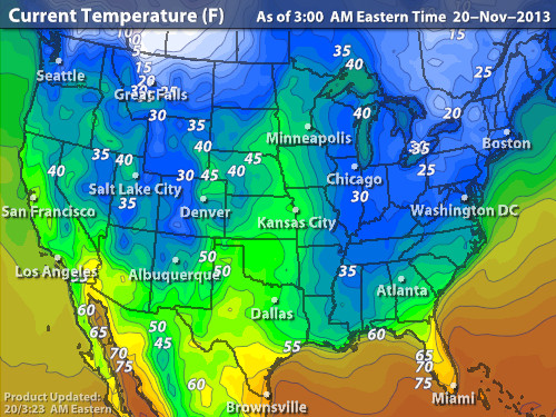
Much of the Nation...chilly to cold this a.m. Notice the "white" in the upper left corner in Canada. That is arctic cold and it's on the way this weekend for much of The Nation. Lots of places will have temps. averaging 10 to 20 below the average...and wind in Northeast will make it even colder!
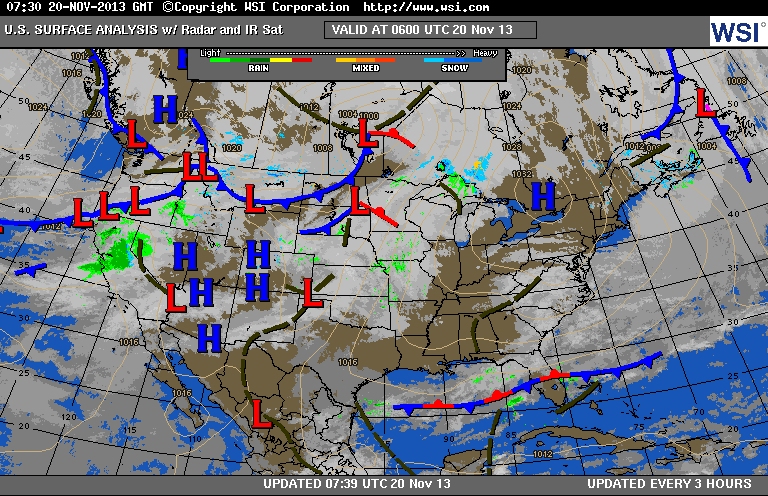
Current weather map showing cold high in the East. Numerous low pressure centers in West will combine and drag arctic air down this weekend. Finally ...a storm in the southwest will head east and present some forecast problems next Wed/Thanksgiving Day for East Coast. I think airport delays are possible Wednesday for East Coast...and then it will not only be cold turkey on Thursday....but you won't want to fly a kite either.
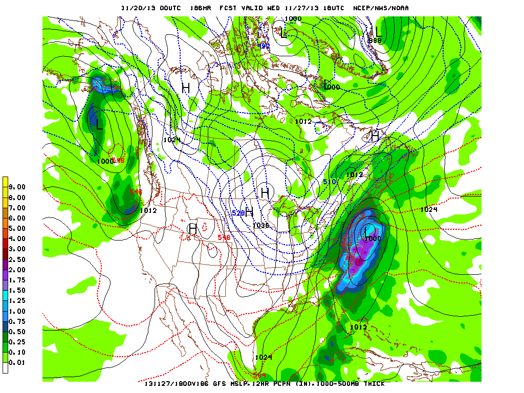
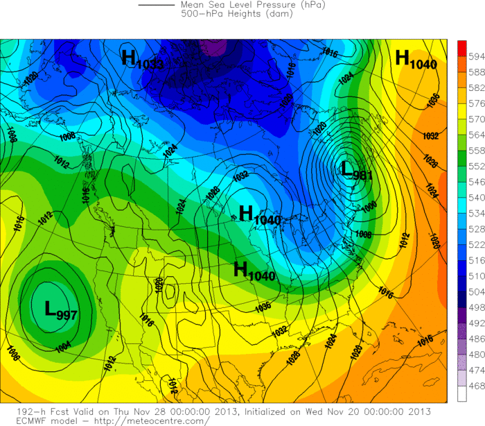
Below...models for Wed/Wed nite next week...prior to Thanksgiving.
1- GFS - robust storm Wed. 2 - Canadian - an even deeper storm..a bit faster 3- Euro - intense storm and even faster. They are coming together...so the timing issue should be resolved this weekend for next week. Just a heads up for traveler's. Later.
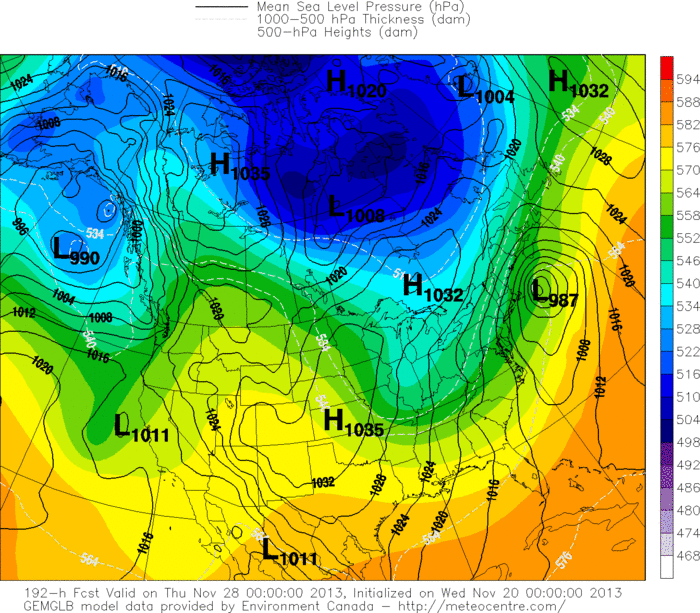

 RSS Feed
