Metro Weather Inc. Services
Like us, follow us, link to us, contact us!
  • Home
    • Daily Weather Discussion
  • Weather Prepared for You
    • Film and TV Production
    • Radio & Television
    • Government and Industry
    • Forensic Services >
      • Weather Record Request Form
    • Metro Morning Monitor
  • About Metro Weather
    • Senior Staff
  • Your Weather Images
  • Contact Us

Sizzling-Southwest, Cooling Down-Northeast

8/31/2017

0 Comments

 
Picture
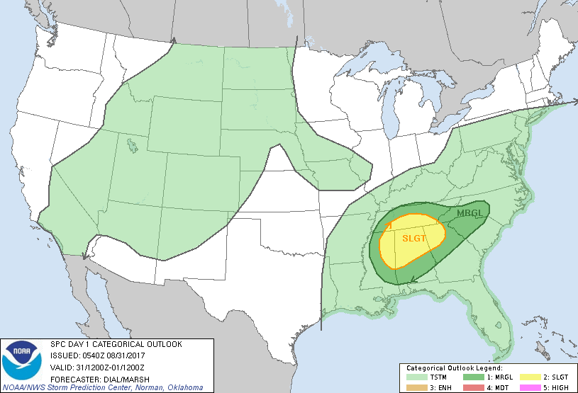
​Harvey spinning away in Louisiana - moving northeast and will bring heavy rain to Tenn & Ohio Valleys then to Northeast Sunday.  Below - risk of severe weather today - in dark green and yellow.
Picture
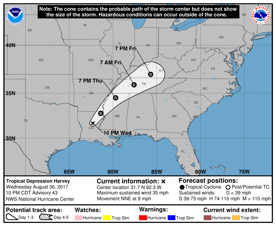
​Below - track of Harvey as a depression. Following that - current map - and animation for next 2 days.
Picture
Picture
Picture
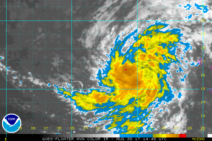
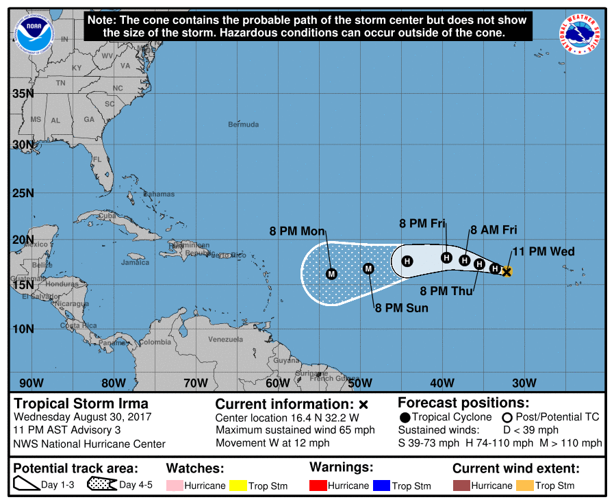
Below...satellite of our latest tropical storm...soon to be Hurricane Irma. She is moving across the So. Atlantic and expected to become a major Hurricane...perhaps even a super hurricane. The track is west for now..but by next week...it's not certain. Models are all over the place and this will not be an easy forecast in advance but will need too be watched closely due to the intensity expected. Until tomorrow...be safe.
​

Picture
Picture
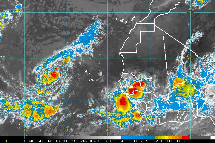
​Oh...1 more thing...look at this satellite....could that be Jose coming off the African coast ? 
Picture
0 Comments


Leave a Reply.

    Genesis of a Tornado
    We'll have daily weather discussions, talking about major systems on the horizon along with anything noteworthy that pops up on our radar.

    Pat Pagano,
    Mike Merin

    Follow us on Twitter and like us on Facebook to get updates whenever we post a new entry!

    RSS Feed

Powered by Create your own unique website with customizable templates.