
Front in Midwest -heads east and showers and storms in progress will head east creating severe threat for Northeast today and tonight.
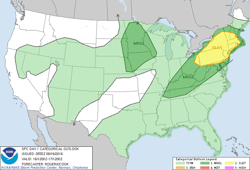
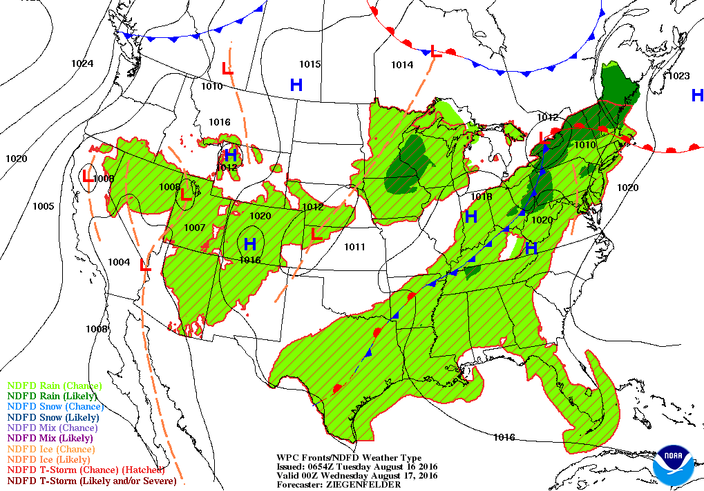
Threat of severe weather today in dark green and yellow. Below..weather map for this evening ....showing cold front approaching from Ohio Valley.
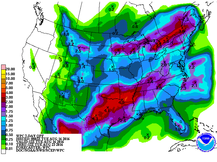
Below...rainfall amounts over next 7 days.
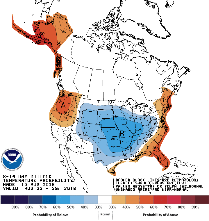
Long range prediction of how temperatures will average through Aug. 29th.
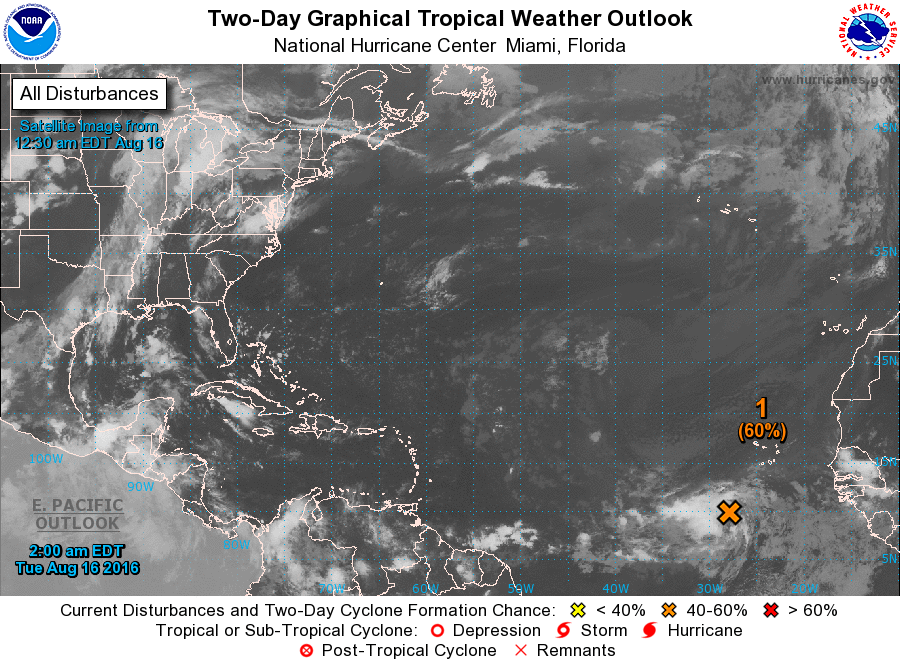
Finally...hurricane center watching disturbance off Africa which has a better than 50% chance of turning into a tropical storm...but many days away. Stay safe.

 RSS Feed
