
Earrly morning radar/satellite showing strong convection...thunderstorms moving into Northeast. This area will expand and affect Ne & MidAtlantic today with severe thunderstorms and possible tornadic activity.
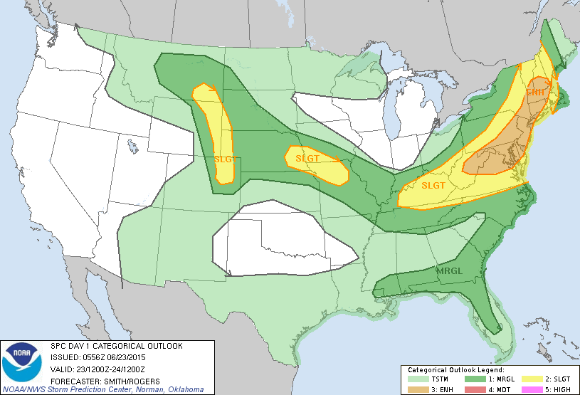
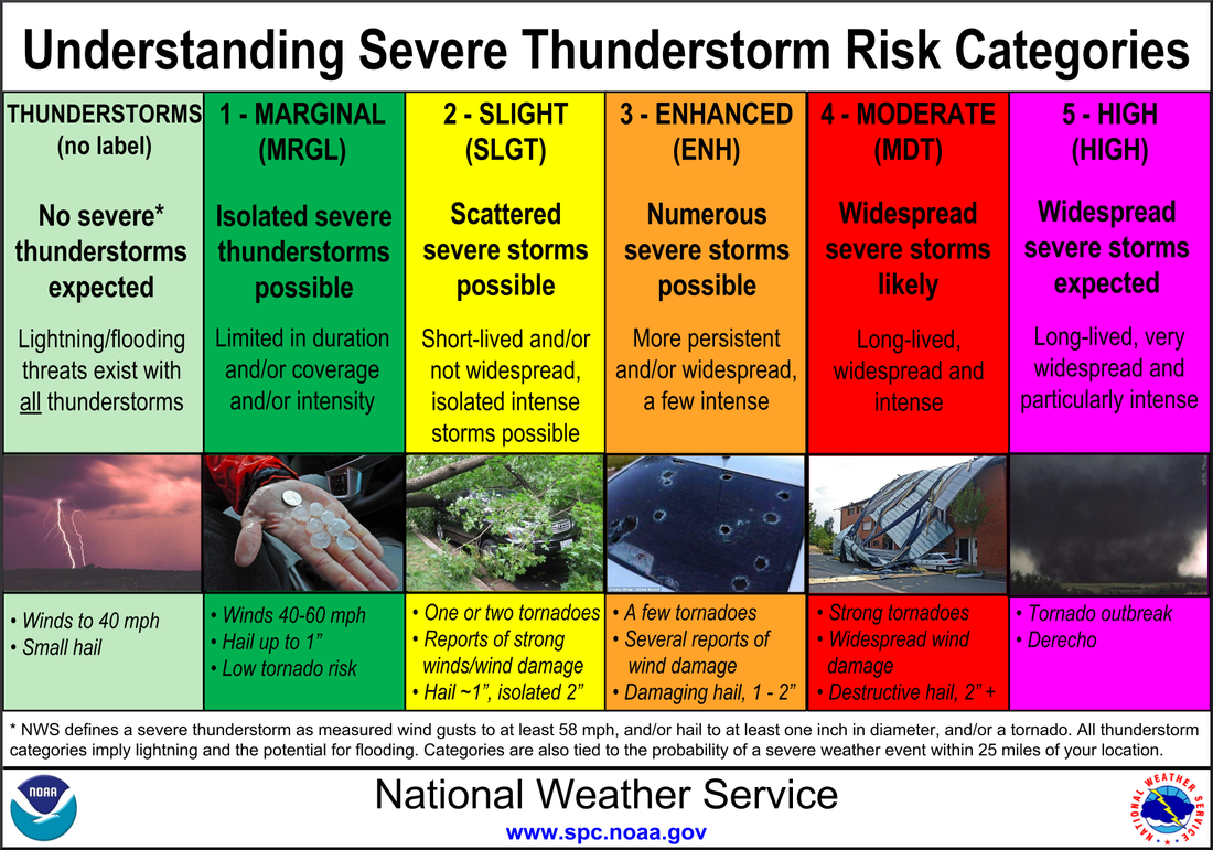
Today's severe weather risk....yellow and tan. Tan is obviously in a better threat which includes 1/4 billion people. Below...is the table to explain threat above.
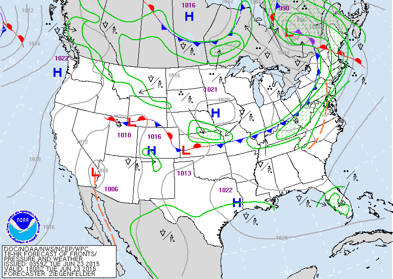
Weather map for mid day Tuesday showing cold front in East with thunderstorms in advance.

These are projected high temperatures for this Sunday.....the cool in East mainly due to clouds and some rain. Scorching - record breaking heat out west.
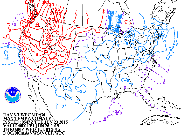
Above....how daytime temperatures will average over next 7 days....as compared to average. Blue = cooler...red = hotter.
Below....amount of rain over the next 7 days. Ugh !
Below....amount of rain over the next 7 days. Ugh !

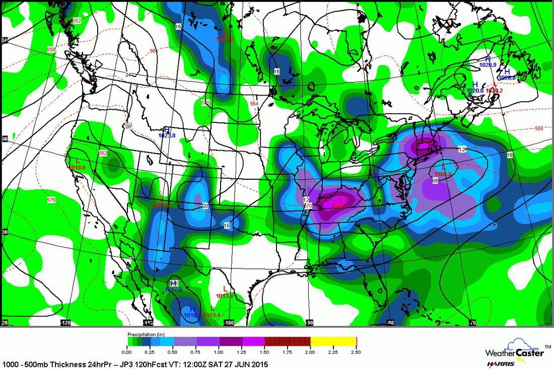
Above - Japan Model for this Saturday showing a double low bringing rain over the Eastern Half of the Nation.
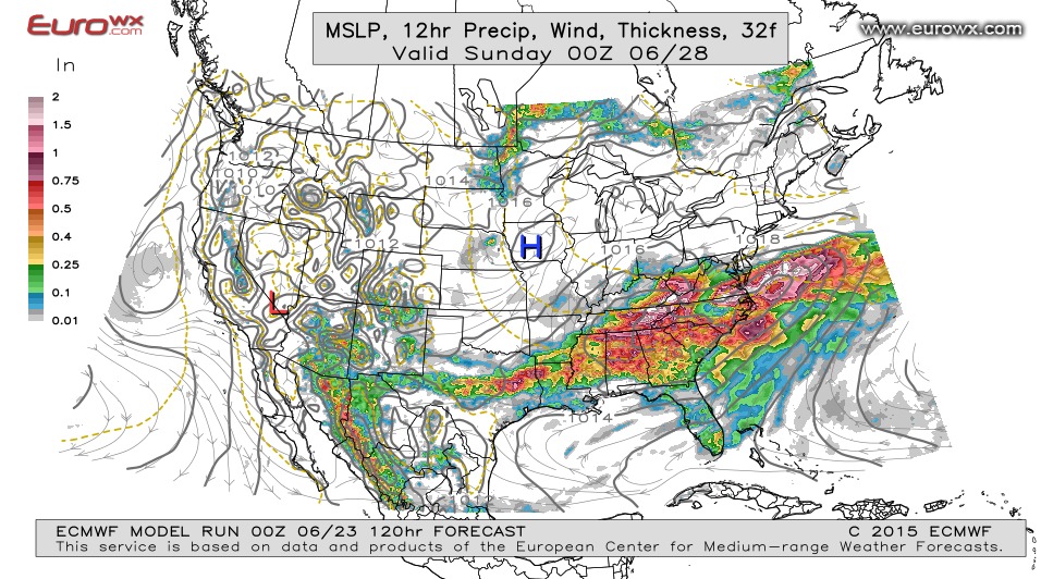
Below...The Euro Model....keeping the rain south of
New England...but overall quite similar. Be safe.
Below...The Euro Model....keeping the rain south of
New England...but overall quite similar. Be safe.

 RSS Feed
