Metro Weather Inc. Services
Like us, follow us, link to us, contact us!
  • Home
    • Daily Weather Discussion
  • Weather Prepared for You
    • Film and TV Production
    • Radio & Television
    • Government and Industry
    • Forensic Services >
      • Weather Record Request Form
    • Metro Morning Monitor
  • About Metro Weather
    • Senior Staff
  • Your Weather Images
  • Contact Us

Severe Weather - Midwest !

6/22/2016

0 Comments

 
Picture
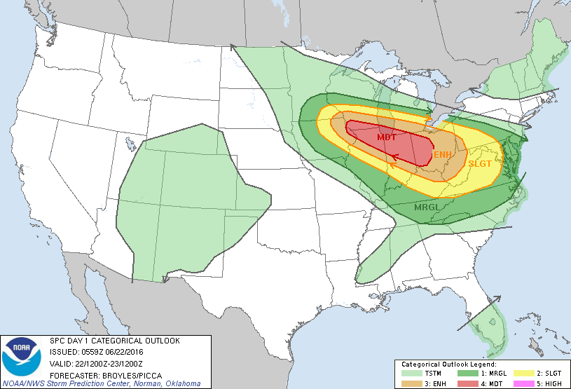
Above...severe outlook for today and tonight shows a moderate risk of severe storms and tornadoes for Midwest and Ohio
​Valley.

Picture
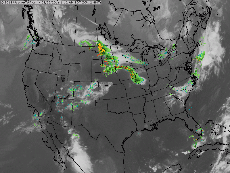
​Satellite radar shows heavy storms from Dakotas to Midwest already....leading us to believe that this will be a rough day ahead.
Picture
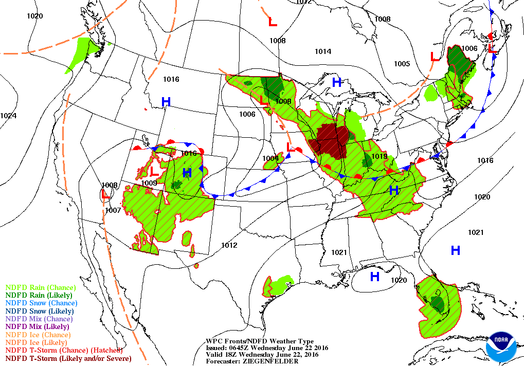
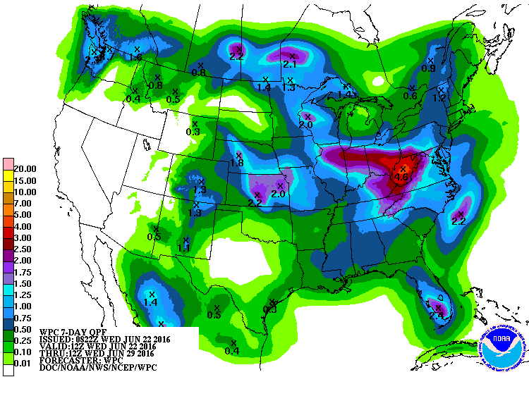
Map above for early afternoon today. Intense area of storms in Midwest moving southeast. Below...rainfall totals for next 7 days.
Picture
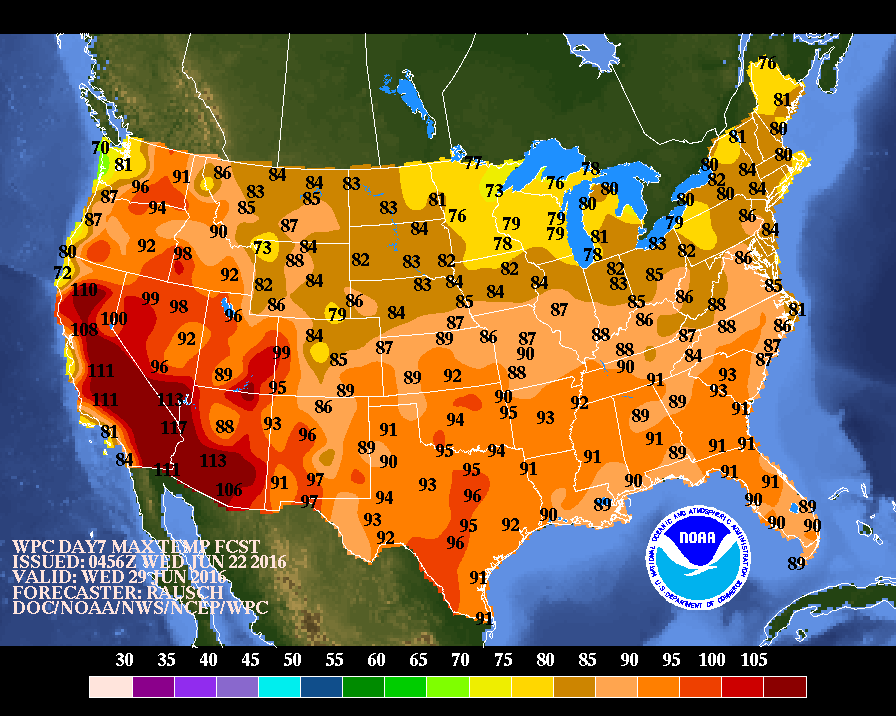
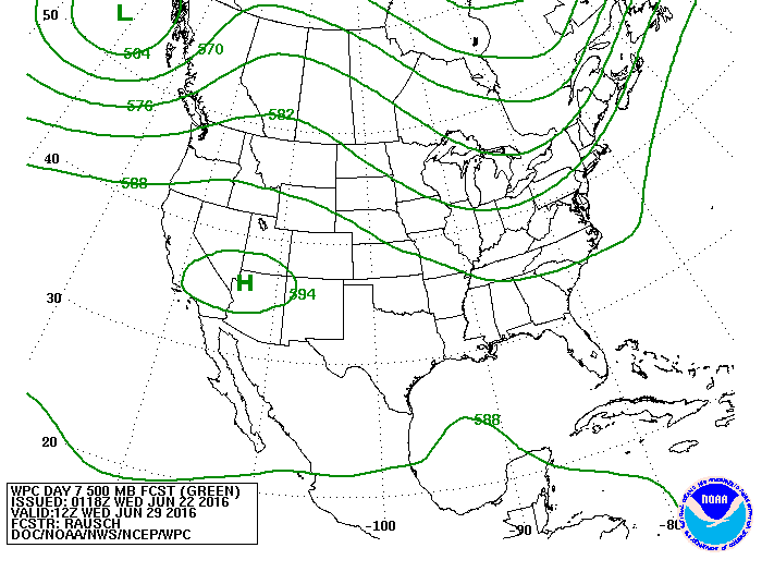
Below...daytime temperatures for next Wednesday. Notice the heat confined to the southwest and no where else. Second map shows the upper air for next week. Once again...high pressure ridge in the southwest with the heat....trof over the East with the "cooler" air. Is this the pattern for the summer ?  Be safe. 
Picture
Picture
0 Comments


Leave a Reply.

    Genesis of a Tornado
    We'll have daily weather discussions, talking about major systems on the horizon along with anything noteworthy that pops up on our radar.

    Pat Pagano,
    Mike Merin

    Follow us on Twitter and like us on Facebook to get updates whenever we post a new entry!

    RSS Feed

Powered by Create your own unique website with customizable templates.