Metro Weather Inc. Services
Like us, follow us, link to us, contact us!
  • Home
    • Daily Weather Discussion
  • Weather Prepared for You
    • Film and TV Production
    • Radio & Television
    • Government and Industry
    • Forensic Services >
      • Weather Record Request Form
    • Metro Morning Monitor
  • About Metro Weather
    • Senior Staff
  • Your Weather Images
  • Contact Us

Send A Message To Michael...."Stay Away".

10/9/2018

0 Comments

 
Picture
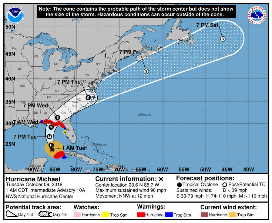
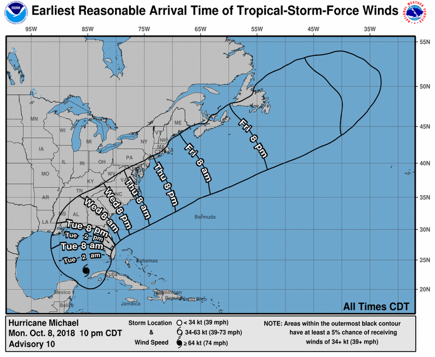
Hurricane Michael...90+ mph winds heads north across the Gulf and will hit the Florida Panhandle by Wednesday afternoon as a Cat 2 storm. After that he will accelerate to the northeast bringing life threatening flooding to Georgia and Carolinas once again. Below..track of Michael and expected storm force wind time table.
Picture
Picture
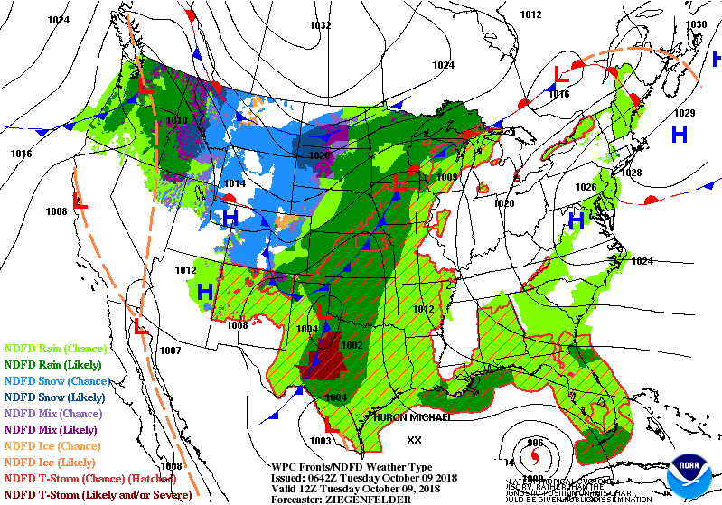
Below current satellite and radar....showing Michael and cold front in
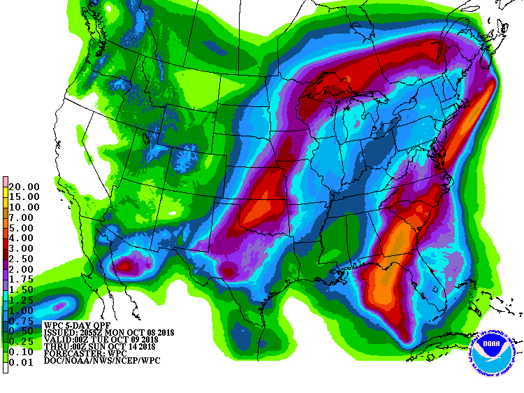
Plains. Both will merge along the East Coast by Friday and then move offshore followed by a real taste of fall.

Picture
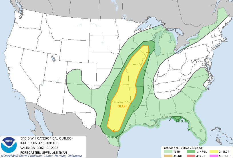
Below - today;s chances for severe is dark green and yellow followed by animated maps and lastly total rainfall over next 7 days. Be safe.
Picture
Picture
Picture
0 Comments


Leave a Reply.

    Genesis of a Tornado
    We'll have daily weather discussions, talking about major systems on the horizon along with anything noteworthy that pops up on our radar.

    Pat Pagano,
    Mike Merin

    Follow us on Twitter and like us on Facebook to get updates whenever we post a new entry!

    RSS Feed

Powered by Create your own unique website with customizable templates.