If you have been a fan of the sun (with a few period of clouds) for the last week & today, then you will enjoy the next week ahead which is looking to be the same story.
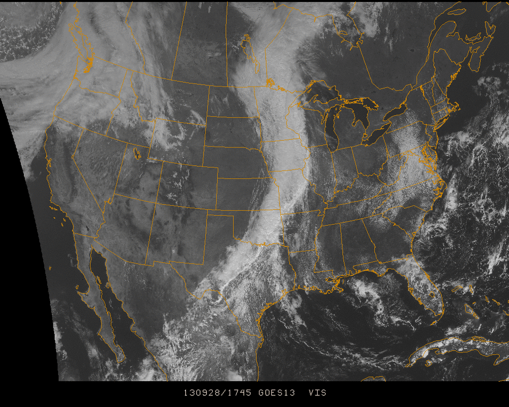
The above visible satellite imagery from midday Saturday shows a long front going straight down the middle of the US. This will be traveling north as it approaches the Ohio River Valley and keep the coastal areas in high pressure entering Monday. The other possibility for clouds and possibly shower activity is a Low circulating off screen to the east near Bermuda. It was showing some weak signs of clipping New England but the track is continuing to become further east. Showers are still a slight possibility for New England but mainly in areas along the coastline of New England starting near Cape Cod, Massachusetts and going North.
Ahead of this though, more sun & dry air with a bit of late summer warmth midweek. Enjoy it as much as you can this week as we head into October, the first month where the talk of snow once again starts to jump into frame for the mountainous regions of the country.
- JL
Ahead of this though, more sun & dry air with a bit of late summer warmth midweek. Enjoy it as much as you can this week as we head into October, the first month where the talk of snow once again starts to jump into frame for the mountainous regions of the country.
- JL

 RSS Feed
