Metro Weather Inc. Services
Like us, follow us, link to us, contact us!
  • Home
    • Daily Weather Discussion
  • Weather Prepared for You
    • Film and TV Production
    • Radio & Television
    • Government and Industry
    • Forensic Services >
      • Weather Record Request Form
    • Metro Morning Monitor
  • About Metro Weather
    • Senior Staff
  • Your Weather Images
  • Contact Us

Rough Weather Week Ahead......

5/14/2018

0 Comments

 
Picture
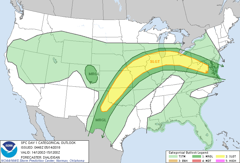
A LOW IN GULF PRODUCING WIDESPREAD - NEEDED RAIN FOR DROUGHT FLORIDA.....ALL WEEK LONG. SHOWERS AND STORMS FROM PLAINS EAST TO LAKES & OHIO VALLEY WILL CONTINUE TO MARCH EAST ALL WEEK LONG. HOT SOUTH - COOL NORTH. BELOW - TODAY'S RISK FOR SEVERE THUNDERSTORMS IN DARK GREEN AND YELLOW.
Picture
Picture
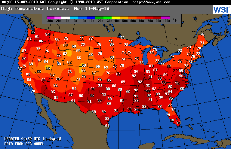
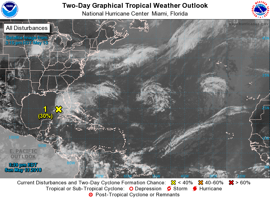
tODAY'S HIGH TEMPERATURES PROJECTED TO BE NEAR RECORDS ACROSS THE SOUTH. MOST PLACES DARK RED - WILL BREAK RECORDS. BELOW - TROPICAL SATELLITE SHOWING A 30% CHANCE OF A TROPICAL SYSTEM FORMING IN GULF.
Picture
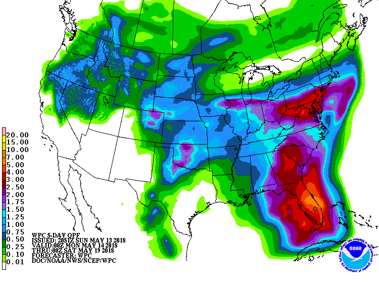
BELOW - EXPECTED RAINFALL FOR NEXT 5 DAYS .....FLORIDA GETTING OVER 6" OF RAIN. 
Picture
BELOW - ANIMATED MAPS FOR NEXT 2 DAYS.  BTW - THE GFS MODEL CONTINUES TO SHOW THE MAKINGS OF A HURRICANE IN THE GULF NEAR MEMORIAL DAY WEEKEND.  VERY FAR OFF...WILL CLOSE IN ON THAT IF IT CONTINUES TO SHOW SUCH A TREND. BE SAFE.
0 Comments


Leave a Reply.

    Genesis of a Tornado
    We'll have daily weather discussions, talking about major systems on the horizon along with anything noteworthy that pops up on our radar.

    Pat Pagano,
    Mike Merin

    Follow us on Twitter and like us on Facebook to get updates whenever we post a new entry!

    RSS Feed

Powered by Create your own unique website with customizable templates.