The stories for this weekend are the record high temperatures hitting the Eastern US, but also the storm that is accompanying all that warm air.

Infrared 12-21-13... 2015 UTC
The national IR map shows the center of the low pressure system in the general Texas area and the extensive distance the associated fronts with it covers (all the way through to Maine and further northeast.
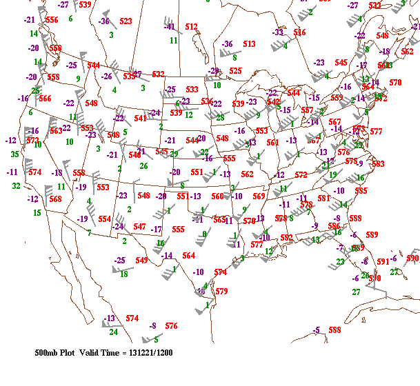
500 mb 12-31-13... 1200 UTC
The flow can be seen also by looking at the 500 mb plot by observing the wind barbs, dipping down west of the Rockie Mountains and flowing back up through Texas & the Gulf of Mexico. The red numbers next to each plot represents 500mb heights or thicknesses in decameters (dm). The height values in the southeast are reaching 5700 meters (decameters x 10) and higher, values you do not tend to see on the first day of winter but much earlier in the Fall, and we can associate these values with warmer air temperatures. These are producing record highs today in many areas and will continue to do into Sunday.
This system is a very complex one and will take time to move out, producing severe weather in the southeast, but tame rain showers in the northeast... By late Monday and into Tuesday morning, the cold front will have passed on and the frigid air will return once again just in time for Christmas Eve and subsequently Christmas Day on Wednesday.
While some light snow activity could be seen Tuesday off of the Great Lakes, conditions for Christmas for right now in the Northeast appear to be dry, cold and not quite a "White Christmas".
- JL

 RSS Feed
