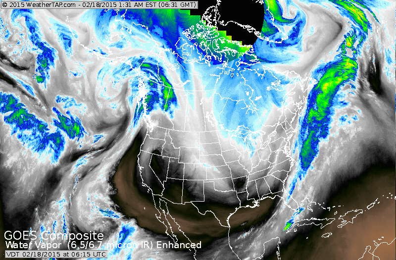
Follow the band of light white down the Rockies...then up the East Coast. The jet stream transporting yet another arctic blast for The East....this one will be setting records all the way south.
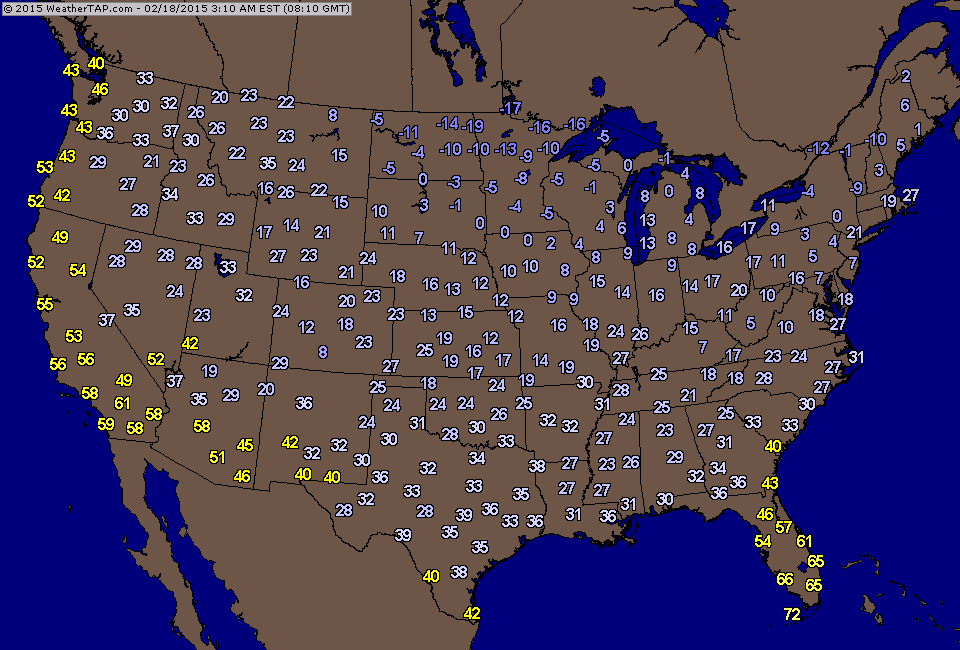
Current early morning temperatures.....notice sub zero north central.
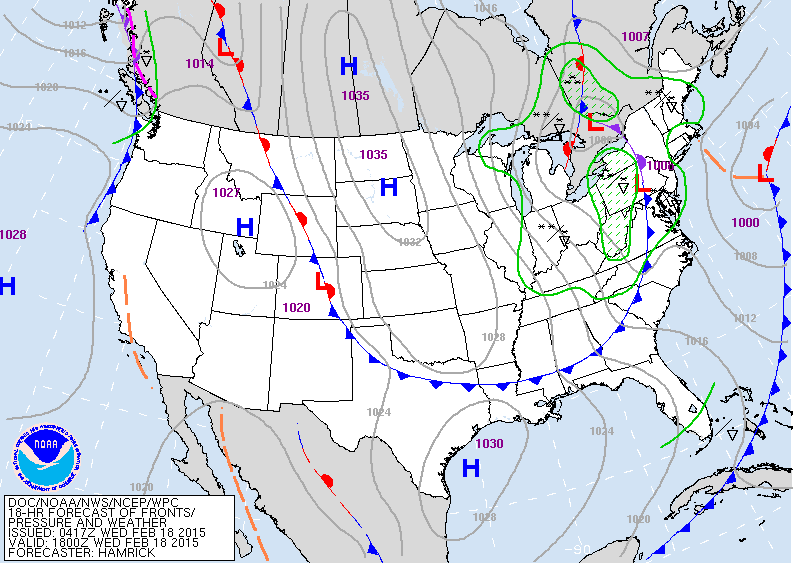
Today's map shows the arctic cold front plugging into The Appalachians accompanied by a band of snowshowers and snowsqualls.
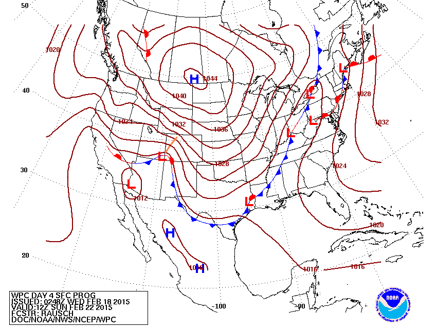
Map above is for this Sunday. Front and lows from Eastern Great Lakes to Texas. This will bring a wide swath of moisture to the Eastern half of the Nation. Heavy snows will fall across the northern Half of the Northeast....while a wintry mix will change to rain in the big cities like NY and
Phily, Washington, Baltimore......Boston will be on the fence.
Phily, Washington, Baltimore......Boston will be on the fence.
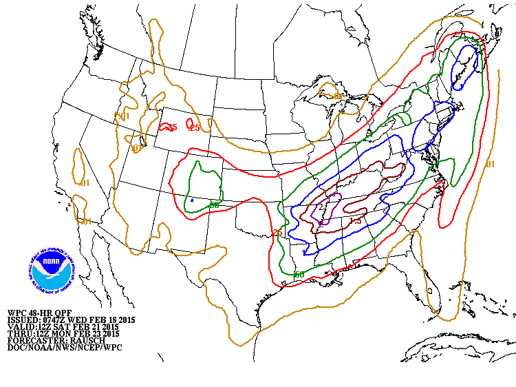
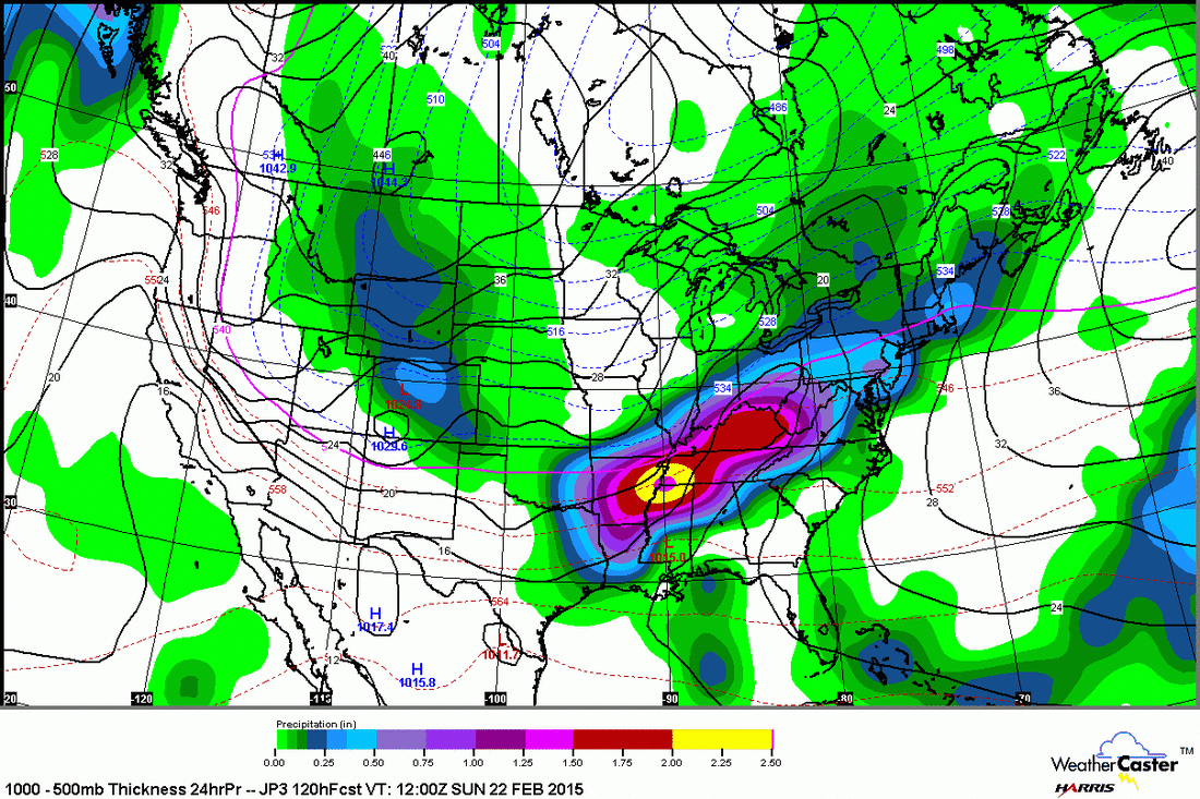
Amounts of precipitation for this weekend. Blue indicates 1.00" liquid..... and when you overlay that with the rain - snow line...... ypu have 10" of snow or more across New York State into No. New England. Below....The Japan Model for Sunday. Find the red line across the Northeast and anything north of that line gets lots of snow. For now...be safe.

 RSS Feed
