Metro Weather Inc. Services
Like us, follow us, link to us, contact us!
  • Home
    • Daily Weather Discussion
  • Weather Prepared for You
    • Film and TV Production
    • Radio & Television
    • Government and Industry
    • Forensic Services >
      • Weather Record Request Form
    • Metro Morning Monitor
  • About Metro Weather
    • Senior Staff
  • Your Weather Images
  • Contact Us

Rain targets The Southeast......

9/23/2015

0 Comments

 
Picture
Low off the Carolinas will produce locally heavy rain there through this weekend. Showers and storms coming out of the Rockies will hit the upper Midwest.
Picture
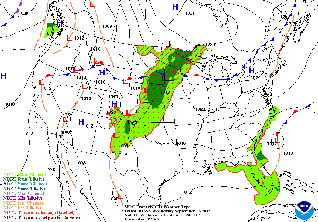
Map above is for this evening. As explained above...low off SE Coast and in Plains are 2 wet weather makers. Most other places not bad for this...the first day of fall.
Picture
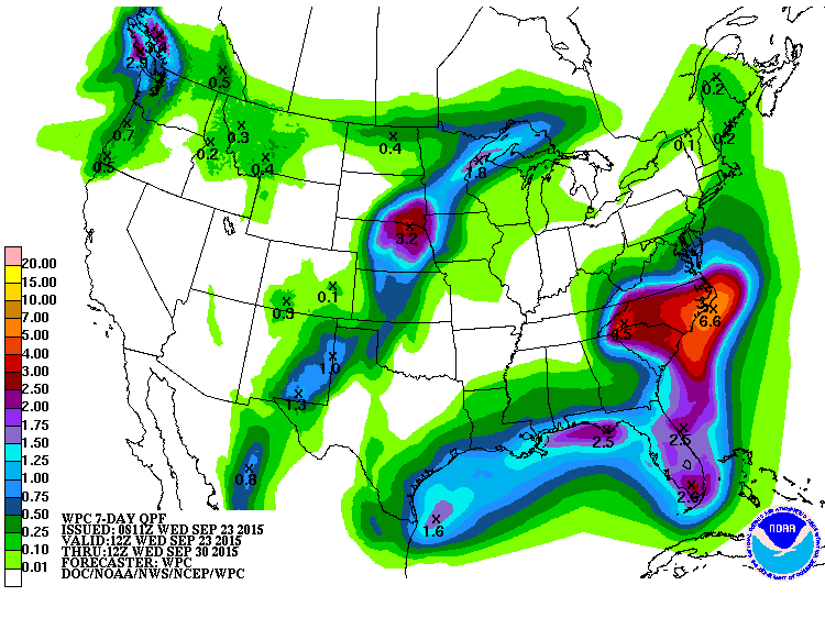
Amounts of rain over the next 7 days include over 6" for N.Carolina.
Picture
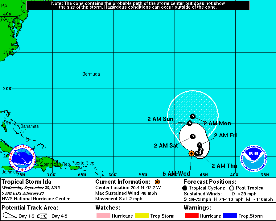
Tropical Storm Ida with 45 mph winds still meandering in Atlantic.  Below...her satellite picture...rather healthy.
Picture
Picture
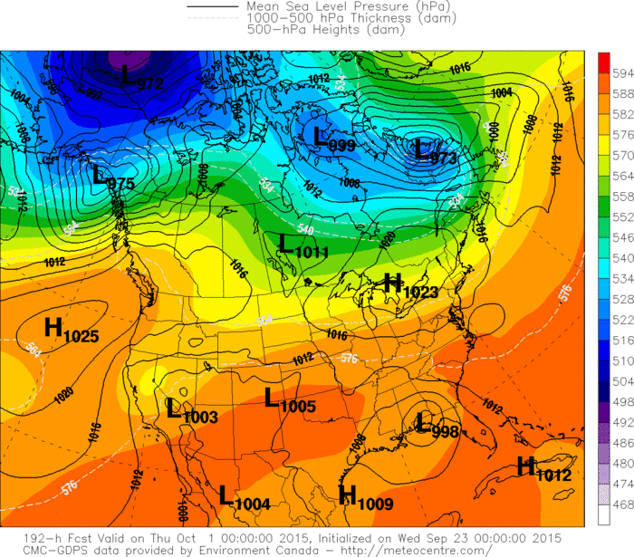
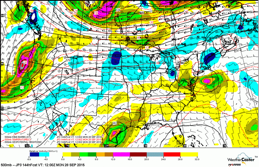
Canadian model insisting on some sort of tropical system hitting Gulf Coast by Oct. 1st.  Below that...the upper air map expected for early next week...which indicates a zonal flow and relatively mild temps.
Picture
0 Comments


Leave a Reply.

    Genesis of a Tornado
    We'll have daily weather discussions, talking about major systems on the horizon along with anything noteworthy that pops up on our radar.

    Pat Pagano,
    Mike Merin

    Follow us on Twitter and like us on Facebook to get updates whenever we post a new entry!

    RSS Feed

Powered by Create your own unique website with customizable templates.