Satellite/radar overlay shows line of moisture over Appalachinas. This may erupt into strong storms for Northeast and Mid Atlantic late today. Storms in Texas moving northeast. Rain in Great Lakes moving northeast.
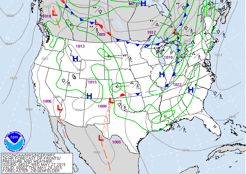
Map of this evening. Front in Ohio will push storms toward the east coast. Scattered showers Rockies.
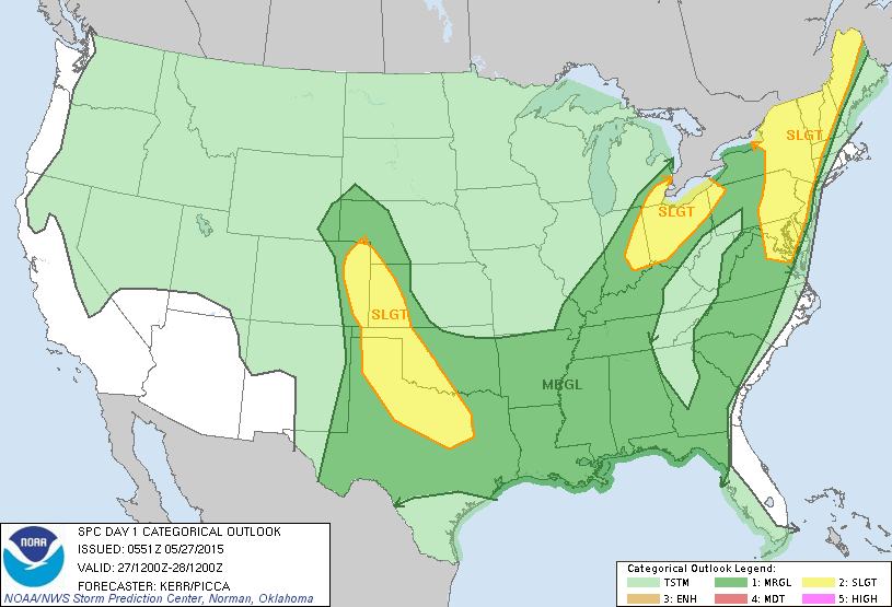
Severe weather threat - yellow....today and tonight.
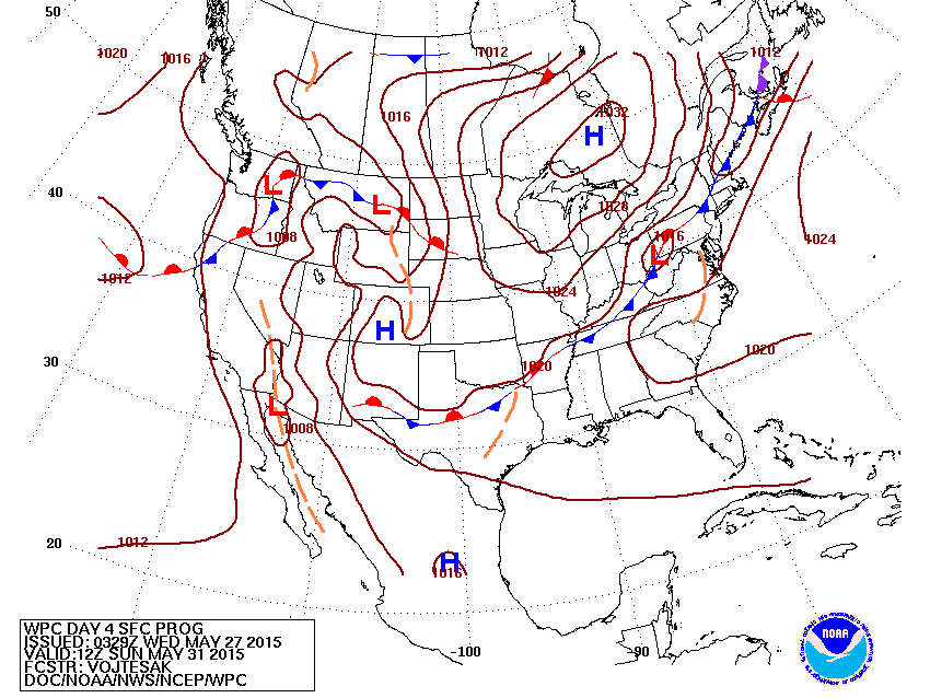
Map above is for Sunday. Front in Northeast may produce widespread rain from Saturday late into Sunday.
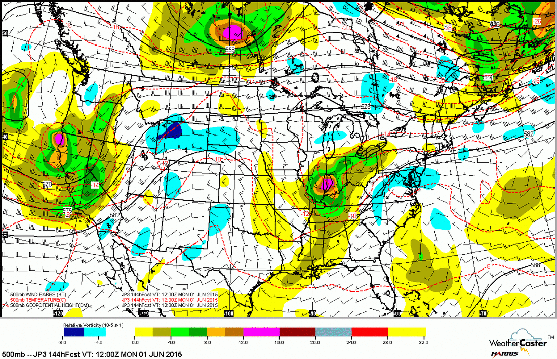
This is the Japan model for SUnday night. Upper low and trof over Ohio Valley should be a good kicker for rain and storms for Eastern third of Nation Sunday.
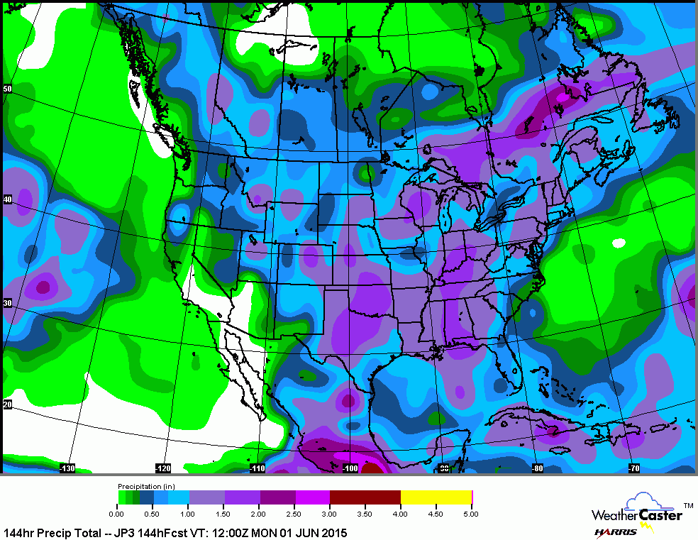
This map...(Japan Model) also shows rainfall totals from
today into Sunday night. Most of the Nation should see some good rains......be safe.
today into Sunday night. Most of the Nation should see some good rains......be safe.


 RSS Feed
