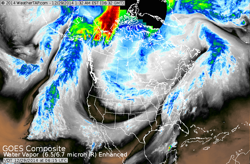
Satellite shows one system moving off the mid Atlantic coast. Another system over the Plains will continue eastward with little if any significant precip. Cold across The Northern-tier.....elsewhere near normal.
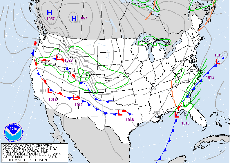
Map above for this evening. Some rain over the southeast.
Some snow across The Rockies...and cold in the Plains.
Some snow across The Rockies...and cold in the Plains.
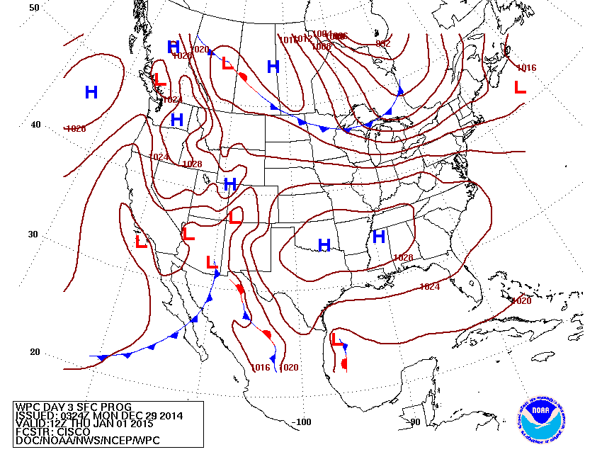
Map above for New Year's Day. Some snow in upper Midwest.......snow and rain in the southwest. Elsewhere...quiet.
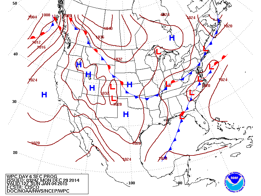
Above...map for this Sunday. A couple of system converge on The East...AND an assortment of precip. is possible there. Elsewhere - quiet.
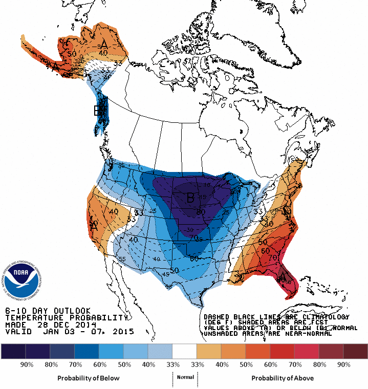
Above...map from Jan 3 to Jan 7 - showing how temperatures will average. Blue = colder than average...Orange to red = warmer than average.
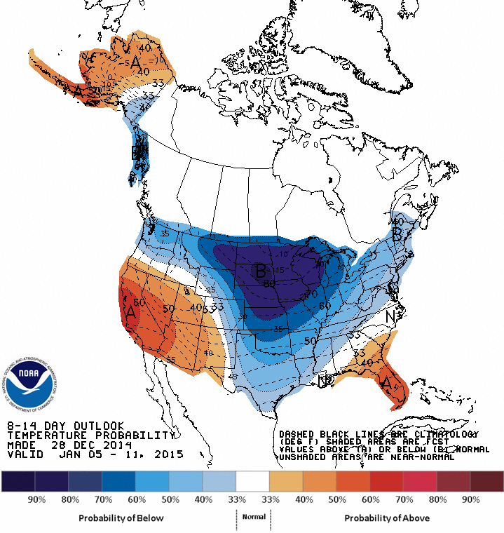
Above....map from Jan. 5 to 11th.....colder than average moves into The Northeast. Warmer than average southeast and West. Be safe all....see you tomorrow.

 RSS Feed
