
Satellite/Radar shows storms in Tennessee Valley tempering the heat. More storms in Midwest today...reaching the East Thursday.
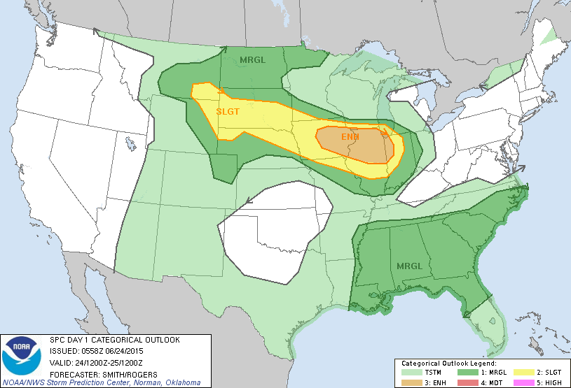
Severe weather threat today from So.Dakota to Indiana...yellow..... tan - more widespread threat.
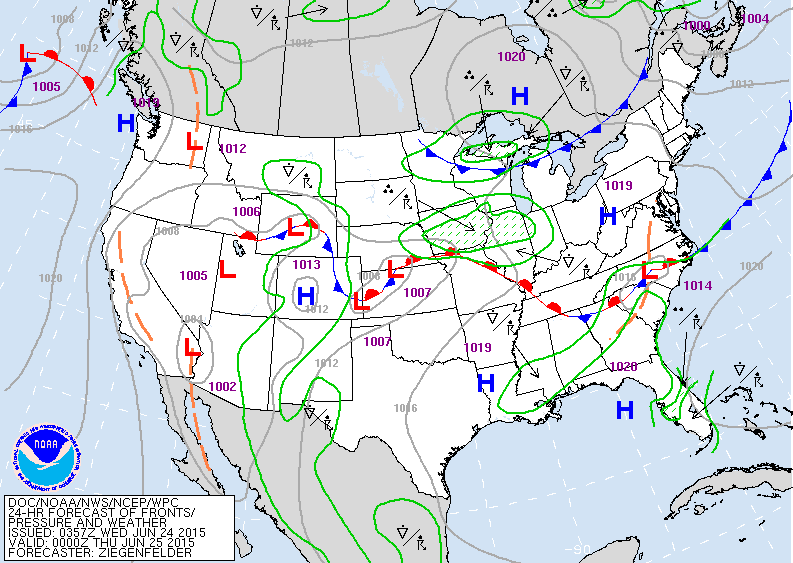
Nice weather northeast. Rain and storm Midwest move to east late Thursday. Storm in Rockies heads east to bring more wet weather to east coast this weekend.
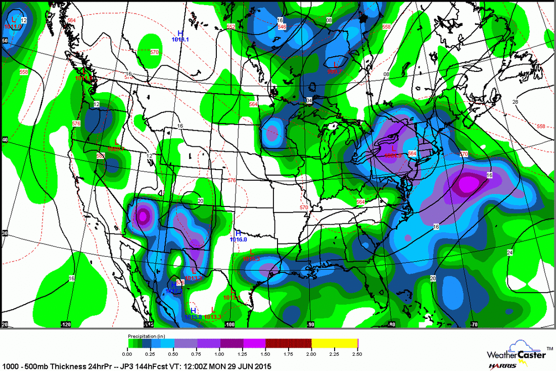
Japan model for Sunday....wet in Northeast.....Gulf....
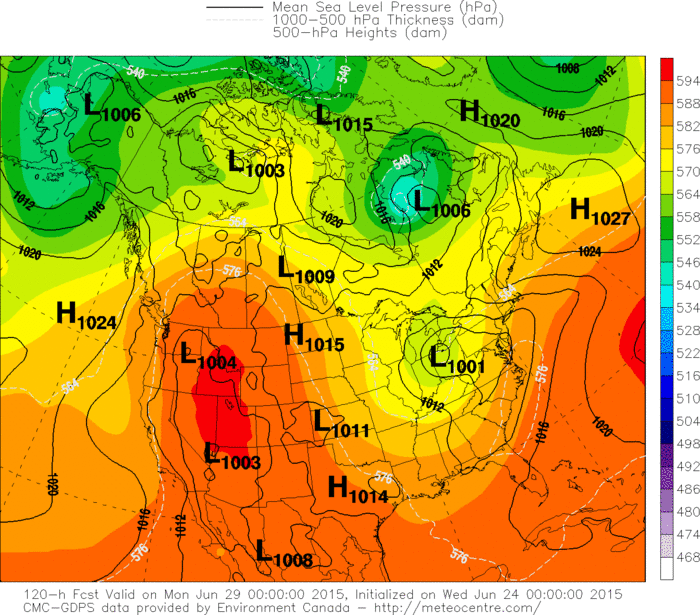
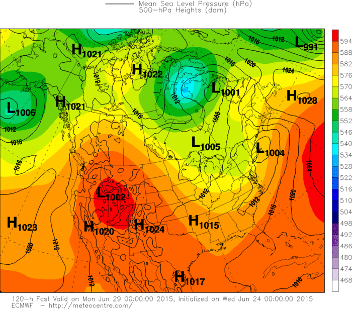
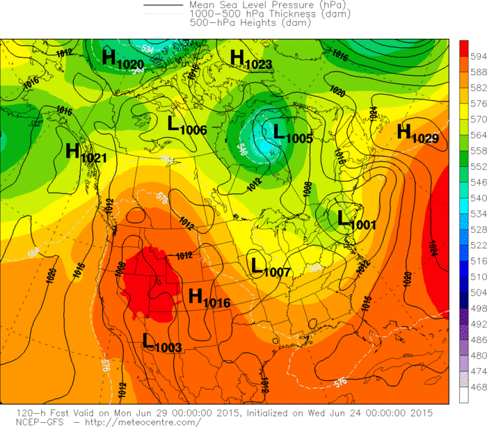
Upper Midwest and Southwest. Below....the other models all depicting a storm for Sunday in East......with Euro being the fastest....and UK Met being further south. It all adds up
to not a beach weekend in Northeast. Be safe.
Upper Midwest and Southwest. Below....the other models all depicting a storm for Sunday in East......with Euro being the fastest....and UK Met being further south. It all adds up
to not a beach weekend in Northeast. Be safe.

 RSS Feed
