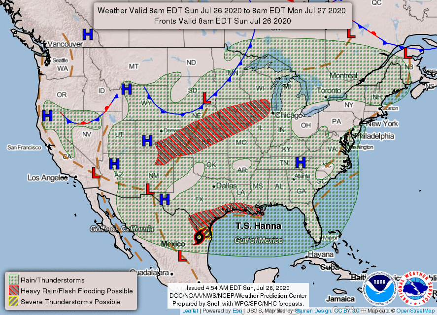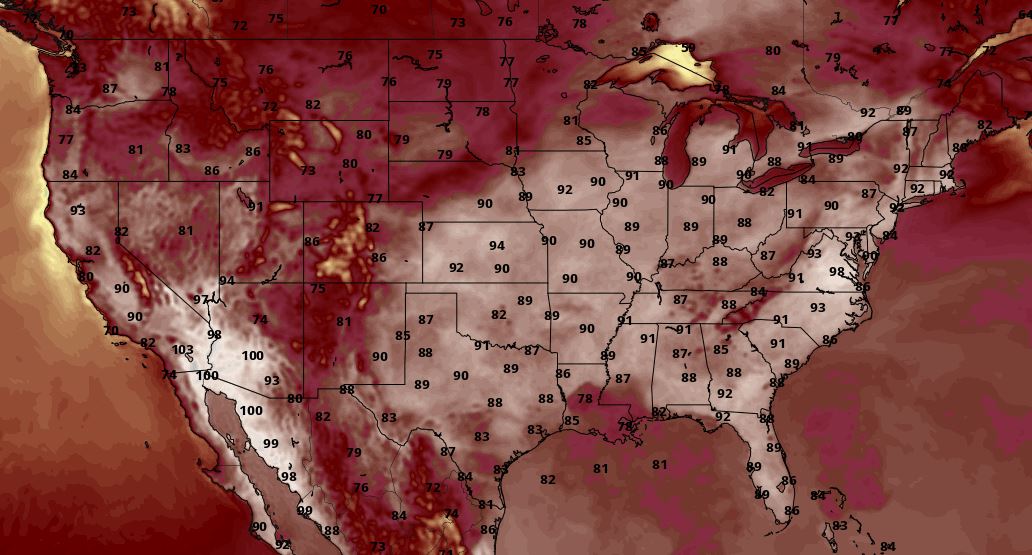
The Northeast remains very hot as high temperatures and humid conditions extend across much of the eastern portion of the country. Heat Advisories are in effect for areas of the Tri-State region. Heat indices in the Northeast will reach at or even above 100 degrees at times during the afternoons from Sunday to Tuesday. Record highs are a possibility as well in the Mid-Atlantic and southern New England areas as temperatures soar into the 90sduring this time period.
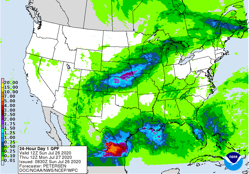
Elsewhere, Tropical Storm Hanna will move into northeast Mexico today from southern Texas. Winds will begin to diminish in intensity as the storm moves farther inland and weakens. However, don't let your guard down as heavy rain will continue to occur with Hanna as we head into Monday morning. Rainfall rates may be upwards of 2-3 inches per hour at times, especially in some of the stronger rain bands and around the center of the storm. This excessive amount of rainfall along with saturating soils will lead to both flash flooding and river flooding that could potentially become life threatening in the southern Texas coast to the Lower Rio Grande Valley regions. In addition, there is also a slight risk of severe thunderstorms associated with some of Hanna's outer rain bands in extreme southern Texas.


 RSS Feed
