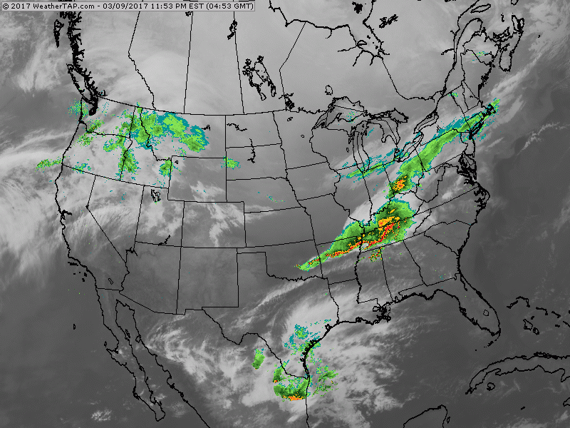
Satellite/radar showing storm moving toward Mid Atlantic. Snow north of track..rain and thunderstorms south of track. Rest of the Nation - fair very cold.
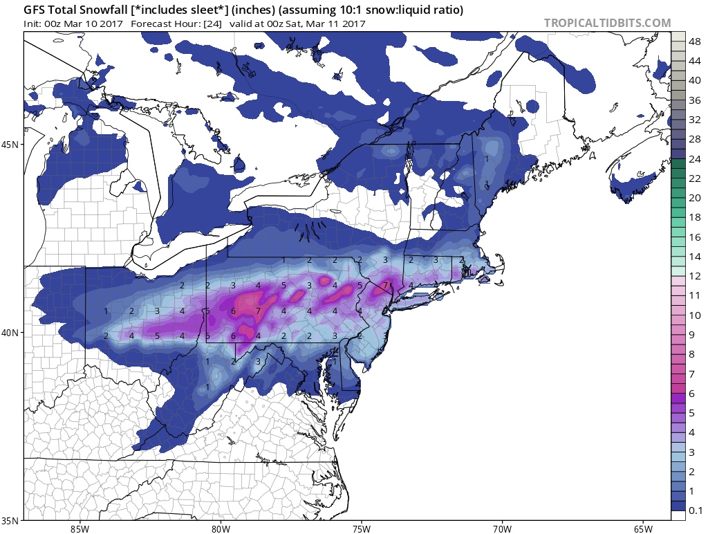
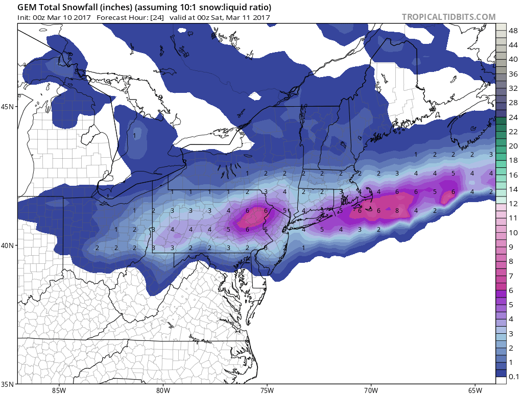
Above - GFS and Canadian prediction for snowfall today.
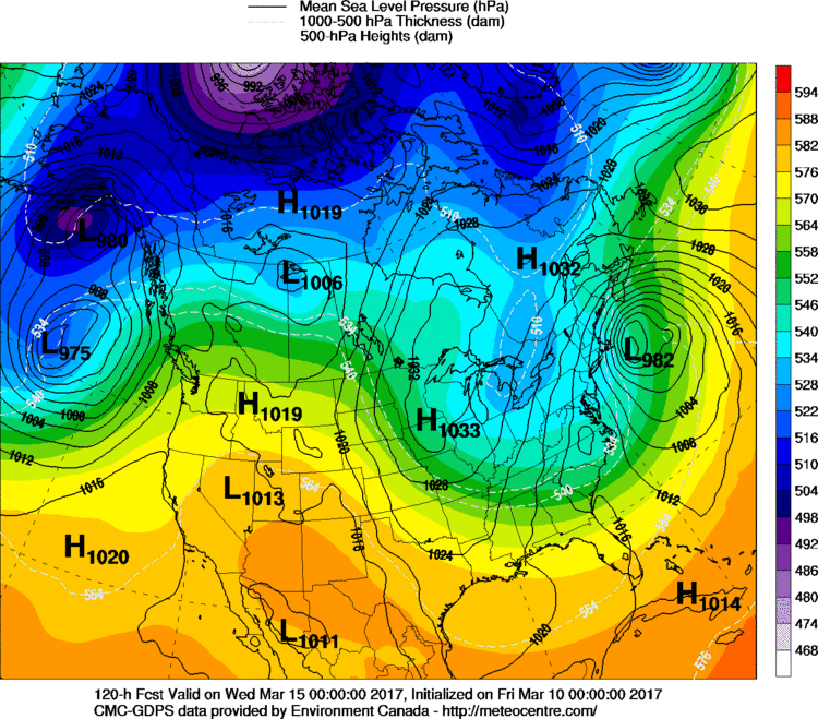
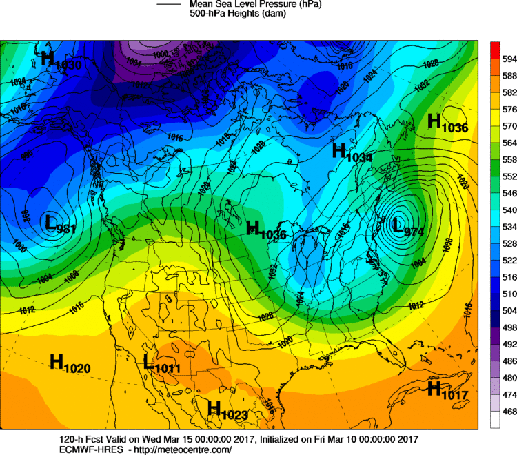
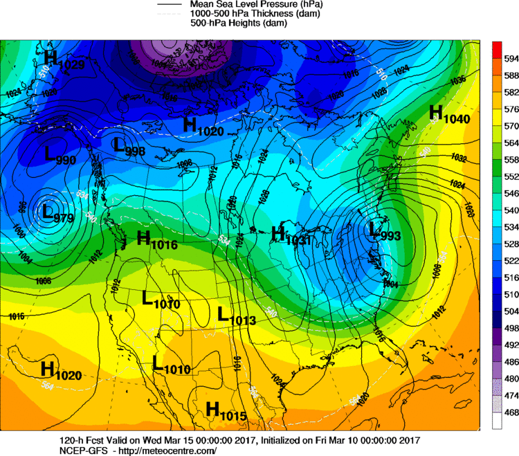
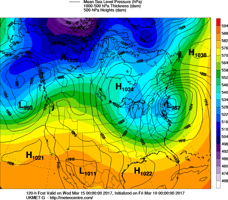
Below....Major Winter Coastal Storm possible next Tuesday. Below...you will find the models placement of that storm today. Note: The GFS is the closest to the coast indication snow/ice changing to rain for NYC/Long Island/ Ct. Most all other models say - all snow . Depending upon that storm track....if it stays all snow...many places from Mid Atlantic to New England will be measuring more than inches.
Be safe. Have a nice weekend.

 RSS Feed
