Metro Weather Inc. Services
Like us, follow us, link to us, contact us!
  • Home
    • Daily Weather Discussion
  • Weather Prepared for You
    • Film and TV Production
    • Radio & Television
    • Government and Industry
    • Forensic Services >
      • Weather Record Request Form
    • Metro Morning Monitor
  • About Metro Weather
    • Senior Staff
  • Your Weather Images
  • Contact Us

Pattern Turns Active.....

4/26/2016

0 Comments

 
Picture
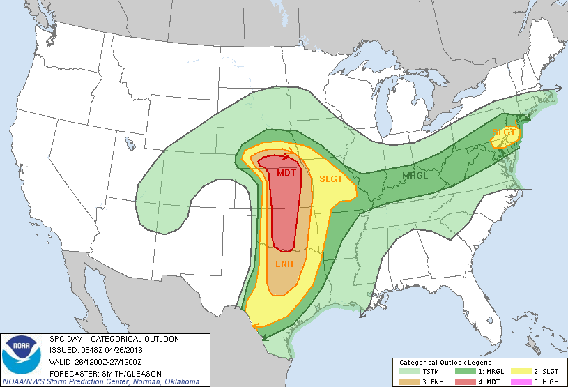
Today's threat of severe weather highlighted by red from Nebraska to Oklahoma....but tan & yellow not to be left out. Small area of severe for mid Atlantic.
Picture
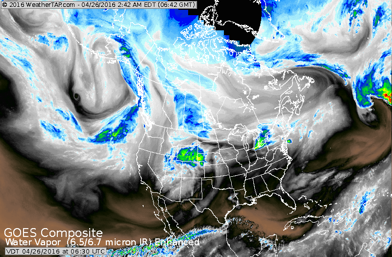
Satellite already shows moisture in Texas Panhandle likely to
trigger severe weather as posted above. Blue and green area over Great Lakes will bring wet weather to Northeast.

Picture
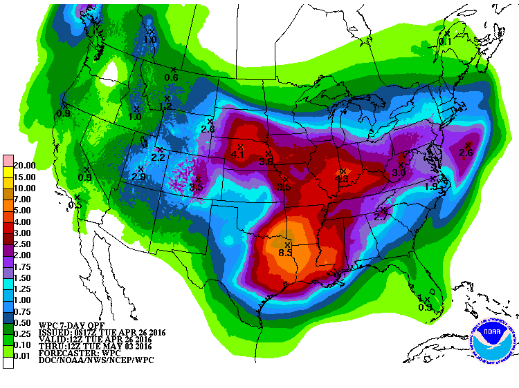
​Above...amounts of rain expected for next 7 days: noted almost 9" for flooded Texas....4" + from Plains to MidAtlantic.  May could be very wet.  Be safe.
0 Comments


Leave a Reply.

    Genesis of a Tornado
    We'll have daily weather discussions, talking about major systems on the horizon along with anything noteworthy that pops up on our radar.

    Pat Pagano,
    Mike Merin

    Follow us on Twitter and like us on Facebook to get updates whenever we post a new entry!

    RSS Feed

Powered by Create your own unique website with customizable templates.