
Satellite shows front moving toward East Coast. Deep trof in Southwest...and Canadian West Coast. Should mean dry for most of the Nation with exception of Southwest due to that trof.
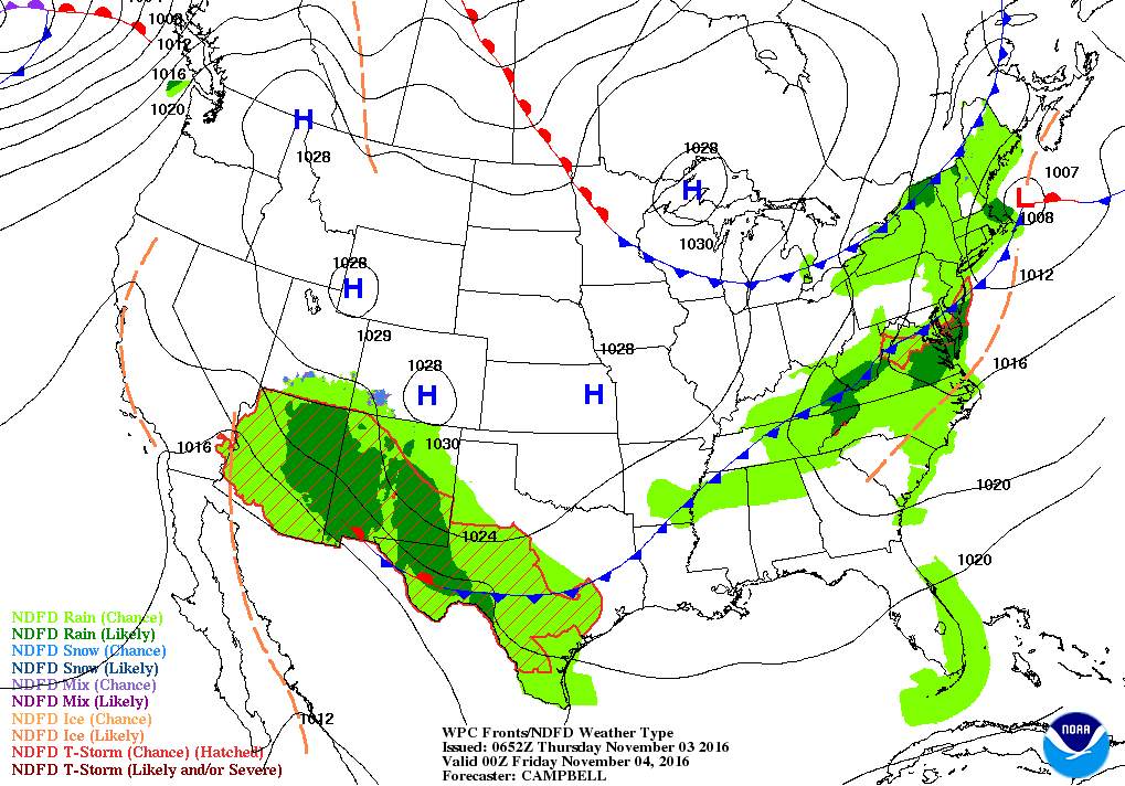
Map for this evening shows moisture pooling in the Southwest and this will be an ongoing problem into weekend. Fronts in East will move south and east offshore.
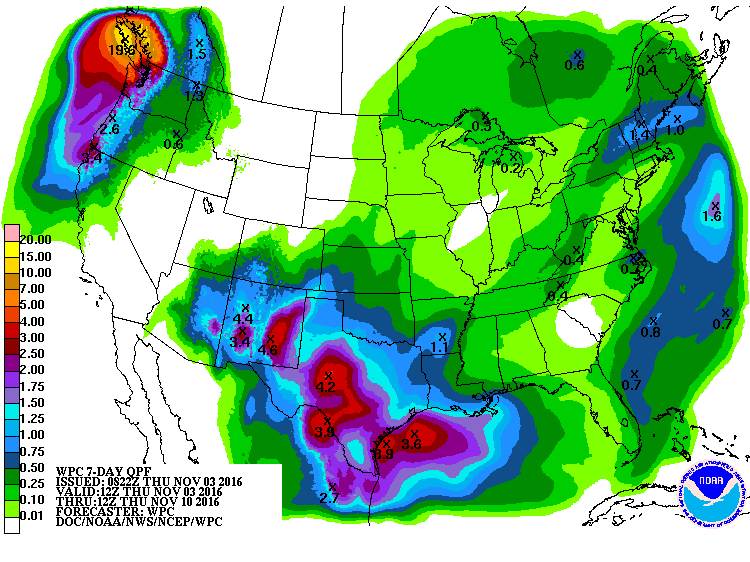
Rainfall map for the next week shows the South getting hit with more and more rain....as the Pacific Northwest.
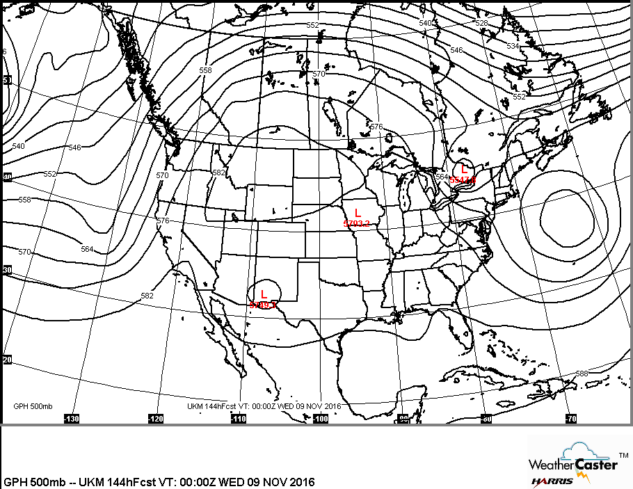
Upper air pattern above for next week indicates warmer than normal for much of the Nation with the exception of the Northeast and Southwest. This is the sign of a pattern change.
Be safe.
Be safe.

 RSS Feed
