Metro Weather Inc. Services
Like us, follow us, link to us, contact us!
  • Home
    • Daily Weather Discussion
  • Weather Prepared for You
    • Film and TV Production
    • Radio & Television
    • Government and Industry
    • Forensic Services >
      • Weather Record Request Form
    • Metro Morning Monitor
  • About Metro Weather
    • Senior Staff
  • Your Weather Images
  • Contact Us

Pattern Change To Take Place

5/31/2016

0 Comments

 
Picture
​Satellite and radar show tropical moisture from Bonnie off the East coast. Next front swinging through the Plains will reach the East by late week. After that....warming west and cooling east.
Picture
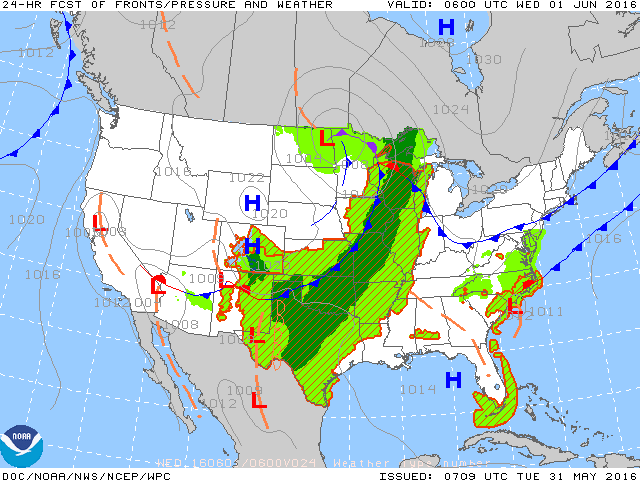
​Map is for tonight: front moving into Midwest....cooler high pressure over Northeast...and out west.
Picture
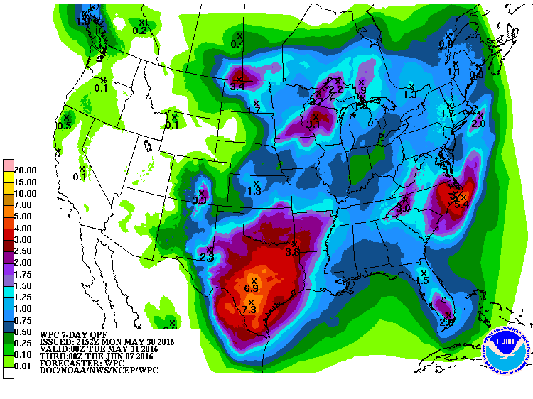
Above - rainfall for next 7 days......Carolinas and Texas get the brunt of rain.....upper Midwest to Great Lakes will also see heavy rains. 
Picture
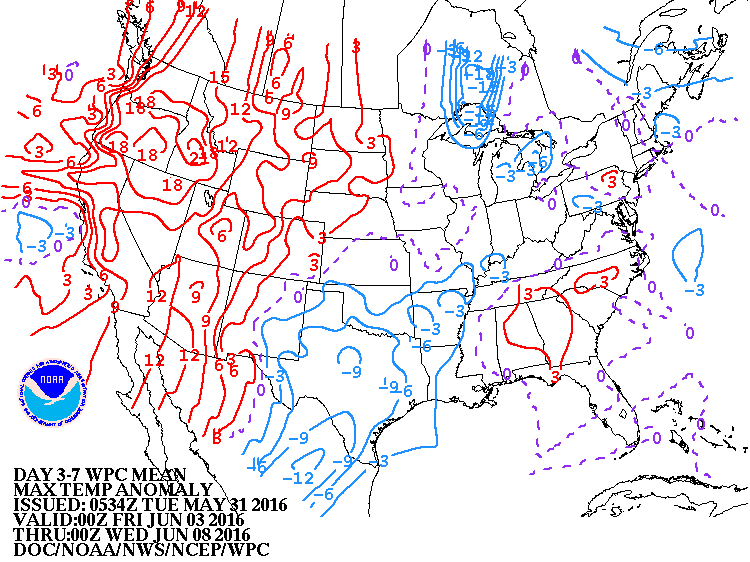
​Temps over the next week will be above in West....Below Great Lakes to Southern Plains.  That trend will spread east.
Picture
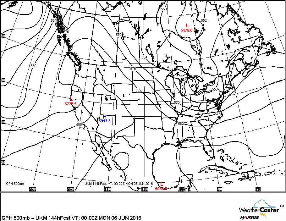
​Map above is upper air map for early next week. Jet stream drops south in the East with cooler air....while just the opposite out west. 
0 Comments


Leave a Reply.

    Genesis of a Tornado
    We'll have daily weather discussions, talking about major systems on the horizon along with anything noteworthy that pops up on our radar.

    Pat Pagano,
    Mike Merin

    Follow us on Twitter and like us on Facebook to get updates whenever we post a new entry!

    RSS Feed

Powered by Create your own unique website with customizable templates.