
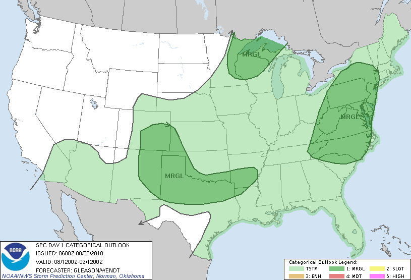
Showers and storms from the Great Lakes south...more over the Southern Plains. Hurricane John off Baja. Below - today's risk of severe weather in dark green. Last night JFK Airport had 3/4" of rain in 11 minutes....flash flooding.
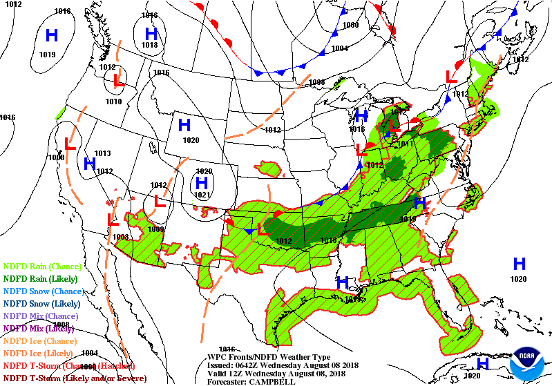
Below - animated maps for the next couple - followed by rainfall for the next 5-7 days. A front will create more thunderstorms in the East today and tonight and then stall to the south of mid Atlantic. As a trof moves in from the west this weekend...wet weather returns to Northeast.
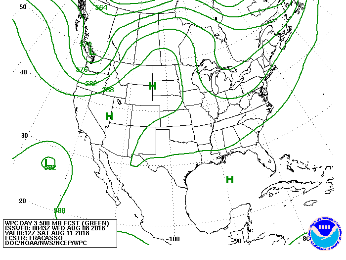
Below - upper air pattern that will bring wetness to Northeast this weekend.
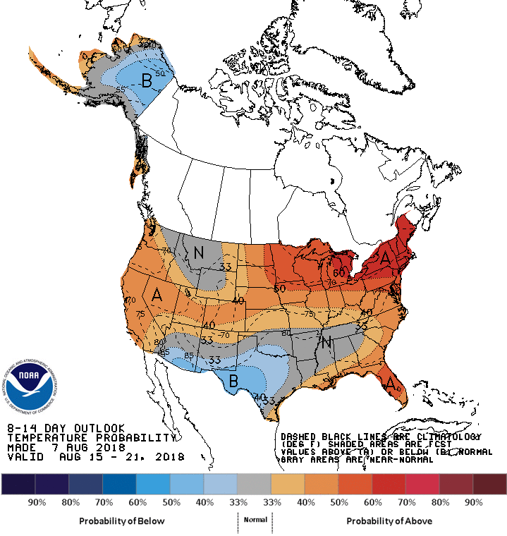
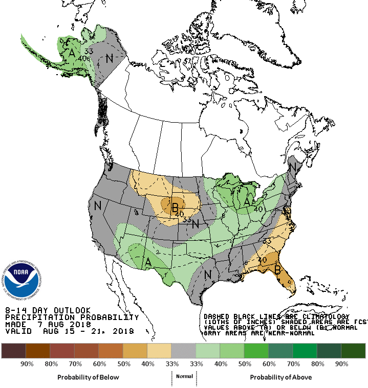
Below - maps showing temperatures and rainfall are expected to average through the 21st of AUg.
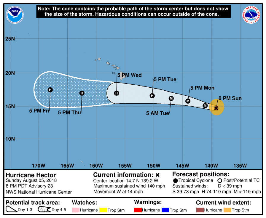
Below- track of Major Hurricane Hector - who will affect Hawaii late today.
Be safe.
Be safe.

 RSS Feed
