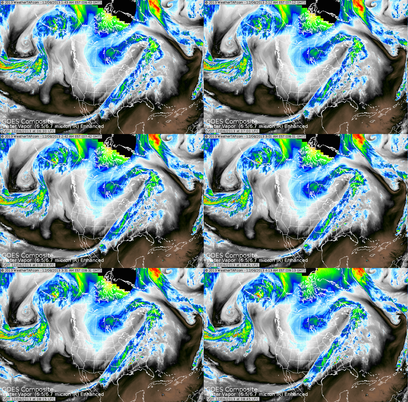
Arctic cold front moving to East Coast....clearly defined on satellite picture. A new storm forming on bottom of cold front in Gulf on Sunday will bring heavy snow to Ohio and Tenn Valleys and a wintry mix to Mid Atlantic-Northeast from late Sunday into Monday.
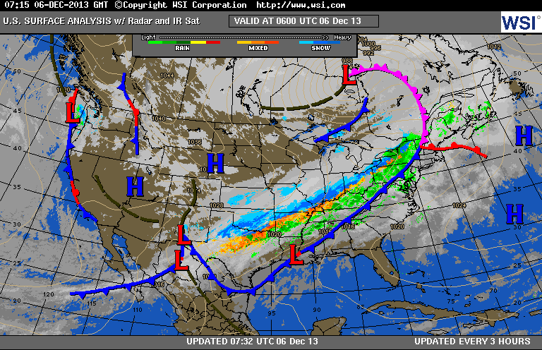
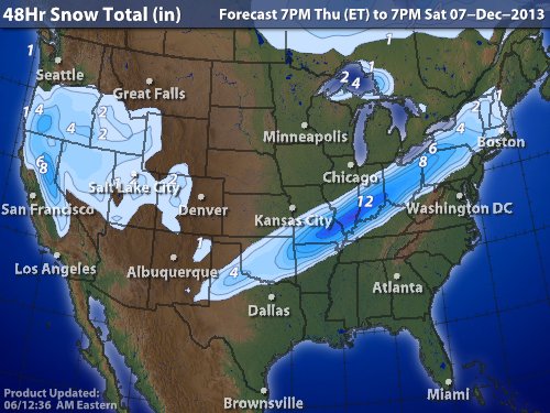
Weather map above...shows rain (green) changing to ice (orange)...to snow (blue) as temperatures drop rather quickly....so be ready East Coast. Below...expected snowfall Sunday.
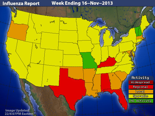
Changing weather...holiday travel = spreading germs. Below..latest map reporting cases of flu. In summary...rain changes to some sleet and snow before ending East Coast Saturday morning. New storm brings heavy snow Sunday into Monday for Ohio/Tenn Valleys and wintry mix for Mid.Atlantic & Northeast. Have a safe nice weekend.


 RSS Feed
