Below..satellite/radar combo showing moisture from Gulf and another batch in Upper Midwest. West coast will have most noticeable precip this week.

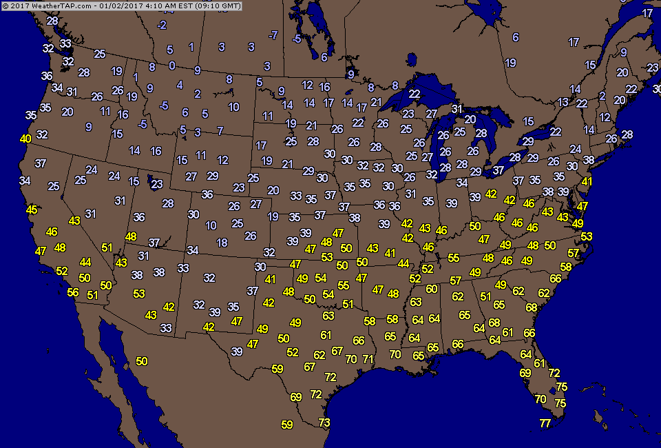
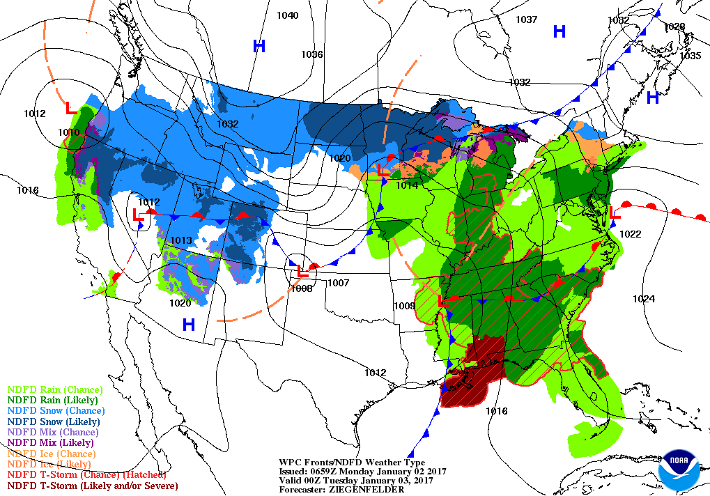
Early a.m.temps: Arctic air returning to Northern Plains and moving south and east. Below...current weather map for this evening showing a wintry mix through most of the Nation.
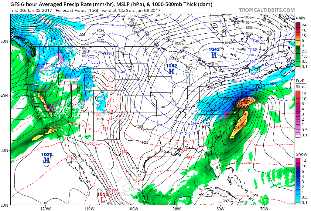
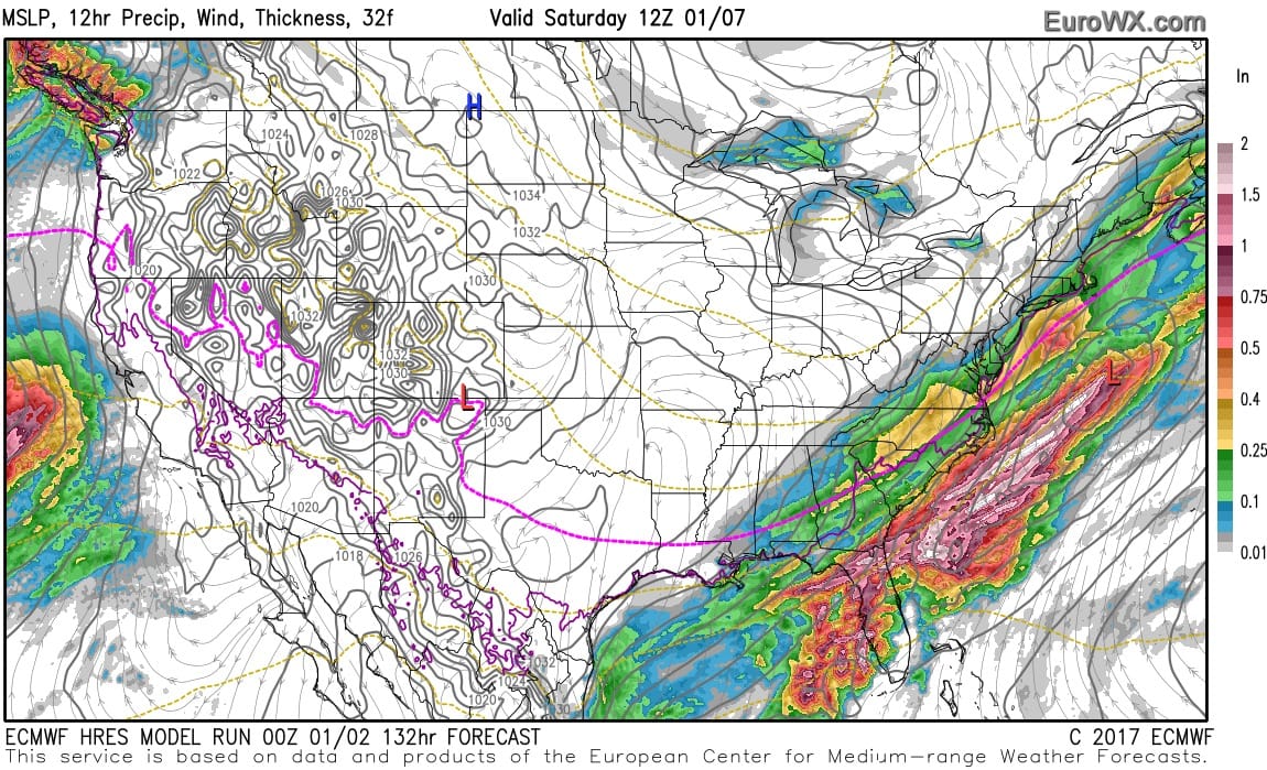
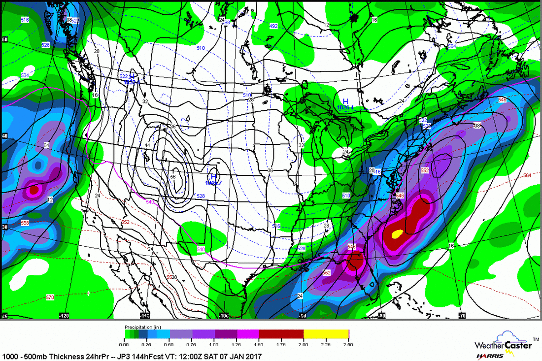
Below..models all showing some snow for the East late this week. Most of them for Saturday except the GFS which blows up a major snowstorm for the Northeast Cities but on Sunday.
Something is in the cards and details will get better as we go through the week. More on that later. Be safe.
Something is in the cards and details will get better as we go through the week. More on that later. Be safe.


 RSS Feed
