Satellite shows jet streaking out of Texas to Carolinas. This will be the problem for The East Friday/ Saturday. Storm in Gulf will head up coast bringing a wintry mix to East Fri.nite & Saturday. After that.....clippers then cold.
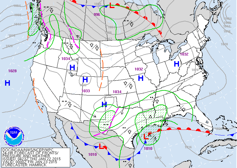
Map above for this evening. Most of the nation...calm.
Exception...south. Rain from Texas to Gulf States as storm forms in Gulf Of Mexico.
Exception...south. Rain from Texas to Gulf States as storm forms in Gulf Of Mexico.
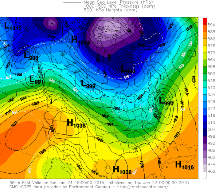
Canadian model for Saturday afternoon. Most of nation...calm. Storm south of New England bringing a
wintry mix to Northeast and Mid aTLANTIC.
wintry mix to Northeast and Mid aTLANTIC.
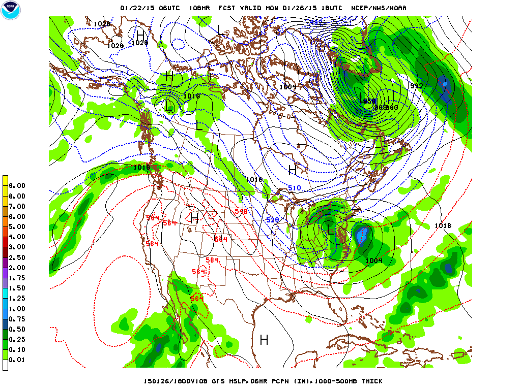
Latest GFS Model showing clipper low in West Virginia Monday afternoon as it does a hand-off to a developing storm along the mid Atlantic coast. Can't believe model is picking this up this far in advance....but buy it 100%. Not sure if I am ready to believe the fact that this model deepens the storm to bring near blizzard conditions to Northeast Mon. nite into Tuesday....but stay tuned.
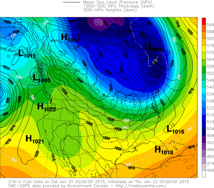
Canadian model above for late next week. Notice the
arctic air pushing south across Gt. Lks and Northeast.
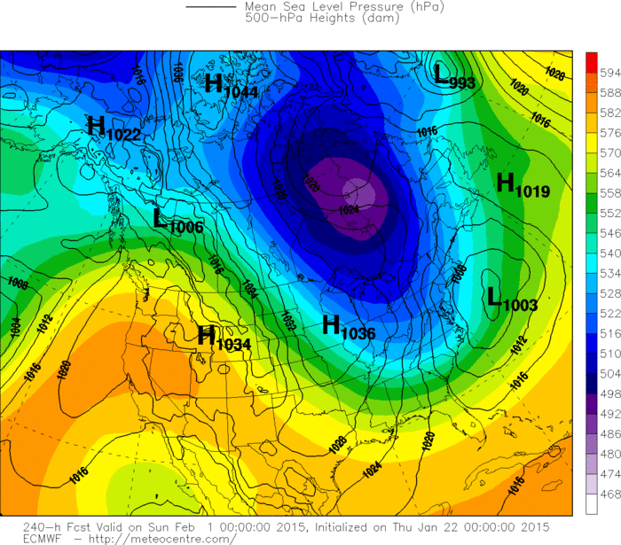
Below...The Euro model doing likewise for next weekend.
So get ready.....Ol Man Winter is awakening. Be safe.
arctic air pushing south across Gt. Lks and Northeast.
Below...The Euro model doing likewise for next weekend.
So get ready.....Ol Man Winter is awakening. Be safe.


 RSS Feed
