Metro Weather Inc. Services
Like us, follow us, link to us, contact us!
  • Home
    • Daily Weather Discussion
  • Weather Prepared for You
    • Film and TV Production
    • Radio & Television
    • Government and Industry
    • Forensic Services >
      • Weather Record Request Form
    • Metro Morning Monitor
  • About Metro Weather
    • Senior Staff
  • Your Weather Images
  • Contact Us

Nothing short of WINTRY.................

1/8/2015

0 Comments

 
Picture
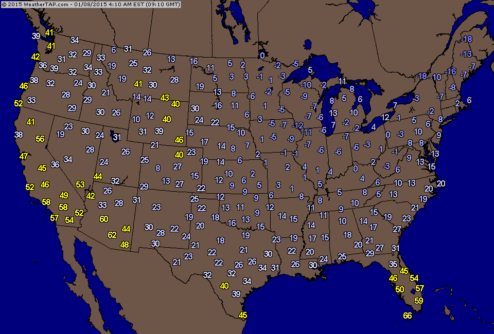
These were the current temperatures as of 4am this morning.
Picture
Satellite shows jet stream down into the Gulf of Mexico...so cold is the word. Area of blue over Great Lakes is next system bringing light snow.....which will head to The Northeast Friday.
Picture
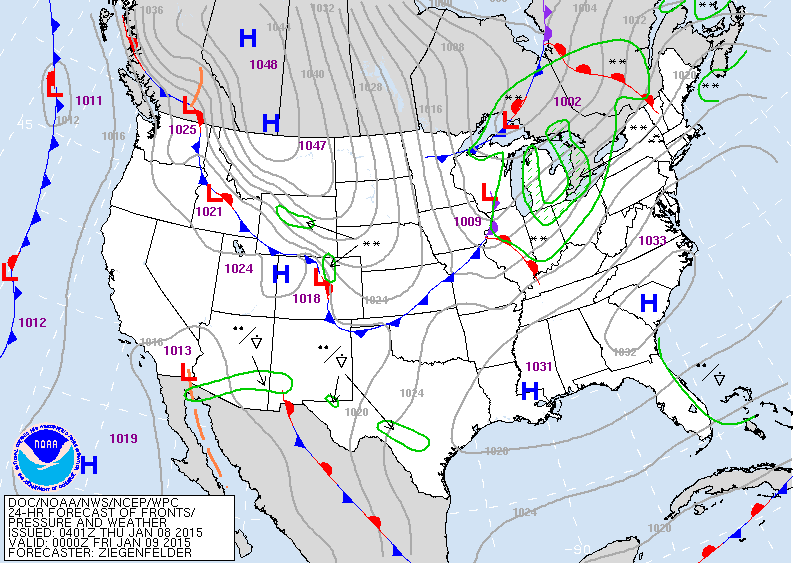
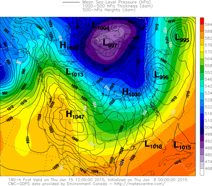
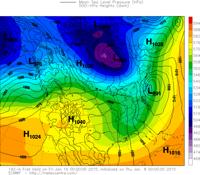
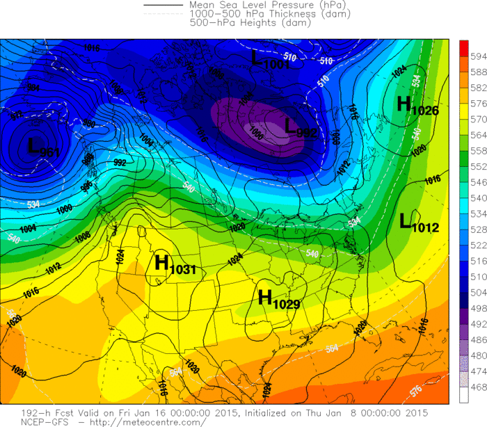
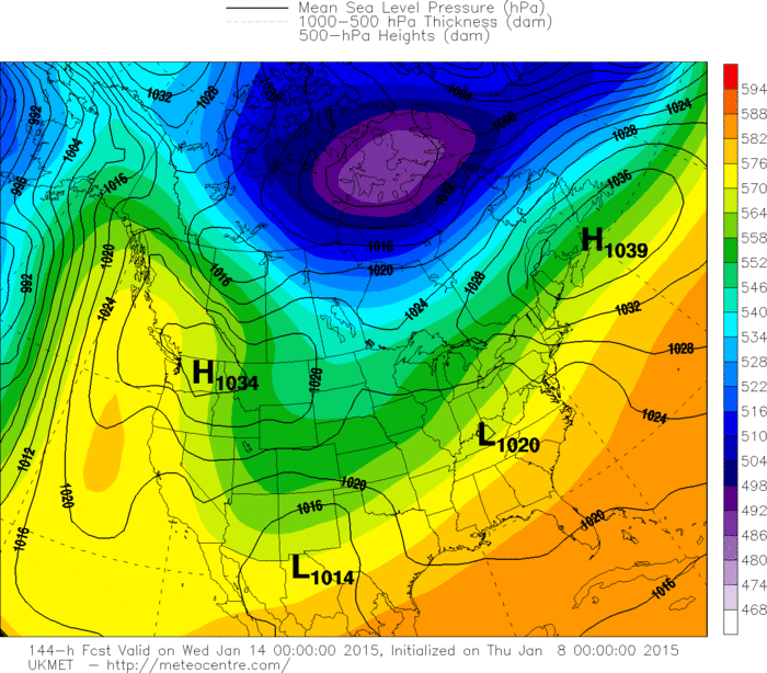
Map above for this evening. Low in Great Lakes will spread light snow eastward....an inch or two likely. Next arctic air mass moving into Rockies. Below...you will see 4 of our models...all based in and around next Thursday. The majority indicate little if any storm for the Nation...specifically the East  EXCEPT......The Euro.  Based on their performances....I will again go with The Euro which seems to out-forecast these other models in a long range
outlook.   Be safe.
Picture
Picture
Picture
Picture
0 Comments


Leave a Reply.

    Genesis of a Tornado
    We'll have daily weather discussions, talking about major systems on the horizon along with anything noteworthy that pops up on our radar.

    Pat Pagano,
    Mike Merin

    Follow us on Twitter and like us on Facebook to get updates whenever we post a new entry!

    RSS Feed

Powered by Create your own unique website with customizable templates.