System in central U.S. heads east with showers and storms then followed by wind and chilly weather this weekend from Great Lakes to Northeast.
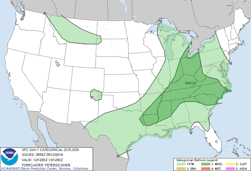
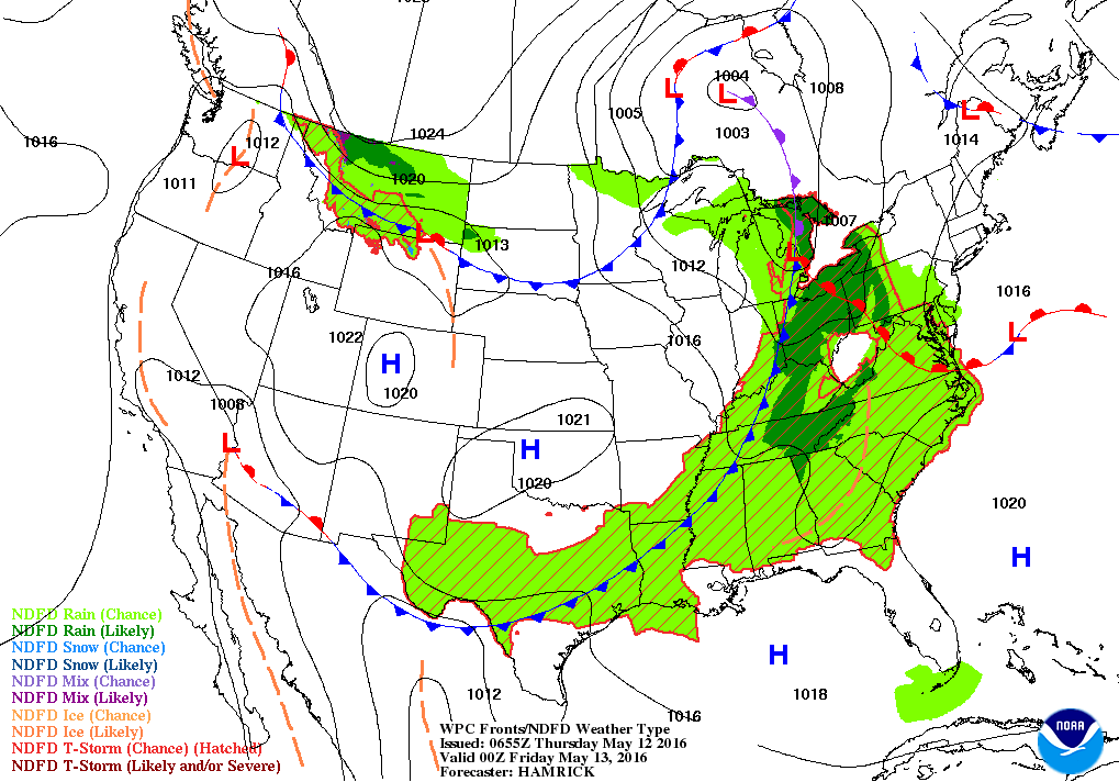
Today's severe weather threat in dark green. Below...today's weather map...showing the system resulting in that threat.
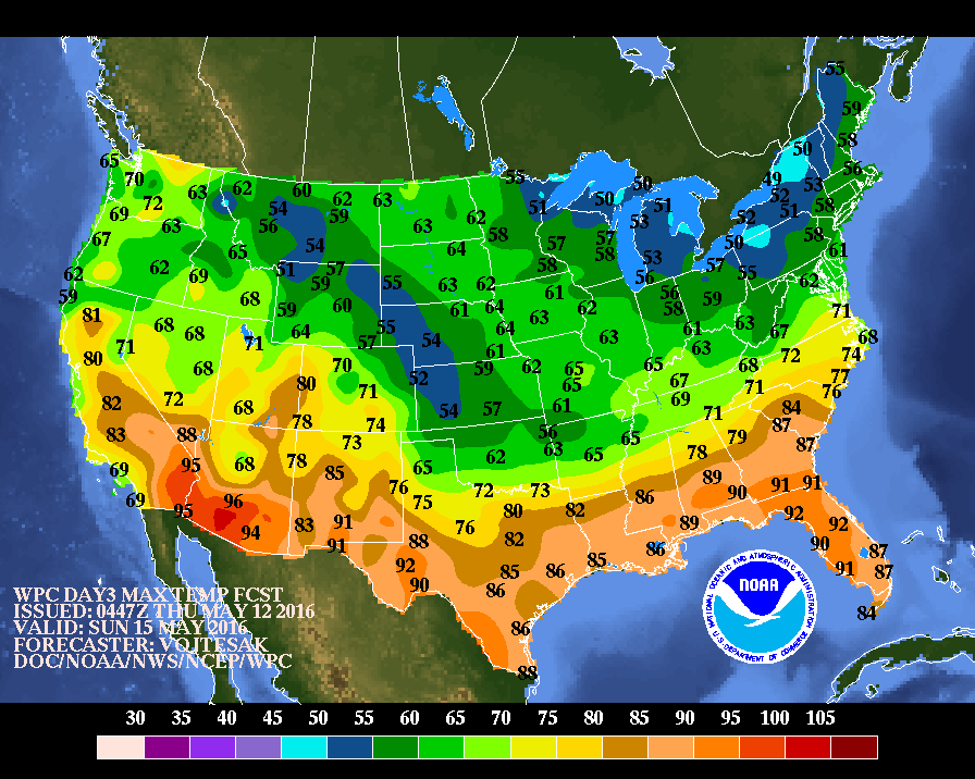
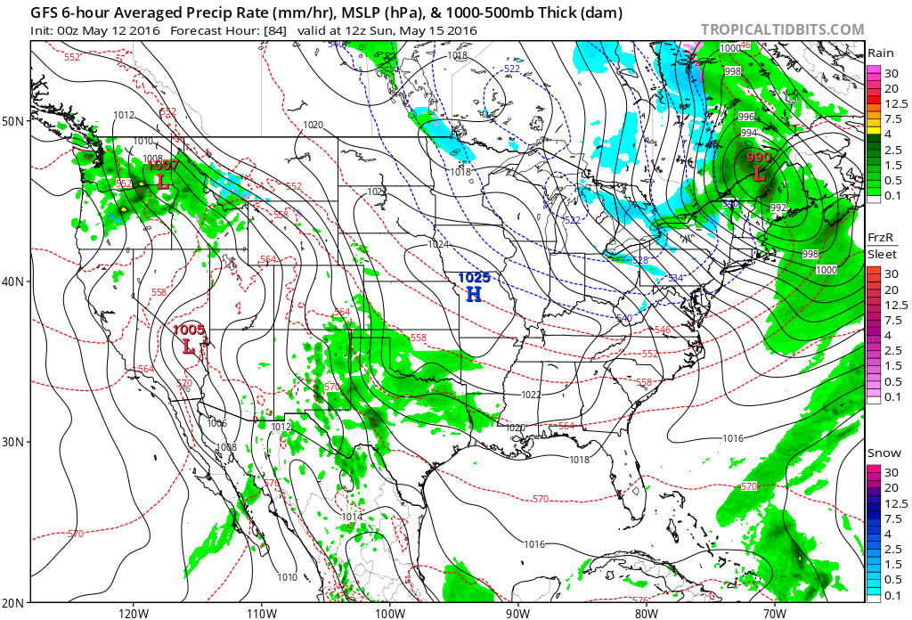
Sunday's daytime temperatures .....light blue is only in the 40s....where some wet snow could fall. GFS Model below - shows thinking for Sunday. Shaded areas of blue indicate wintry precip. Yikes.....May 15th ?
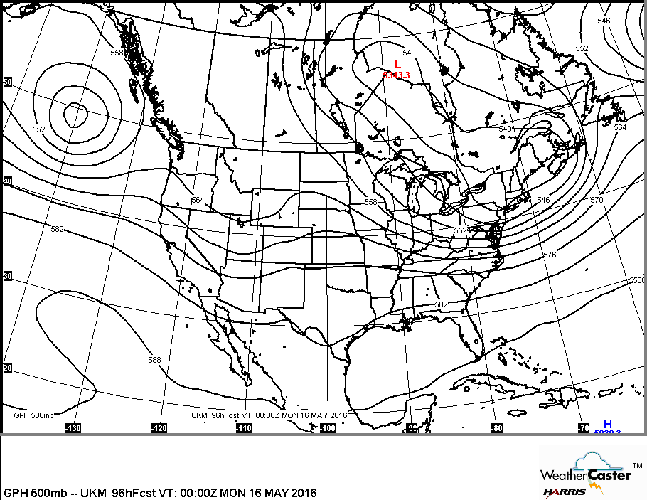
Map below shows the upper air flow: trof in east is culprit for the chilly weather. Be safe.


 RSS Feed
