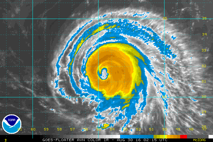
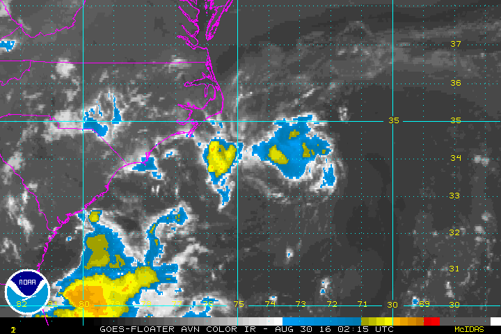
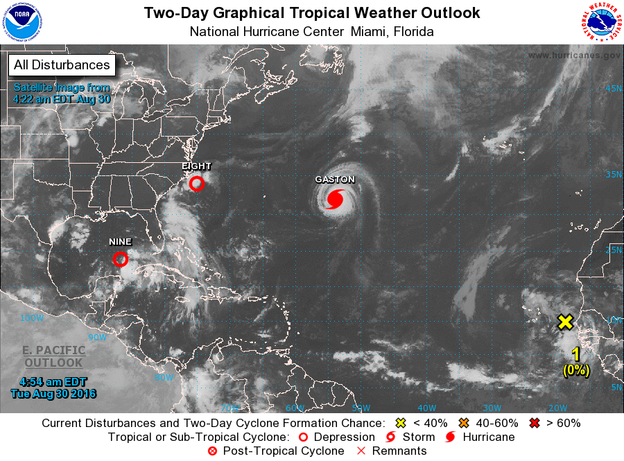
Tropics are active...so below...the satellite pictures for each...
beginning with Hurricane Gaston....100mph + winds. Then Tropical depression 8 - off N.Carolina....then Tropical depression 9 - in Gulf of Mexico.
beginning with Hurricane Gaston....100mph + winds. Then Tropical depression 8 - off N.Carolina....then Tropical depression 9 - in Gulf of Mexico.

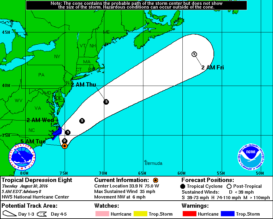
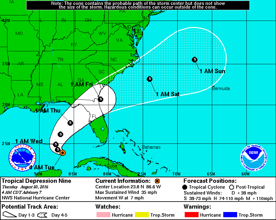
Below...tracks for each of these systems
Here...a look at the Atlantic Basin showing all of the disturbances. Keep your eye on one coming off Africa.
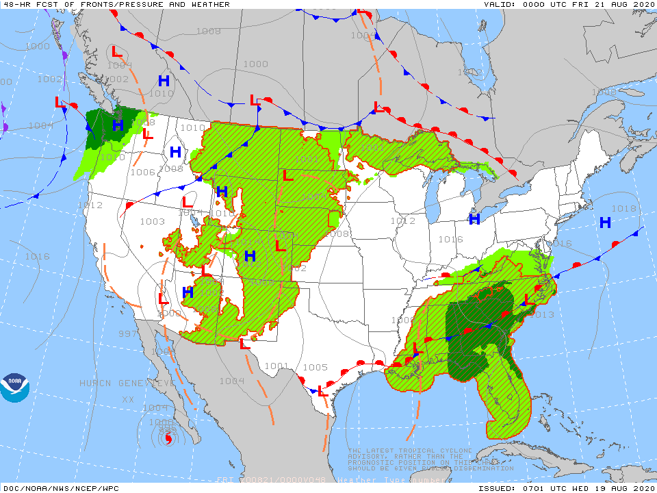
Below....weather map for Thursday. TD # 9 - becomes a tropical storm and heads across the Fla. Panhandle.

 RSS Feed
