
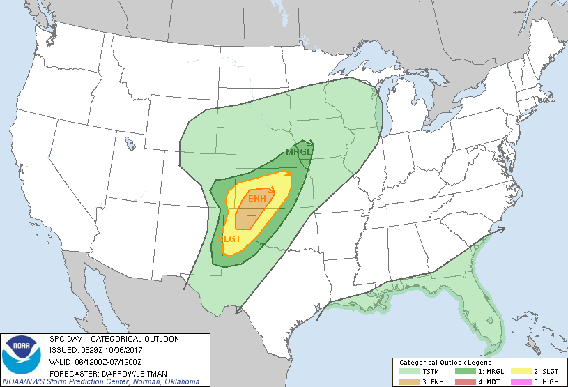
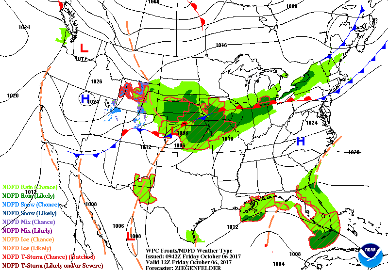
Satellite + radar shows a front from New England to Texas where severe thunderstorms are possible in southern Plains today. Moisture is seen from Nate coming toward the SE Gulf. Nate will become a hurricane and likely make landfall close to New Orleans Saturday night - Sunday a.m. and then head northeast as a rainstorm into Monday. below - today's threat of severe weather - dark green to orange.
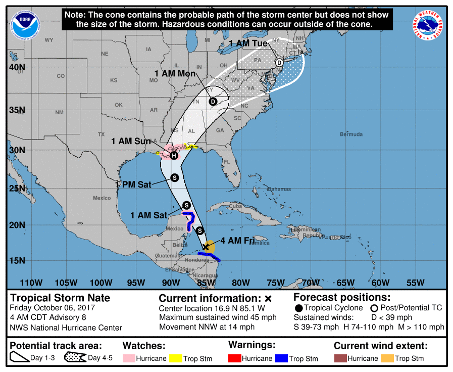
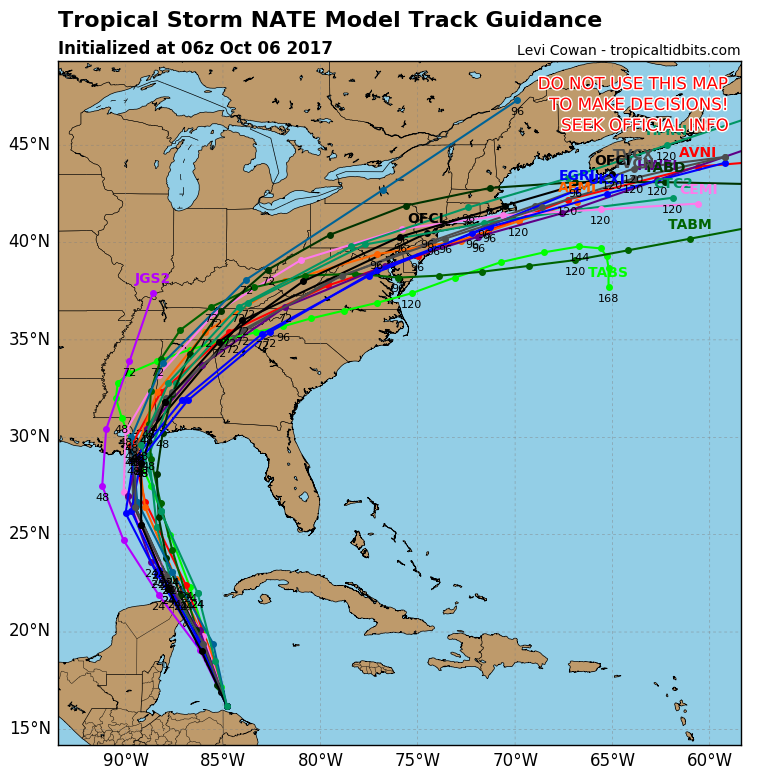
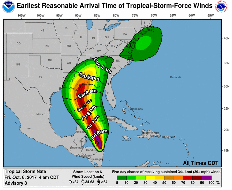
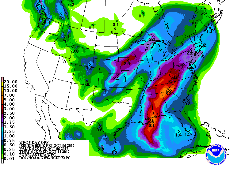
Below - Nate's track by Hurricane Center and then computer models....followed by timeline for wind....and amounts of rainfall over next 5 days.
Below - animated maps for the next couple of days. Be safe.

 RSS Feed
