It has been a really dry start to the season for the Northeast with sunny day after sunny day with a few clouds and more sunny days. Temperatures have touched 80 again in the past couple of days in the NY Metro area.
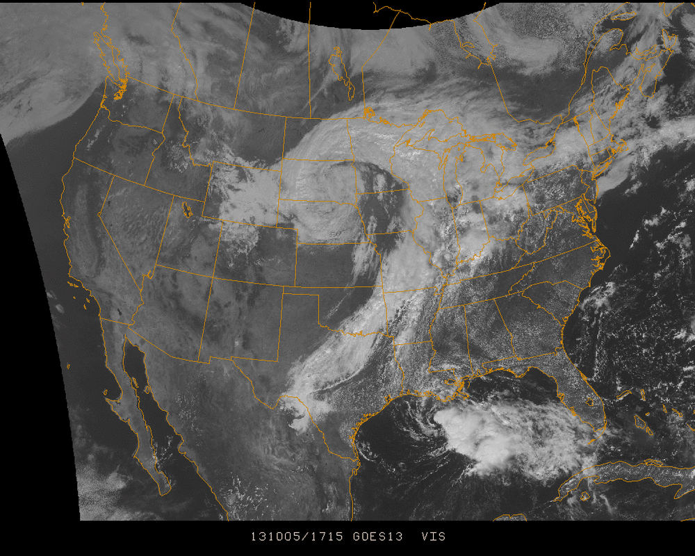
There are a few noticeable features in this afternoon's US visible satellite imagery...
1) Tropical Storm Karen down in the Gulf of Mexico. It's movement has been quite erratic but its future path will be influenced by our #2 feature
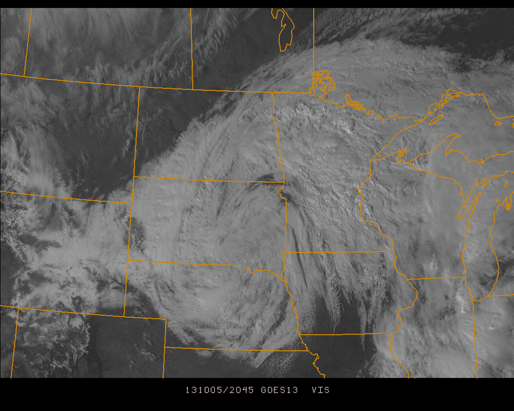
2) The Low Pressure system centered in the North-Central US. This storm has brought so much snow and blizzard-like conditions that you can make out most of Wyoming on this map covered in snow. Below is a closeup of the North Central for better view of the snow. It will be much easier to see the snow on the ground in areas such as South Dakota & North Dakota tomorrow when skies are expected to be clear.
1) Tropical Storm Karen down in the Gulf of Mexico. It's movement has been quite erratic but its future path will be influenced by our #2 feature
2) The Low Pressure system centered in the North-Central US. This storm has brought so much snow and blizzard-like conditions that you can make out most of Wyoming on this map covered in snow. Below is a closeup of the North Central for better view of the snow. It will be much easier to see the snow on the ground in areas such as South Dakota & North Dakota tomorrow when skies are expected to be clear.
Our 3rd feature is a subset of the 2nd feature... The warm/stationary front pushing east across the Great Lakes. This will continue to spawn sporadic showers and thunderstorms in the region in wake of the more consistent rainfall expected Monday into Tuesday for the eastern US.
The exact path of this system has been very inconsistent from model to model so it is still quite uncertain the path this system will exit the region late Tuesday and if some areas closer to the ocean cease seeing rain by Tuesday afternoon or Tuesday overnight. A few days ago, Karen appeared as if it would beat the upper low into the east and bring an even higher rainfall to the eastern seaboard. Its current path has it riding the south end of the cold front across Florida before stalling off the Carolina coastline and weakening even more...
We will be closely monitoring all of this as it unfolds over the next 48 hours into Monday.
- JL

 RSS Feed
