Metro Weather Inc. Services
Like us, follow us, link to us, contact us!
  • Home
    • Daily Weather Discussion
  • Weather Prepared for You
    • Film and TV Production
    • Radio & Television
    • Government and Industry
    • Forensic Services >
      • Weather Record Request Form
    • Metro Morning Monitor
  • About Metro Weather
    • Senior Staff
  • Your Weather Images
  • Contact Us

More Typical Summer Weather....

6/30/2015

0 Comments

 
Picture
Satellite/radar shows a front moving toward the east coast with showers and thunderstorms into Wednesday. Heat continues out west for mainly mountain thunderstorms.
Picture
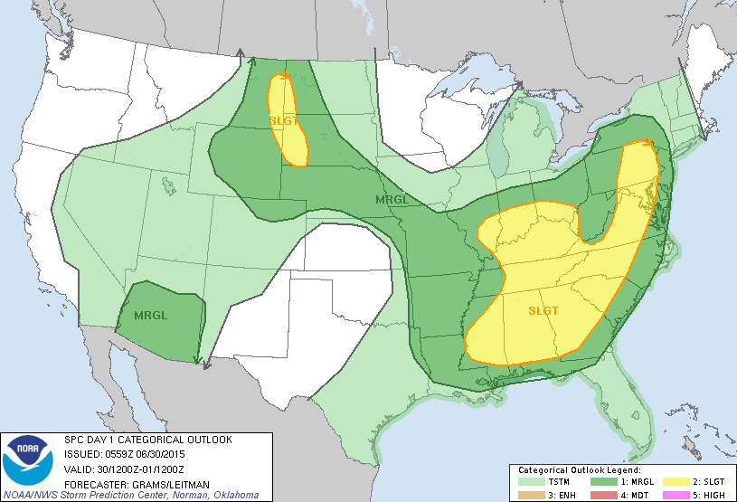
Today's severe threat in dark green and yellow.
Picture
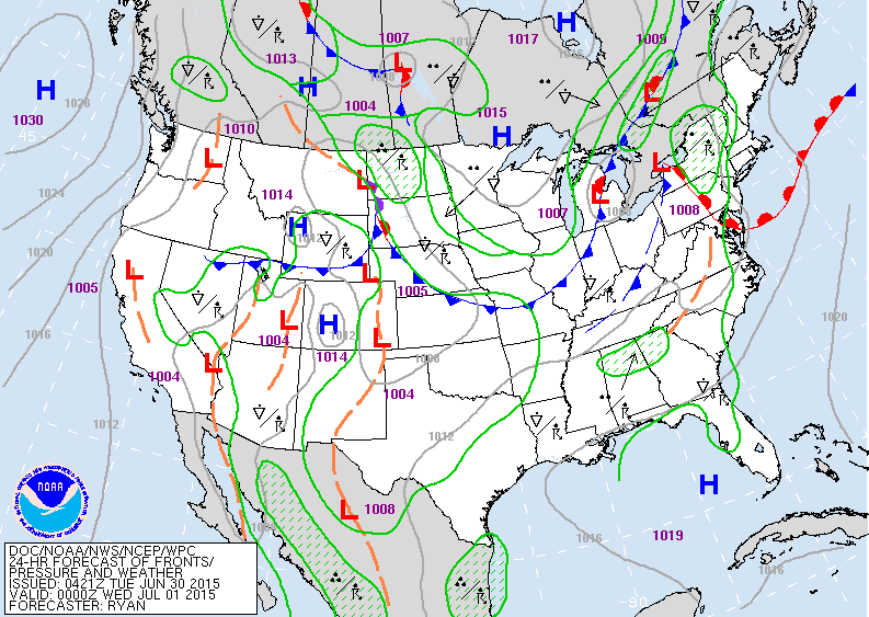
On today's map...cold front in Great Lakes will cause showers and thunderstorms over the east.  Low moving out of Montana will result in storms over The Dakotas.
Picture
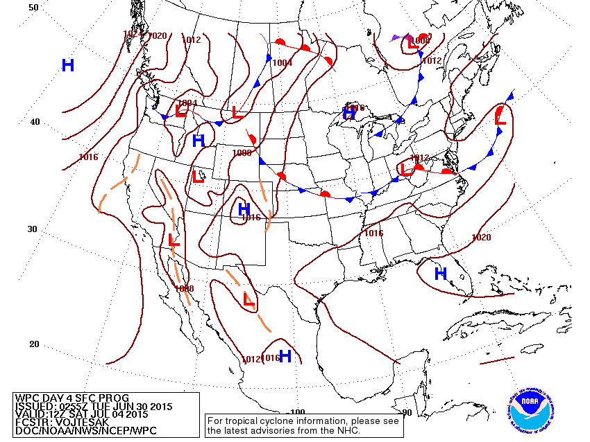
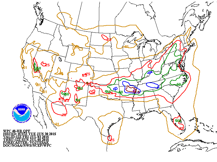
Map above is for Saturday - The 4th.  If you are close to any of the fronts you see on the map...chances are will will at least have a chance of a shower or thunderstorm. Below..you will see projections of rainfall from Friday into Sunday.
Picture
Picture
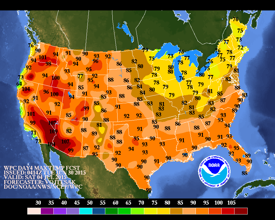
Above...projected afternoon temperatures for Saturday..the 4th. Be safe.
0 Comments


Leave a Reply.

    Genesis of a Tornado
    We'll have daily weather discussions, talking about major systems on the horizon along with anything noteworthy that pops up on our radar.

    Pat Pagano,
    Mike Merin

    Follow us on Twitter and like us on Facebook to get updates whenever we post a new entry!

    RSS Feed

Powered by Create your own unique website with customizable templates.