
Satellite shows how the jet stream continues to carve out much of the nation east of The Rockies. Lake effect snows will continue ...places like Buffalo/Hamburg NY have already received 4ft + and they will get another 1-2 ft.

A reenforcing shot cold air heads across The Gt. Lakes today with more lake effect. Showers So. Florida, rain along west coast. Below...models for Thanksgiving Day.
All indicating about the same.
All indicating about the same.
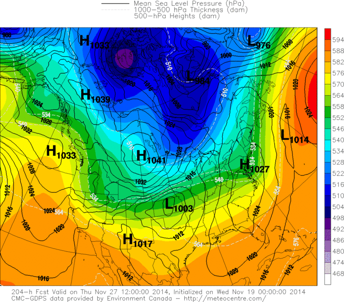
Above..Canadian. Yesterday - forecasting a nor-easter for The East...today...Sunny and cold. A winter storm in Central Plains would mean bad weather there into Midwest...otherwise dry.
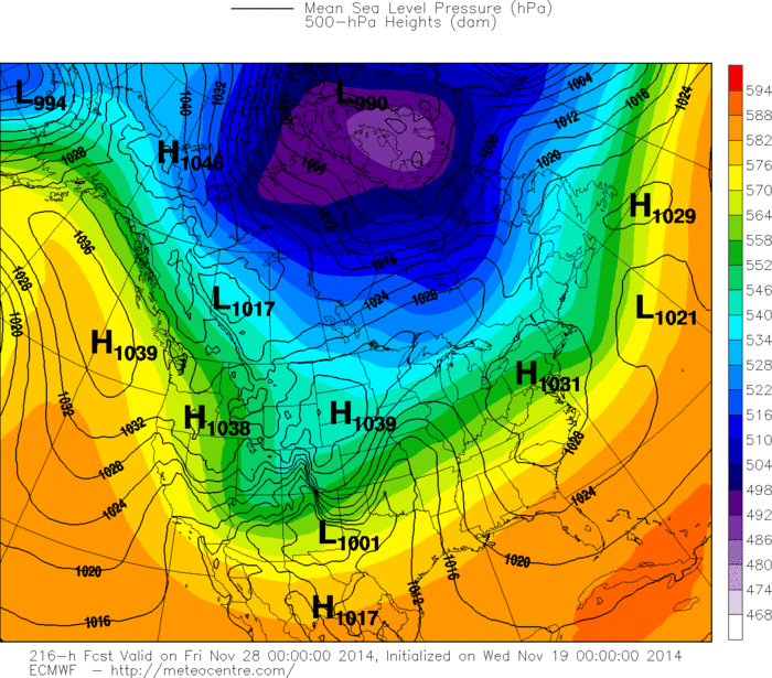
Above - Euro Model - fair - dry - cold east. A strip of wintry precip from Gt. Lks to Midwest to Southern and Central Plains.
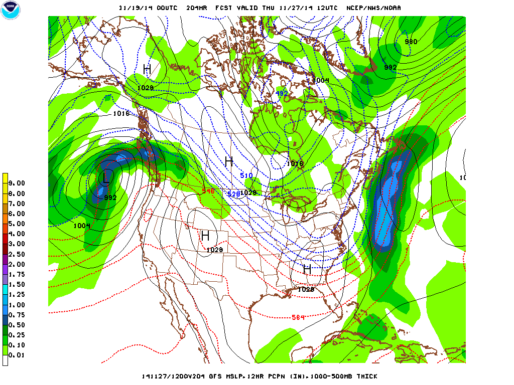
Above - GFS Model - dry weather most of the Nation...their version. Snow in upper Great Lakes otherwise cold for East...mild for west. They will all come together by early next week. Be safe.....stay warm.

 RSS Feed
