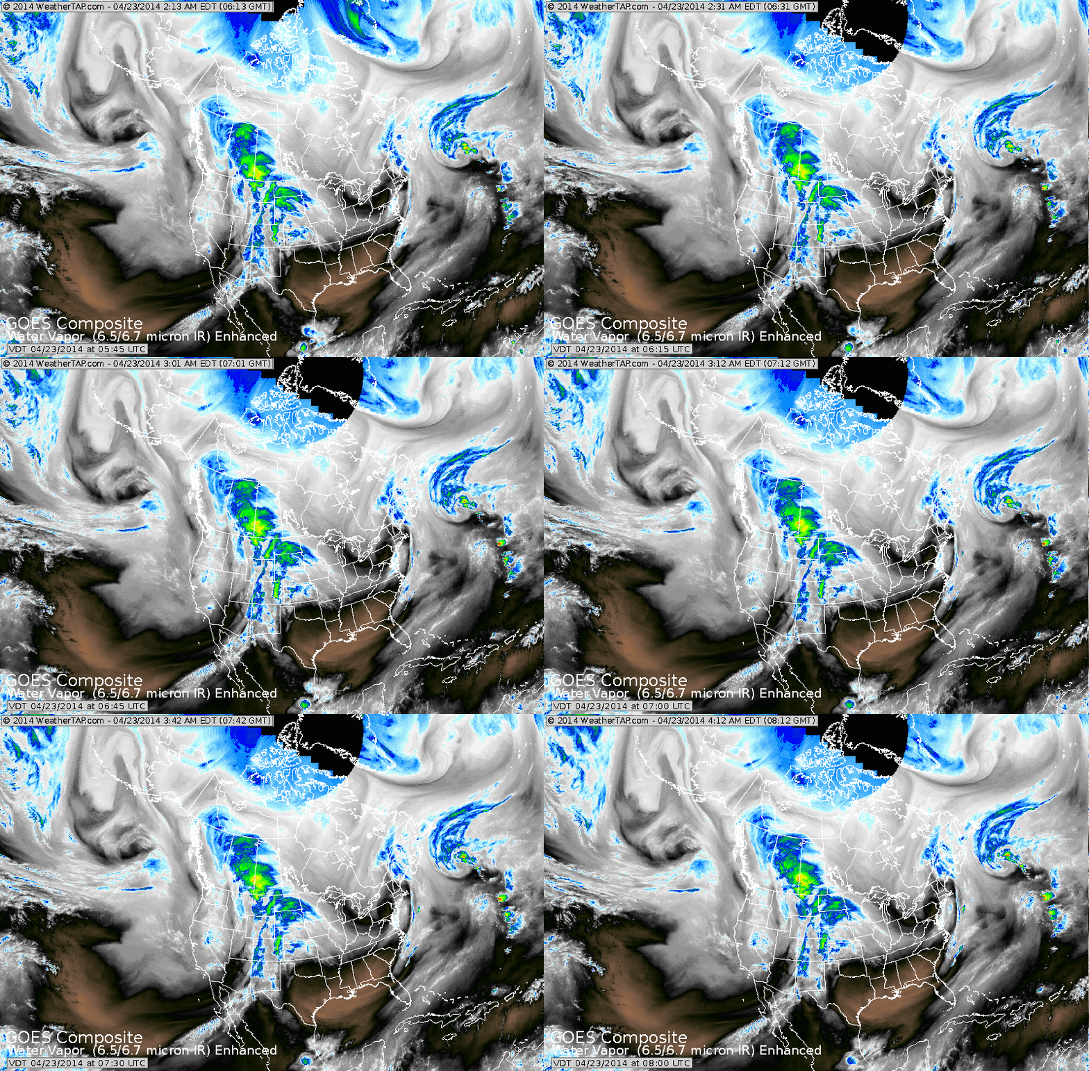
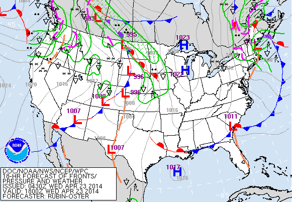
Above...starting in Northeast.....deep low and front moving offshore...so in its wake...lots of wind and left over showers. Sunny Great Lakes and south. Rockies into Plains...next system with showers and thunderstorms...which will move to The East Coast by weekend. System in Pacific will be a slow - trouble-maker mid part of next week.
Above...you can see how the weather map corresponds quite well with satellite above.
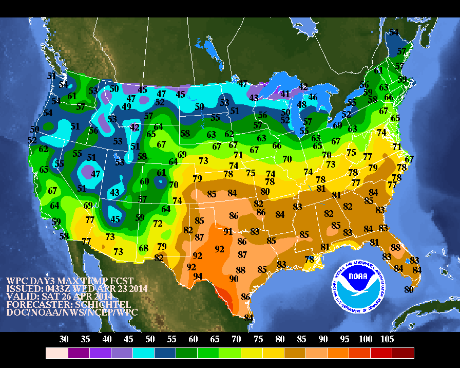
Map above shows expected high temperatures for this Saturday...which will be the warmest...nation-wide of the next 7-10 days.
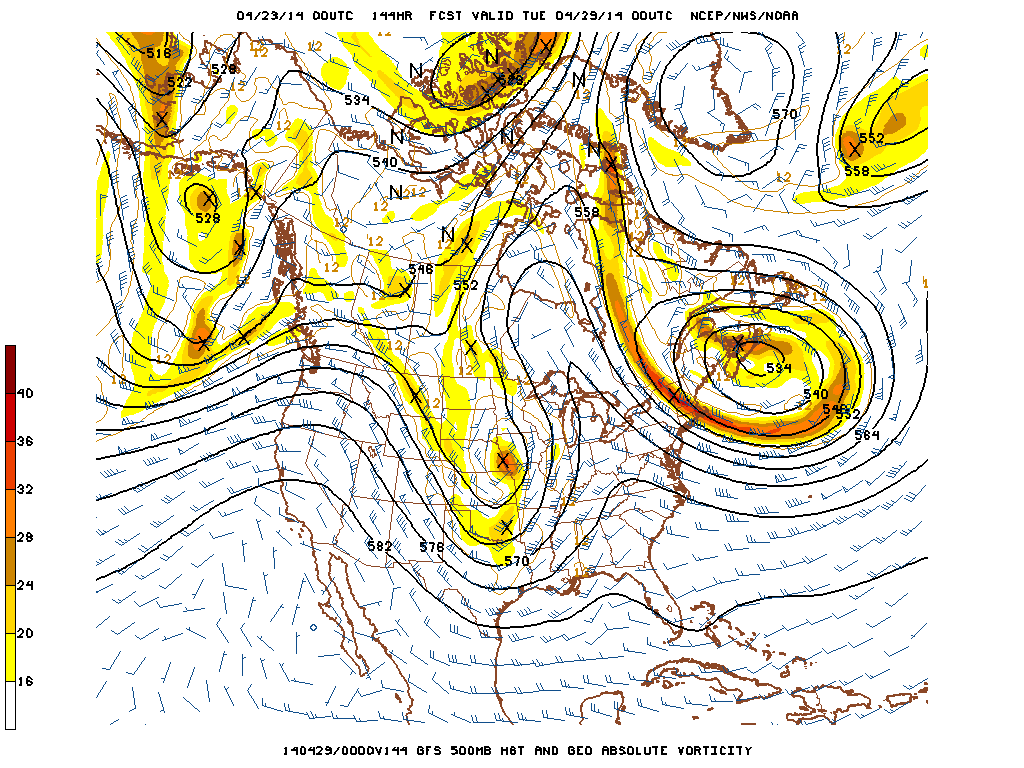
Above map is for next Wednesday...and this is the upper winds at 18,000ft. Notice a circle over Greenland......that is a high or ridge.
Notice the swirling circles over Nova Scotia.....that is a low or trof.
It cannot go anywhere because of blocking high to north. The elongated "u" shaped system in Plains is the next trof which has to
go underneath the ridge over The Great Lakes.....since pattern is blocked across Canada. That will cause a slow moving storm to move across The Nation mid part of next week.
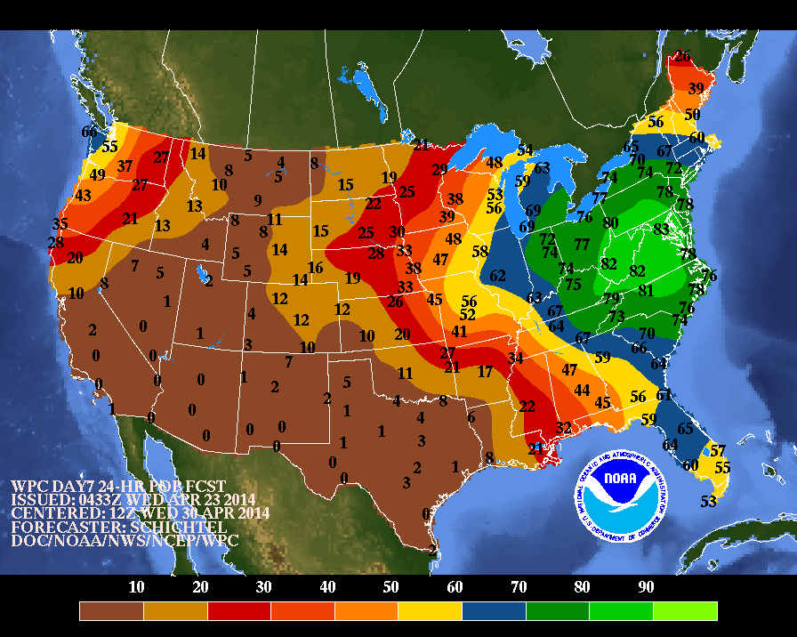
Above...probabilities of precip for next Wednesday due to that slow
moving storm. Do not expect things to dry out for a few days next week...so April showers will easily carry into May. Later.
moving storm. Do not expect things to dry out for a few days next week...so April showers will easily carry into May. Later.

 RSS Feed
