Metro Weather Inc. Services
Like us, follow us, link to us, contact us!
  • Home
    • Daily Weather Discussion
  • Weather Prepared for You
    • Film and TV Production
    • Radio & Television
    • Government and Industry
    • Forensic Services >
      • Weather Record Request Form
    • Metro Morning Monitor
  • About Metro Weather
    • Senior Staff
  • Your Weather Images
  • Contact Us

More Changeable Than Normal

5/9/2018

0 Comments

 
Picture
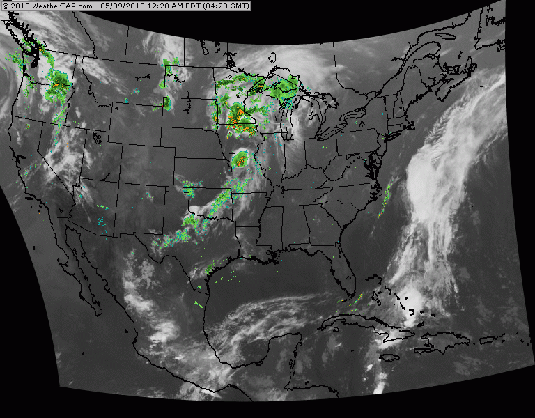
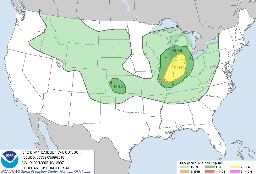
Above - Satellite/radar showing rain & storms Midwest - reaches East late Thursday...offshore Friday. Showers in Northwest - reaches Northeast Saturday and Sunday. If that 2nd front picks up some speed - things could improve during Mother's Day for Northeast. Best chance of that - New England. Below - today's risk of severe weather - dark green and yellow for Ohio Valley.
Picture
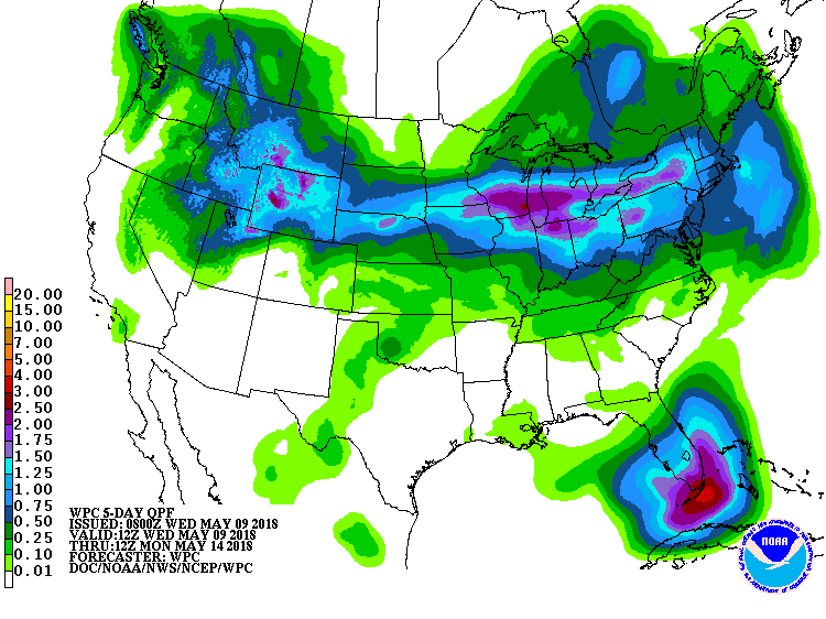
​Below - rainfall predictions for the next 7 days...which includes this weekend. UGH !
Picture
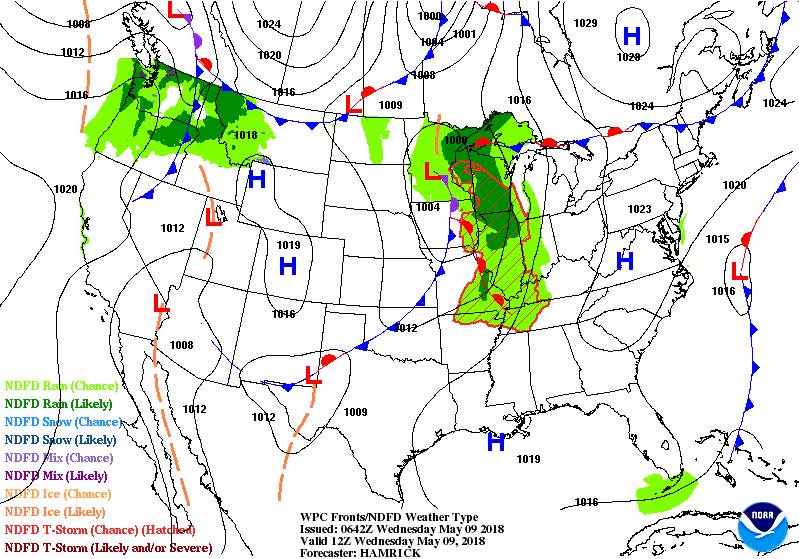
​Below - animated maps for the next couple of days. 
Picture
Picture
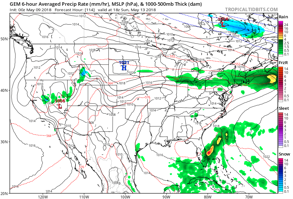
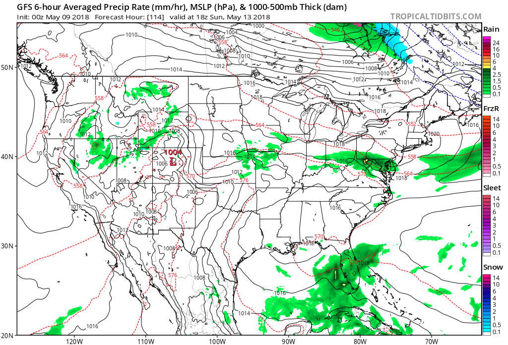
Canadian Model for this Sunday - green indicates rain....so find your locations and you have a forecast by this model. Below - The GFS Model predicts for this Sunday.
Picture
​Looks like the best chance of rain for Mother's Day - over Florida...next best chance - Northeast.  Be safe.
0 Comments


Leave a Reply.

    Genesis of a Tornado
    We'll have daily weather discussions, talking about major systems on the horizon along with anything noteworthy that pops up on our radar.

    Pat Pagano,
    Mike Merin

    Follow us on Twitter and like us on Facebook to get updates whenever we post a new entry!

    RSS Feed

Powered by Create your own unique website with customizable templates.