Metro Weather Inc. Services
Like us, follow us, link to us, contact us!
  • Home
    • Daily Weather Discussion
  • Weather Prepared for You
    • Film and TV Production
    • Radio & Television
    • Government and Industry
    • Forensic Services >
      • Weather Record Request Form
    • Metro Morning Monitor
  • About Metro Weather
    • Senior Staff
  • Your Weather Images
  • Contact Us

Mild...unsettled then colder.

12/3/2013

0 Comments

 
Surface map below will show much of the nation under clouds. Biggest weather maker coming out of Rockies into the upper Midwest where up to 1/2 foot of snow will fall only to be followed by temps. between 10 and 15 below zero by late week. Some of that colder air moves east this weekend....accompanied by rain and a touch of snow. 
Picture
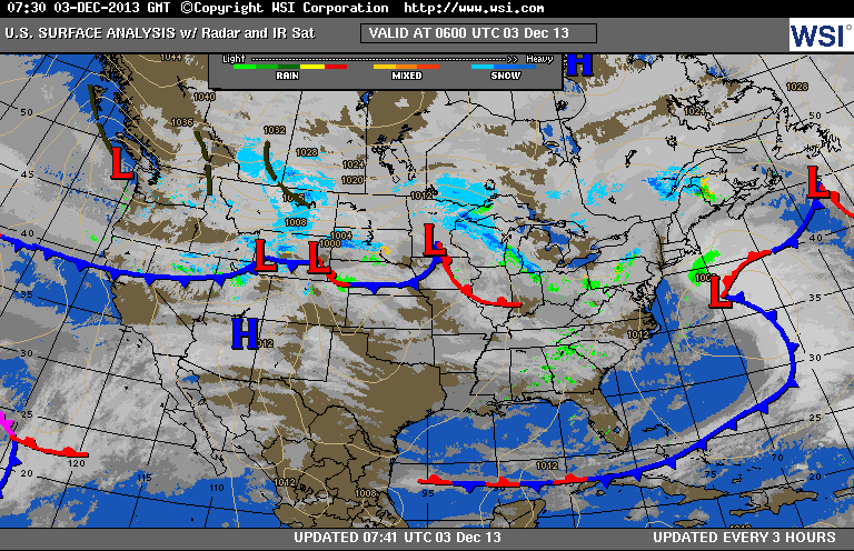
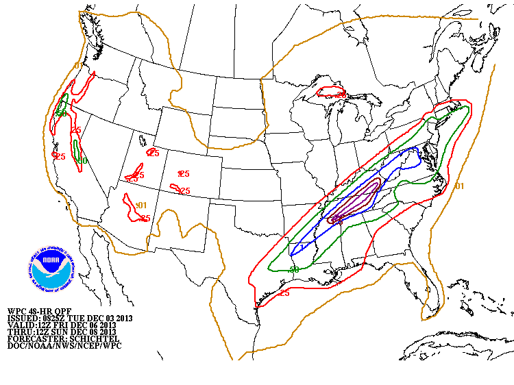
Below...satellite picture showing the most vigorous system off the East coast.....not affecting much. Below that is the amount of rain expected from Friday into Sunday. Clearly the heaviest Tenn.Valley into Southeast. A storm is likely to hit the Northeast and MidAtlantic Monday...most of which will be rain...with snow confined to interior New England. Until then...happy shopping. Later.
Picture
Picture
0 Comments


Leave a Reply.

    Genesis of a Tornado
    We'll have daily weather discussions, talking about major systems on the horizon along with anything noteworthy that pops up on our radar.

    Pat Pagano,
    Mike Merin

    Follow us on Twitter and like us on Facebook to get updates whenever we post a new entry!

    RSS Feed

Powered by Create your own unique website with customizable templates.