
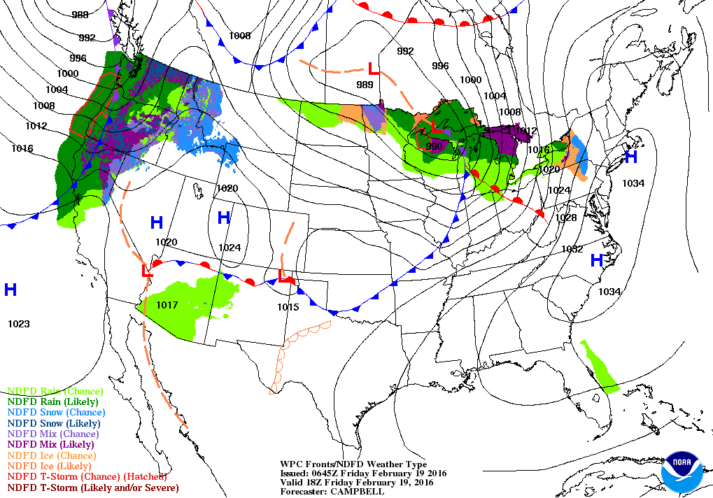
Satellite shows waves of Pacific energy moving from west to east ....giving the nation quick changes this weekend. A more pronounced wave will trigger a storm early next week from Gulf to East coast. Below....weather map for today....showing a windy front passing through Great Lakes and storminess begin to shape out west.
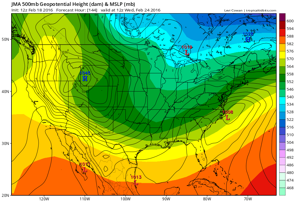
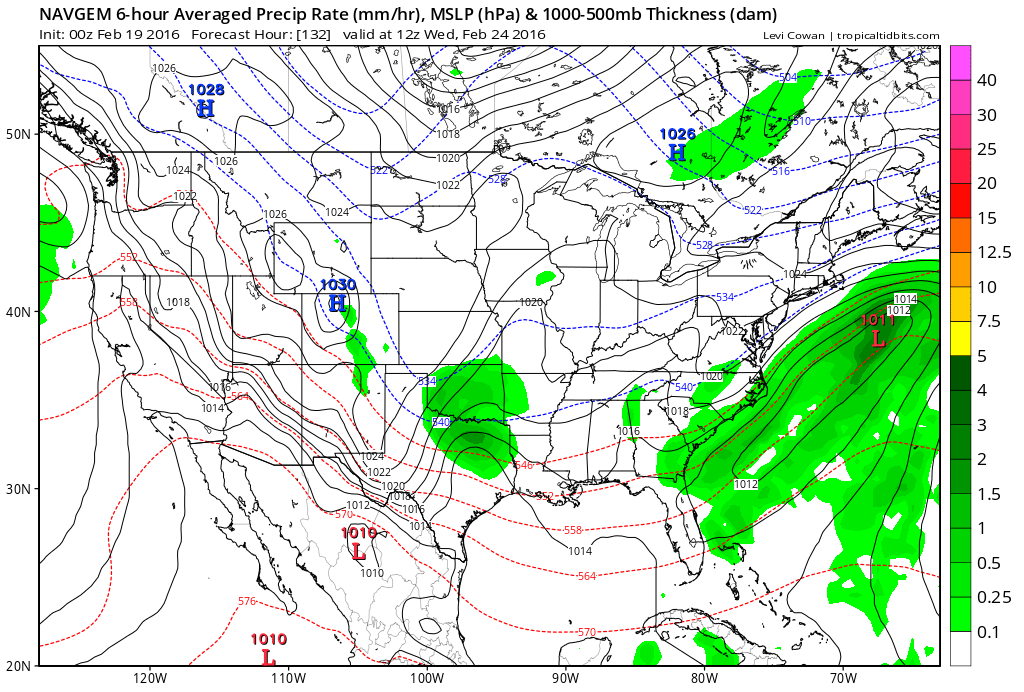
Below...models and their take on storm. GFS is much too fast.
Canadian wants to have more than 1 storm. Euro is too slow and UKMET is too far west. Pick your choice. Thinking is for mainly rain for big cities...wet snow for Appalachians Tues.nite into Wednesday.
Canadian wants to have more than 1 storm. Euro is too slow and UKMET is too far west. Pick your choice. Thinking is for mainly rain for big cities...wet snow for Appalachians Tues.nite into Wednesday.
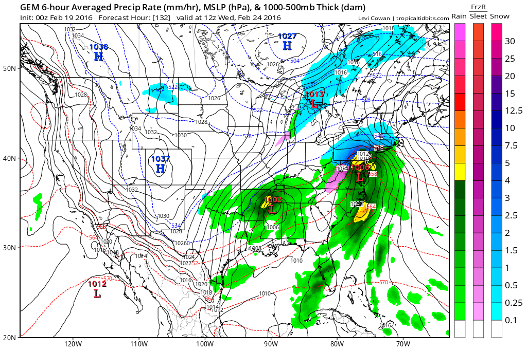
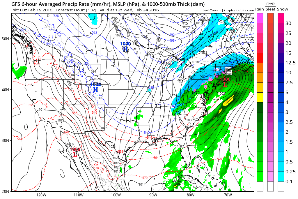
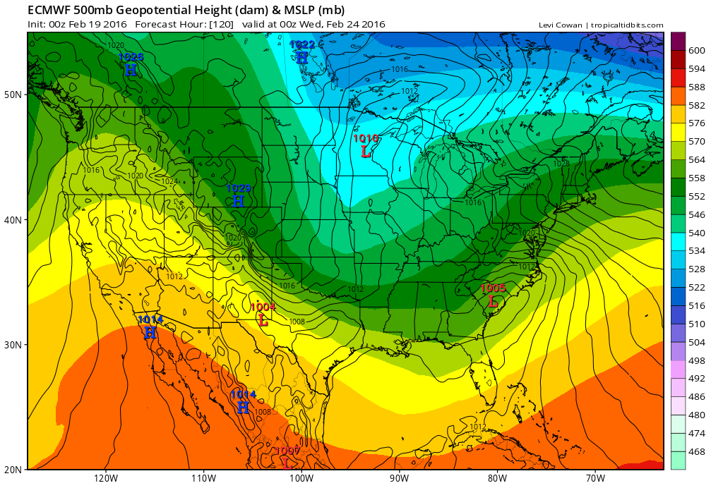
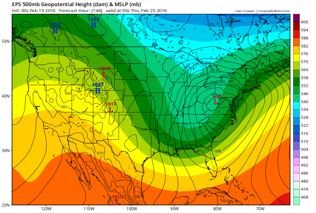
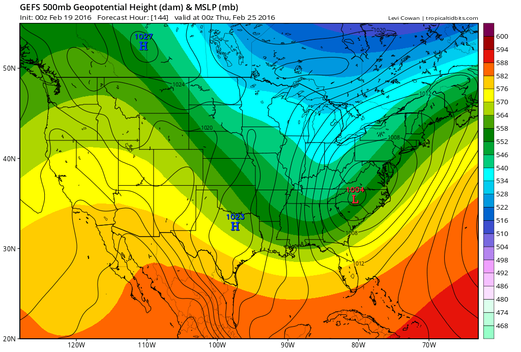
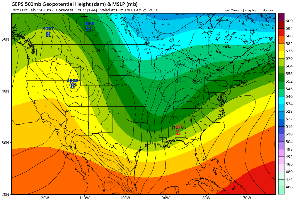
Below are 3 of the different ensemble members which gives even more choices....but in this type of situation we cannot look for these models to solve small details until we get closer to the event. Have a nice weekend.

 RSS Feed
