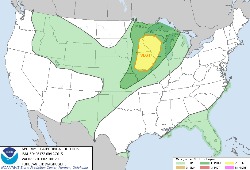
The southeast will continue to be wet next couple...as well as the Northern Plains and Midwest....and Pacific Northwest. Below...today's risk of severe weather in dark green and yellow....which correlates nicely with radar above.
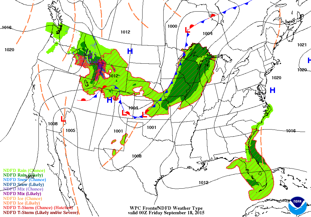
Below...map valid for this evening....showing cold front moving through Great Lakes.
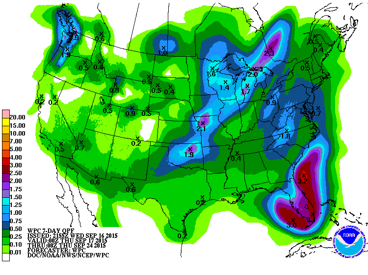
Rainfall amounts expected over the next 7 days. Florida gets over 3".....while Great Lakes down to Southern Plains receive over 2".
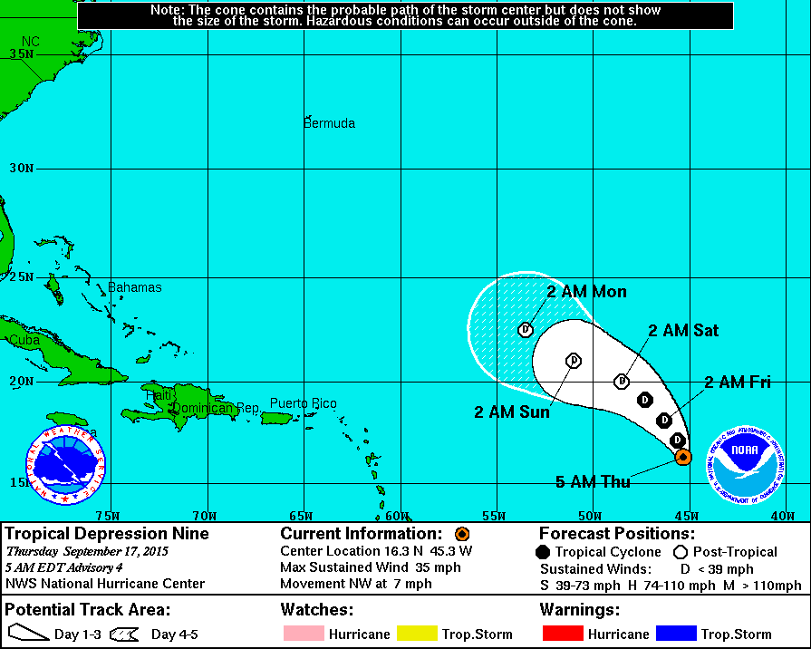
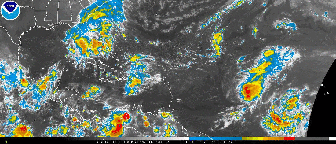
Tropical Depression # 9 has 35 mph winds but not expected to become a storm. Below..a satellite picture showing
it...as well as another disturbance to it's east. Be safe.
it...as well as another disturbance to it's east. Be safe.


 RSS Feed
