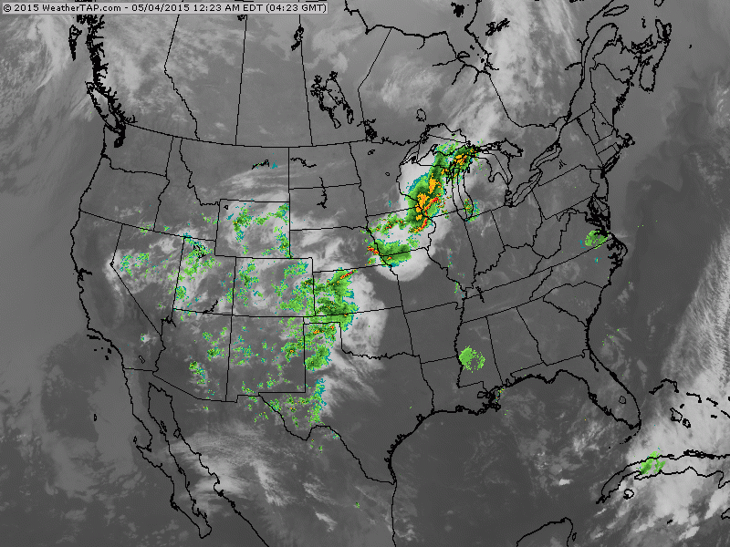
Above....satellite overlayed with radar. Showers and some storms fron Gt.Lakes into the Southwest. These are associated with a front which may result in severe weather today....which we show below. Clouds and showers in Bahamas will spark a low which may become tropical by late week.
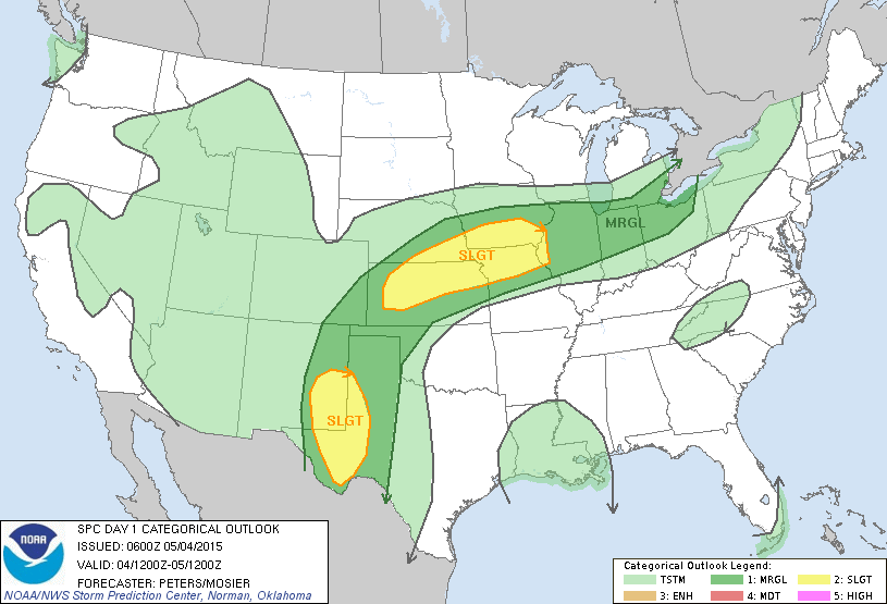
DArk green and yellow indicate best chance for any severe storms today.
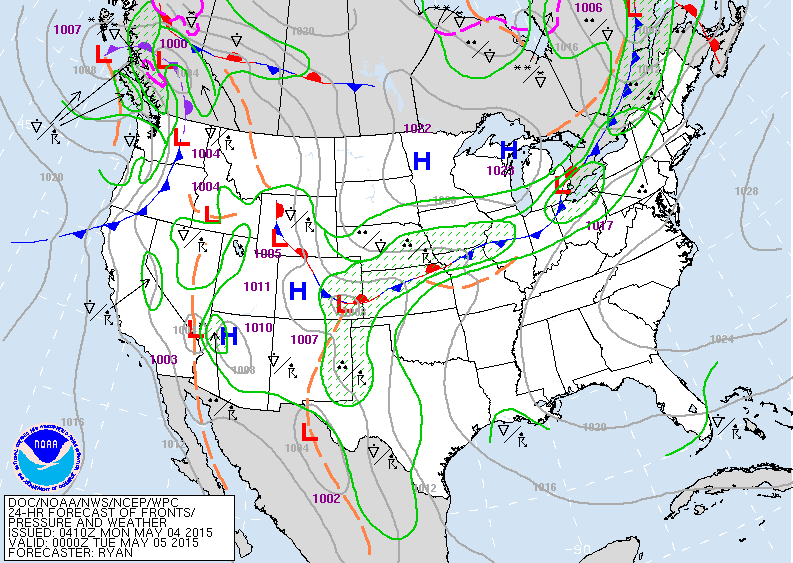
Map for this evening....showing cold front from eastern Great Lakes to Colorado. Showers and storms along this front. Another front in Pacific Northwest with showers.
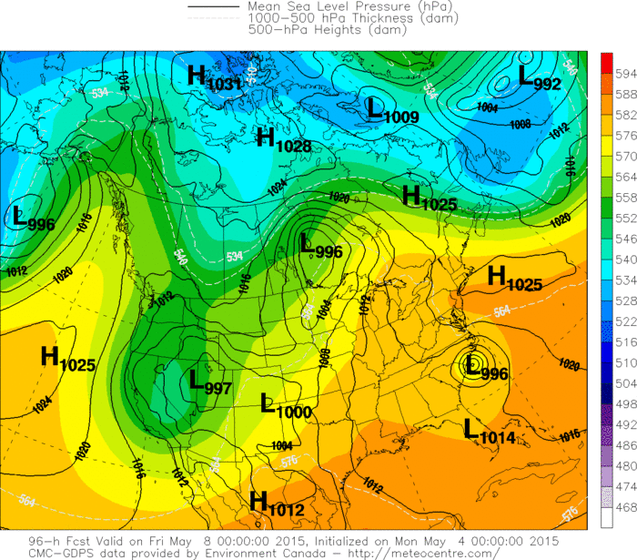
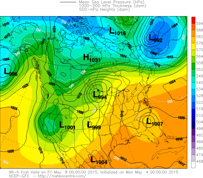
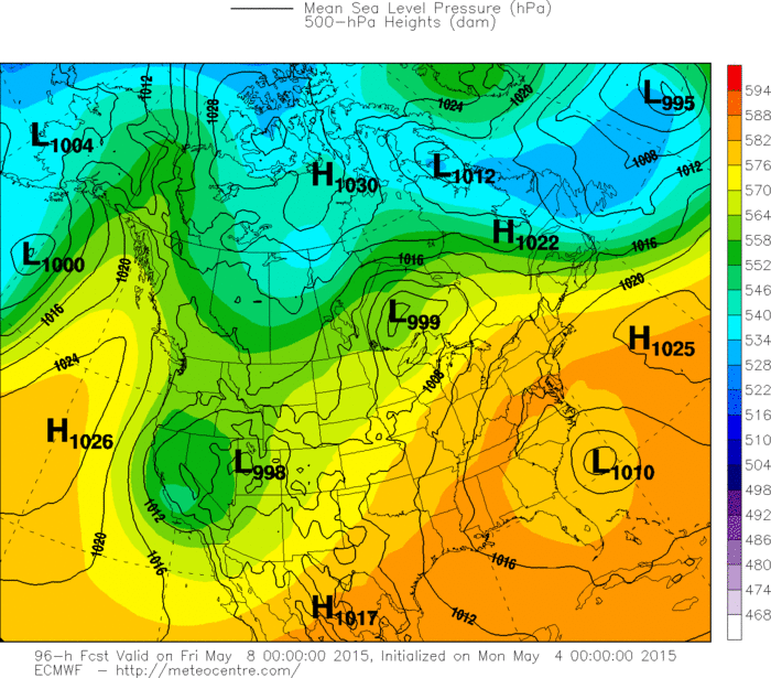
Below...in this order...Canadian....GFS.....Euro Model all depicting a sub-tropical low off southeast coast for late week. Until tomorrow....be safe.
Below...in this order...Canadian....GFS.....Euro Model all depicting a sub-tropical low off southeast coast for late week. Until tomorrow....be safe.

 RSS Feed
