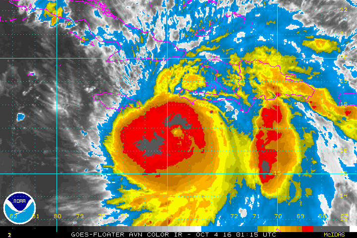
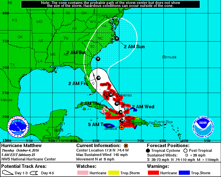
Matthew continues as a category 4 - dangerous hurricane some 200 miles south of sw tip of Haiti. Still sporting 150 mph winds with life threatening storm surge and rains. Track is posted below....hurricane watches will go out for Florida later this a.m.
The entire East Coast must watch this storm.
The entire East Coast must watch this storm.
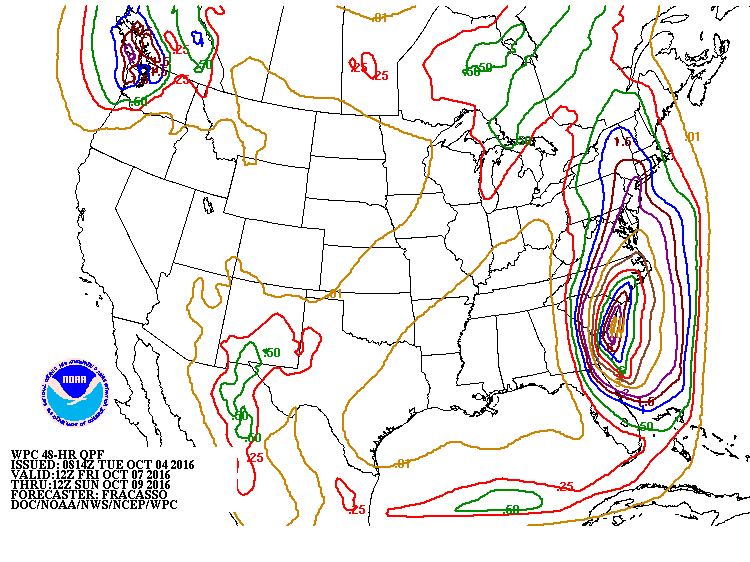
Projected amounts of rain from Matthew below...which starts
Friday and goes into Sunday.
Friday and goes into Sunday.
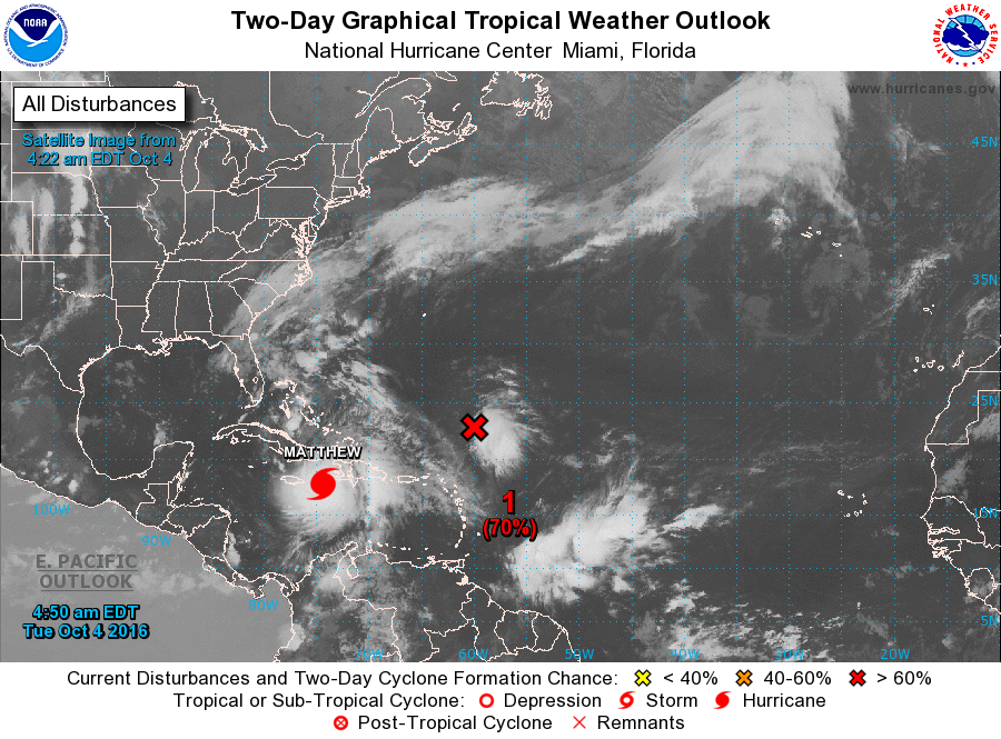
To complicate things even more so...below is the tropical Atlantic. We are 2 other disturbances not far from Matthew...and they will need to be watched as well. One would think they would be absorbed by Matthew...but tropical weather doesn't work that way.
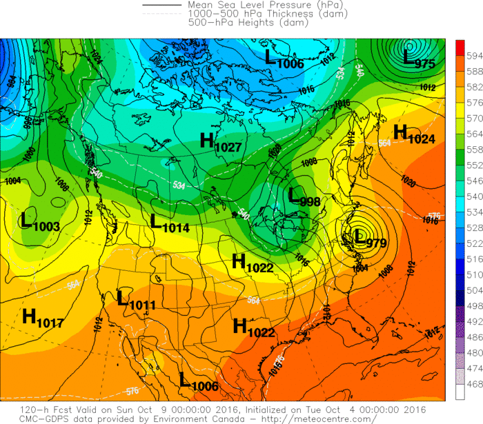
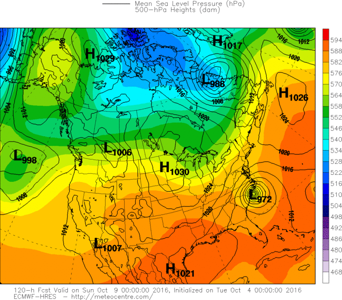
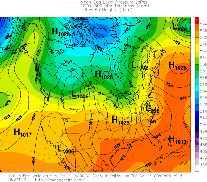
Here are the projections from our computer models - valid for Saturday evening.

Finally - front in Rockies will cause severe weather today...below...map showing that area in dark green...yellow and orange. Be safe.


 RSS Feed
