
Satellite/radar pix shows next cold front flying into the Northeast with more showers. Old front causing rain in
Florida.
Florida.
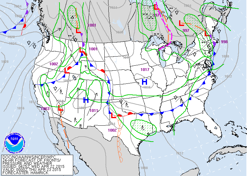
Weather map for early this evening. Cold front moving off
east coast with showers. Rain and snowshowers from the Great Lakes to New England. Widespread precip. in the Rockies. Looks like that system will head for Mid Atlantic and Southeast this weekend.
east coast with showers. Rain and snowshowers from the Great Lakes to New England. Widespread precip. in the Rockies. Looks like that system will head for Mid Atlantic and Southeast this weekend.
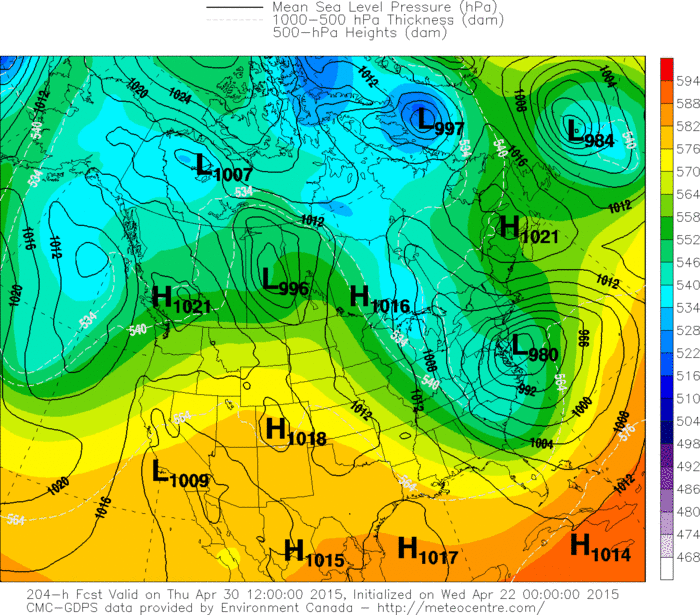
Long range models have delayed the onset of any major spring storm until the end of NEXT week. Above....Canadian model showing a robust storm off the Mid Atlantic....where yesterday...it was earlier...weaker...and further offshore.
If this were to verify...accumulating wet snow could fall in parts of the Appalachians.
If this were to verify...accumulating wet snow could fall in parts of the Appalachians.
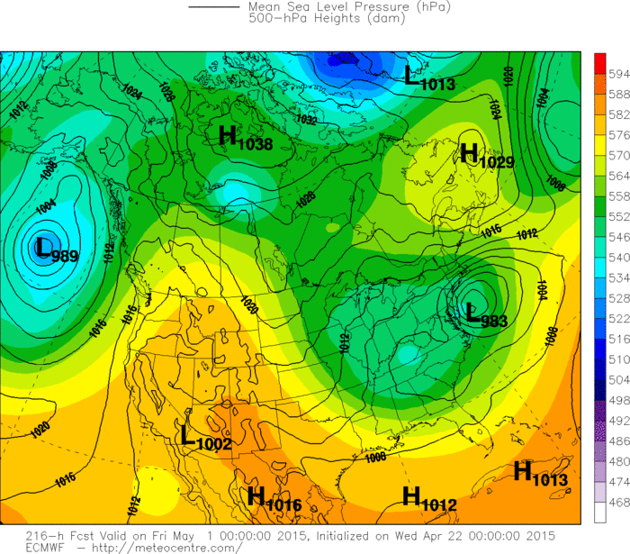
Above...Euro Model....looking very similar to Canadian.
Once again Euro is later...but as intense and a bit further east than their forecast yesterday. These models are all being based on an upper pattern that could turn out to be a bit wacky. So....will April go out like a March Lion......stay tuned and we'll find out. Meanwhile...nippy north...warm and wet south. Be safe.
Once again Euro is later...but as intense and a bit further east than their forecast yesterday. These models are all being based on an upper pattern that could turn out to be a bit wacky. So....will April go out like a March Lion......stay tuned and we'll find out. Meanwhile...nippy north...warm and wet south. Be safe.

 RSS Feed
