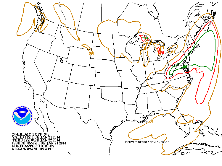
Low pressure over Tennessee Valley will hop off the mid Atlantic coast tonight and bring near blizzard conditions from mid Atlantic to southern New England. 6"-10" from Boston to Washington/Baltimore...with as much as 15" from New Jersey shore thru Long Island and The Cape.
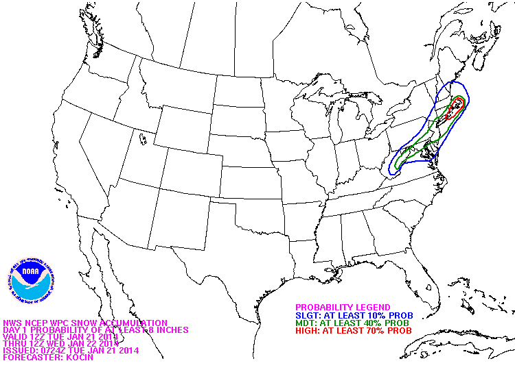
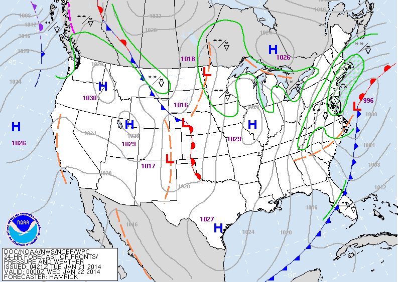
From Appalachians into southern New England...3"-6". Below...you can see the amounts of liquid expected ( normally 10" of snow for each 1"...but due to cold air...that will be either 15 to 1 or 20 to 1. ) Following chart shows probability of 8" or more.....followed by what the weather map will look like this evening.
From Appalachians into southern New England...3"-6". Below...you can see the amounts of liquid expected ( normally 10" of snow for each 1"...but due to cold air...that will be either 15 to 1 or 20 to 1. ) Following chart shows probability of 8" or more.....followed by what the weather map will look like this evening.
The storm exits on Wednesday...and very cold air continues from The Plains to The East Coast. From time to time...clippers will bring
bouts of snow. This will easily be one of the roughest...longest periods of winter thus far for many places. Below...will attempt an animated radar loop....let's hope it works. If it doesn't...you'll find our satellite below that. Stay safe.
bouts of snow. This will easily be one of the roughest...longest periods of winter thus far for many places. Below...will attempt an animated radar loop....let's hope it works. If it doesn't...you'll find our satellite below that. Stay safe.


 RSS Feed
