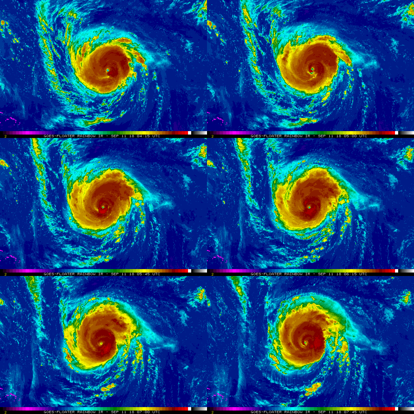
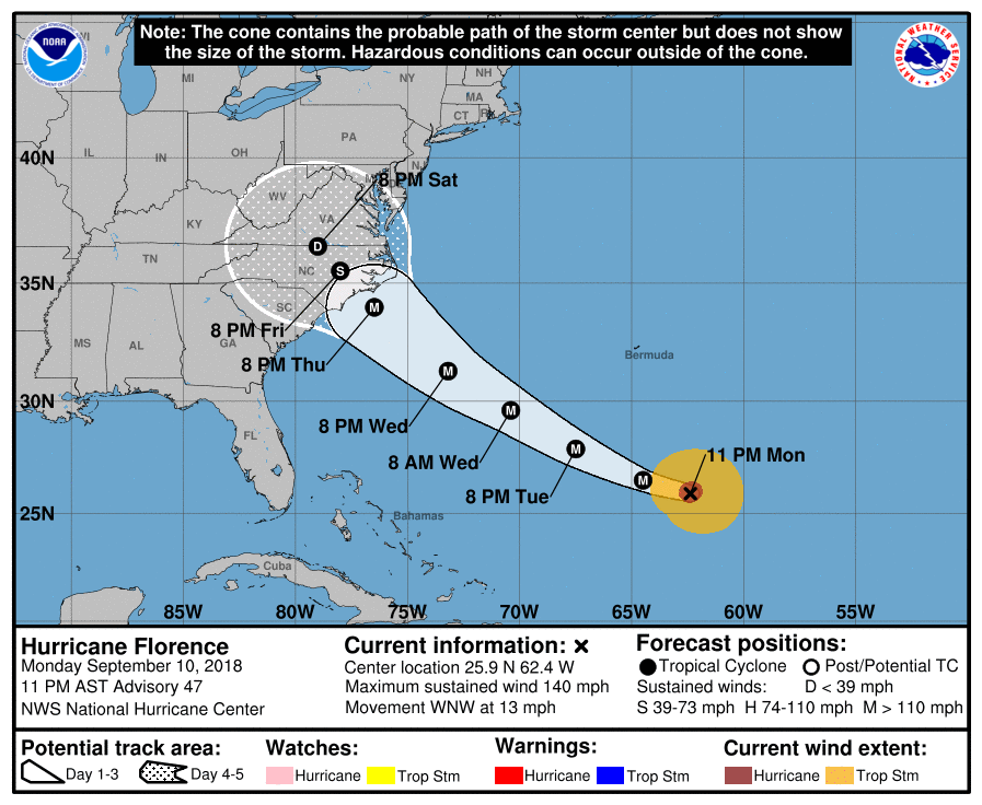
Hurricane Florence - a major destructive hurricane with 140-150 mph winds heading west northwest toward the Carolinas of The U.S. In addition to many questions on her track...it looks certain that she will directly affect the Eastern third of the Carolinas with destructive wind..rain- floods and storm surge and then inland areas as far northwest as Virginia. Since the storm will stall...rainfall could easily measure over 2-3 FEET IN PLACES BY THE TIME THE WEEKEND IS OUT. This storm will become historical as far as flooding and should not be taken lightly.
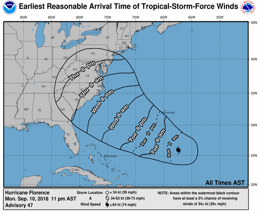
Below...it's track...timing on storm force winds.
Below...it's track...timing on storm force winds.
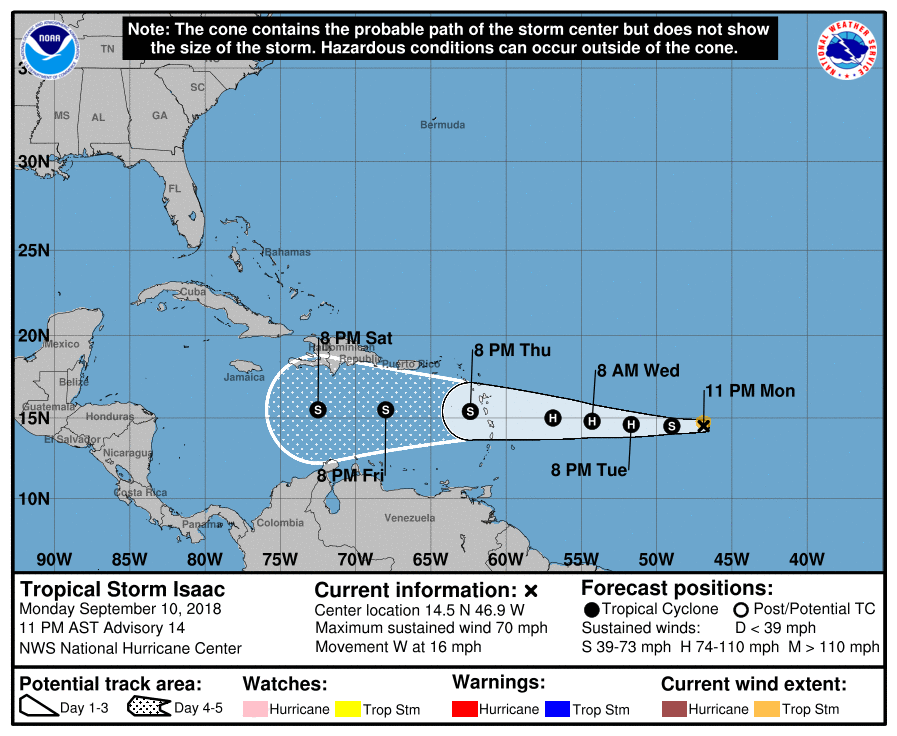
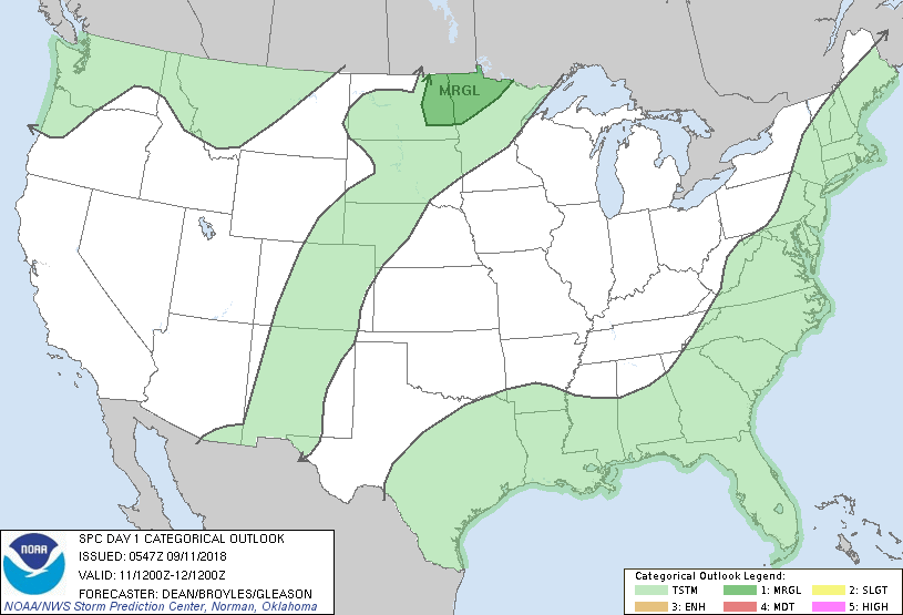
Below is the track of Issac. Following that...today's risk of severe weather in dark green.
Below- satellite picture showing the tropics. Hurricane Helene will curve north and should not be a threat. Issac will stay weak but follow in back of Florence - staying offshore. System in Gulf could become a tropical storm and head for the Texas coast with heavy rains.
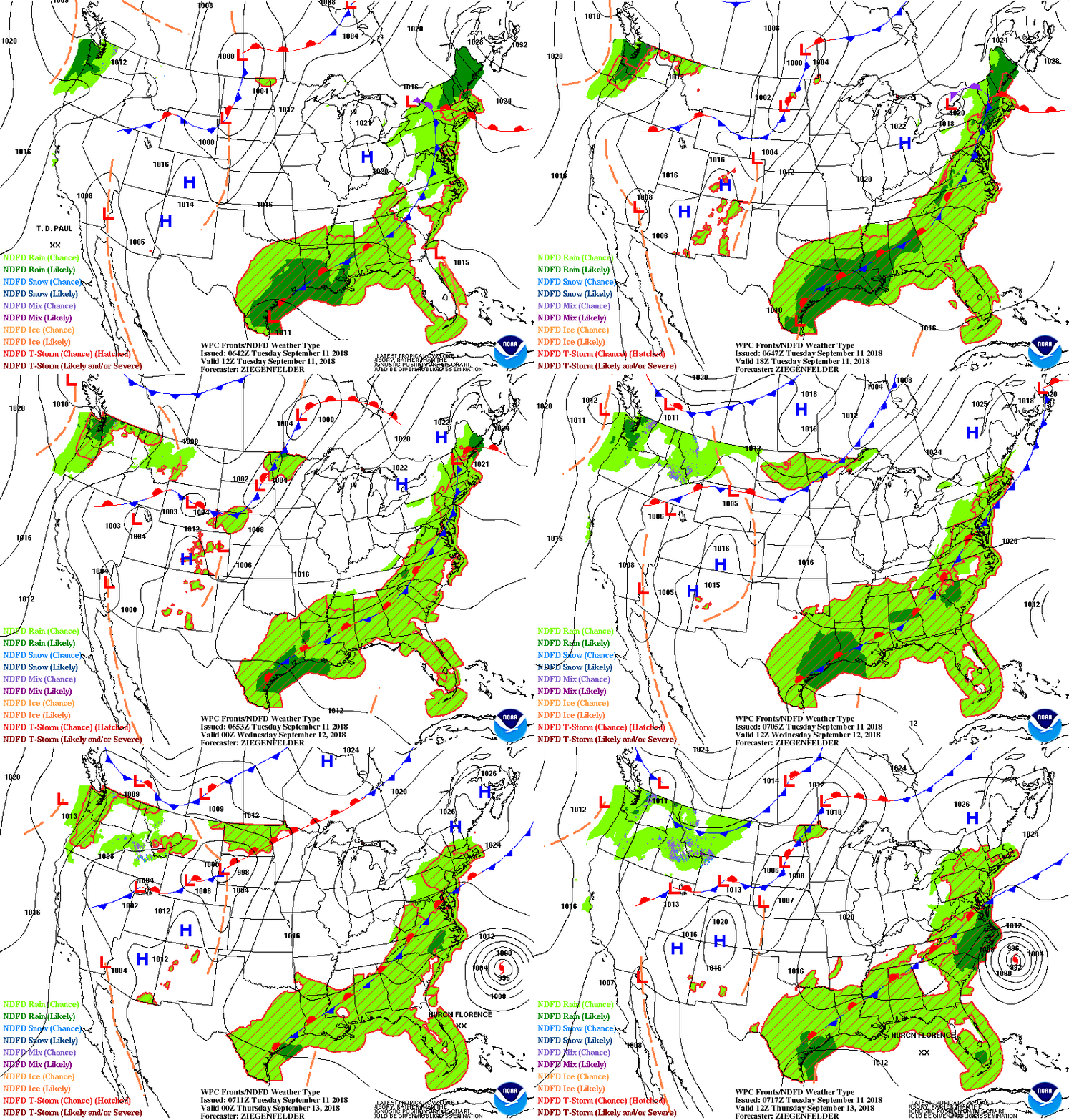
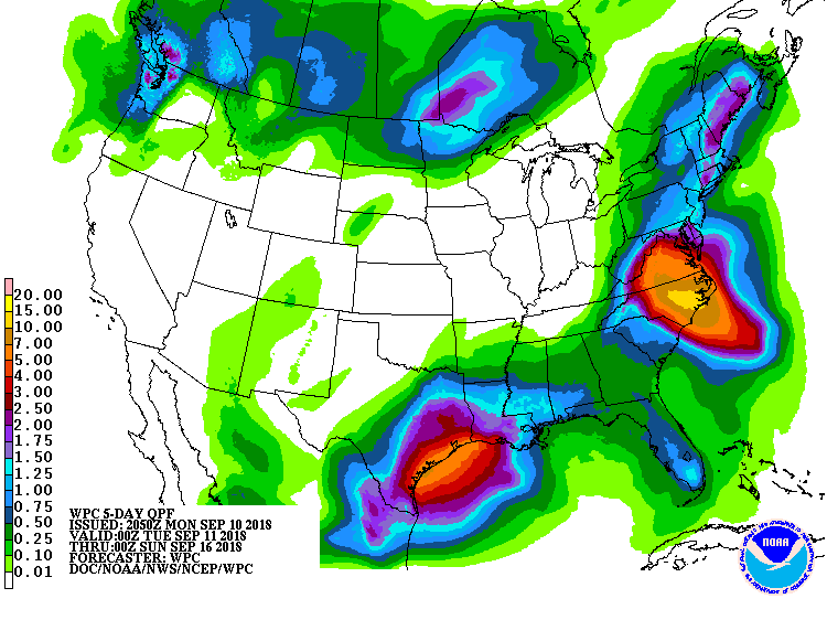
Lastly - animated maps for next 2 days...followed by rainfall next 7 days.
We will be updating Florence as needed. Be safe.
We will be updating Florence as needed. Be safe.


 RSS Feed
