
Satellite shows Hurricane Marie off Baja, Ca....and Hurricane Cristobal moving out of The Bahamas. Both behaving and not threatening land. Storms in Midwest are headed for Gt. Lakes otherwise quiet.
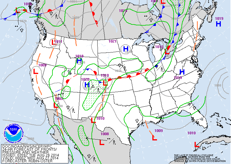
Map for late today - cold front moving thru Great Lakes will be off the Northeast east Wednesday. It will stall east to west and thenlift north over Labor Day Weekend when it will bring warm and humid weather north with chance of thunderstorms....to eastern half of The Nation.
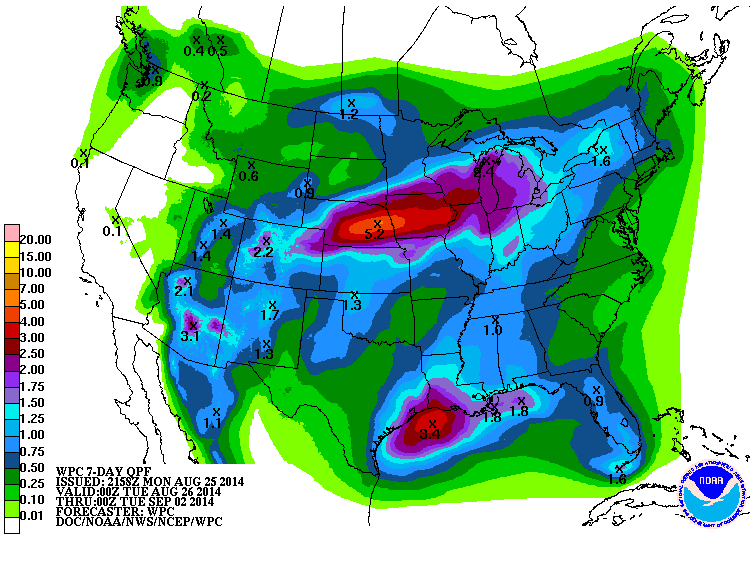
Above map shows expected rainfall through next Tuesday. Heaviest rains from Colorado to Michigan....Nebraska and Iowa getting over 5". Other area of heavy rain...Texas/Louisiana coasts.
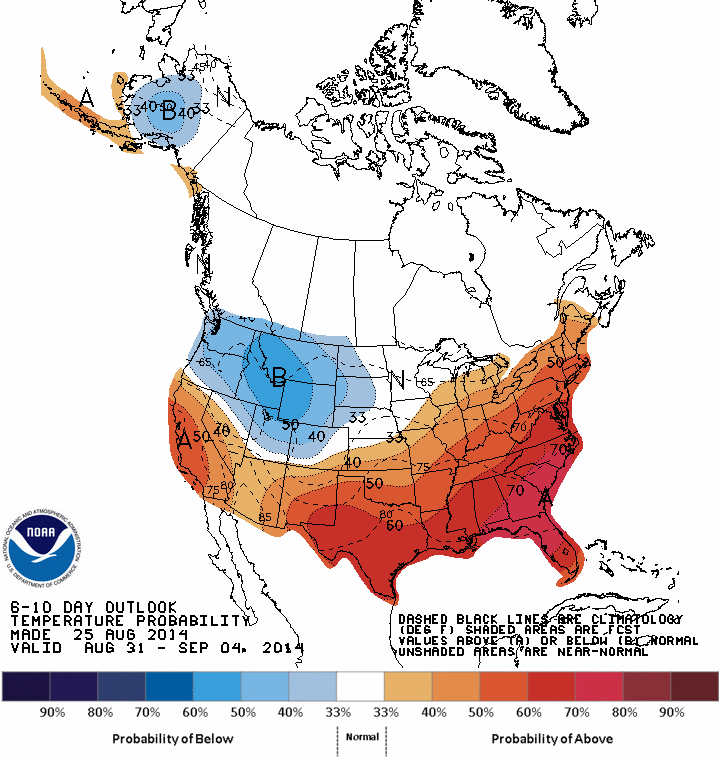
Map above shows how daytime temperatures will average thru Sept. 4....which is above average for much of the Nation.
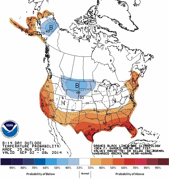
Above map shows how daytime temps. will average from Sept. 4- to Sept. 8.......above - south and east.....rest of the nation near normal. Be safe. Later.

 RSS Feed
