
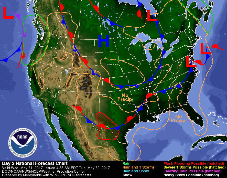
Notice the curl north of Lake Superior: that upper low is causing bands of moisture over the eastern half. This pattern holding into weekend. Below...current map....
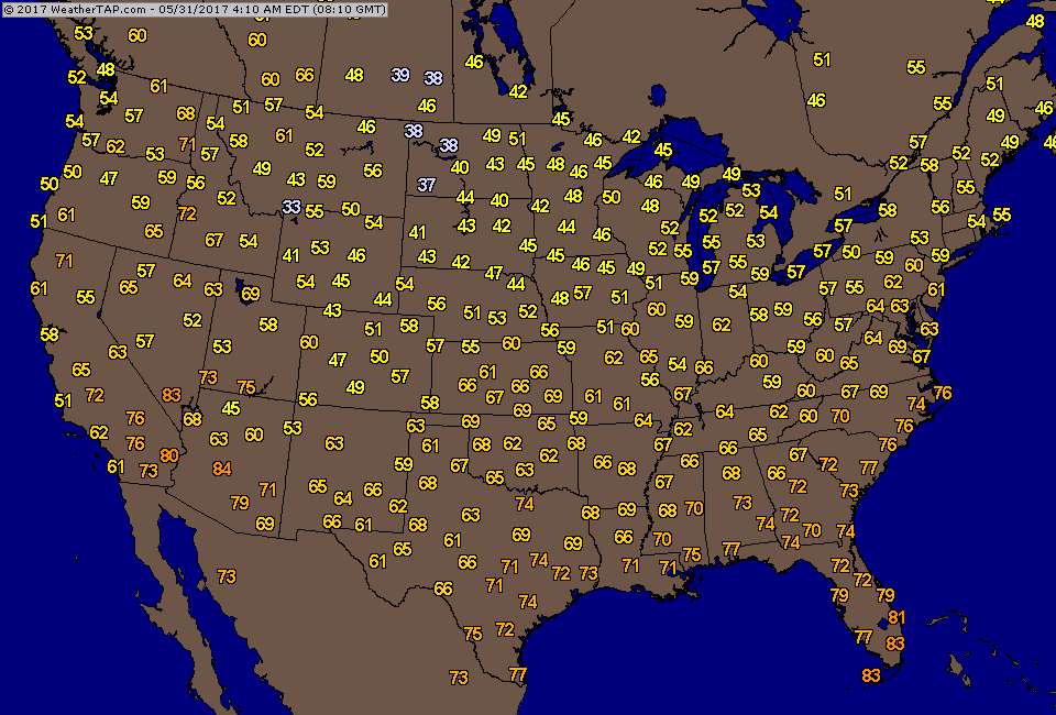
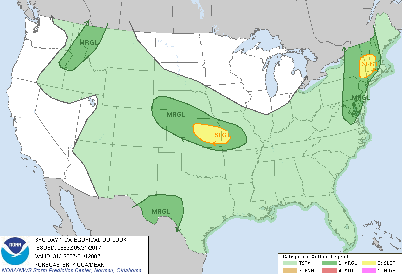
Below - current temperatures - notice the coolness. Below that - risk of severe weather today in dark green and yellow.
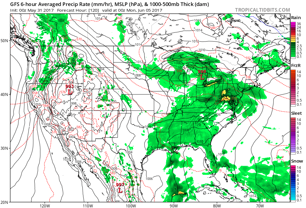
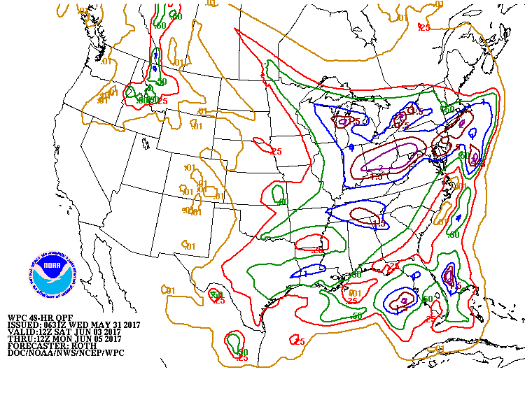
Above - GFS Model for this Sunday. Wet weather from Great Lakes to Northeast and down through The Gulf. Below - amounts of rain expected this weekend.
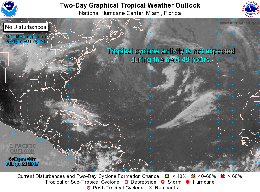
Finally - tomorrow begins the North Atlantic Hurricane Season. Many forecasters think it will be above normal....we do not. However...we do not think it is very possible to predict these storms....so it's anyone's guess. Unfortunately...all you need is 1 to hit the U.S. and it was a bad season. Below - the Atlantic basin. Be safe.

 RSS Feed
