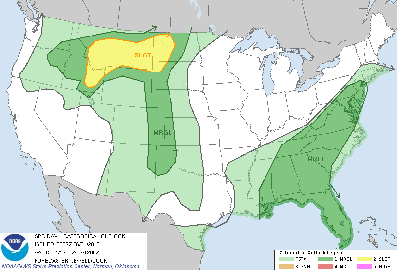
Today's severe threat - marginal in dark green...better chance in yellow.
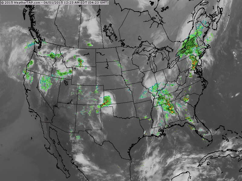
Heavy rains noted in Northeast with another batch coming across the Ohio Valley. Small area for Texas panhandle...and widespread showers in Northwest. Fan of clouds deep in Gulf could turn out to be our next tropical trouble.
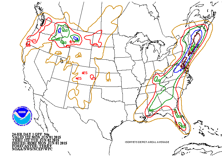
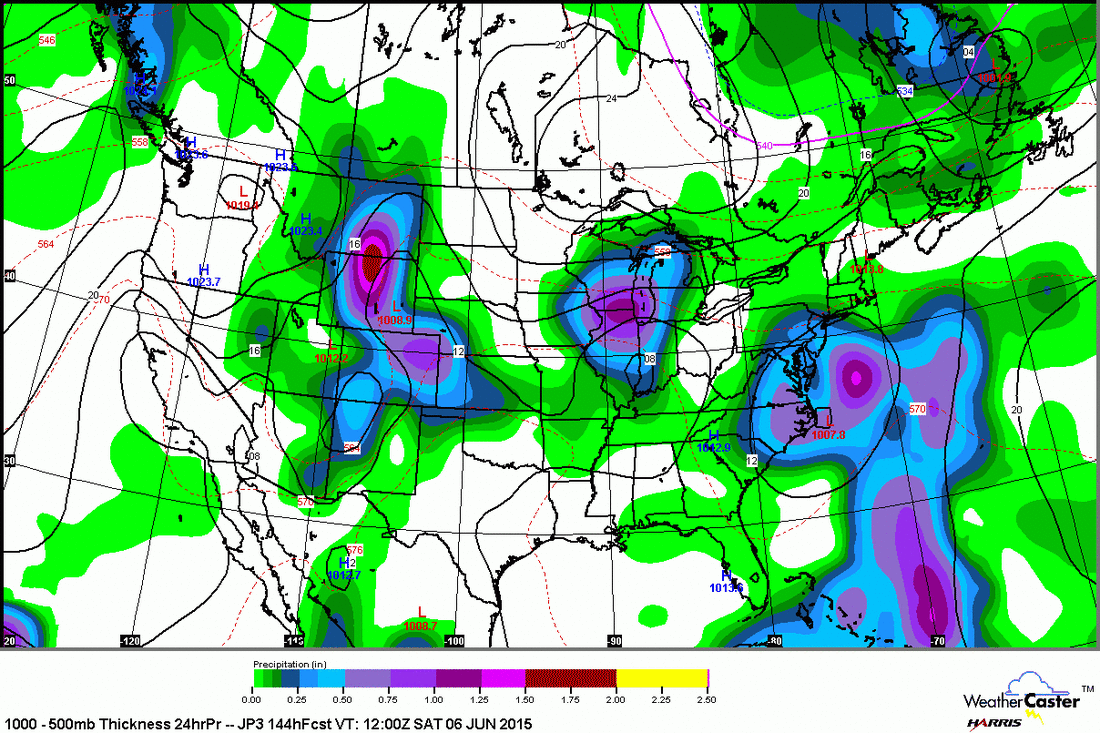
Rainfall amounts for next 24 hours.....1"-2" in Northeast.
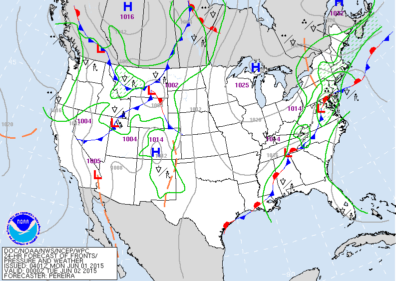
Today's map shows wavy front resulting in the wet weather east......with next web of fronts causing showers out west.
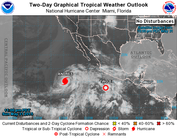
Latest Pacific Map shows Hurricane Andres with 140 mph winds moving west. Expected to weaken next day or two.
Japan Model for this Saturday forming a storm near Cape Hateras N.C. likely to bring rain up the coast. Other models keeping that system well offshore. We shall see.
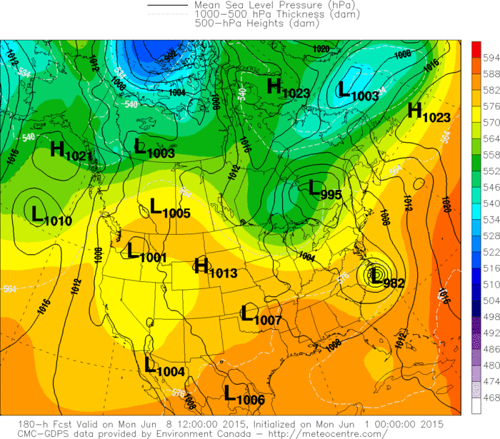
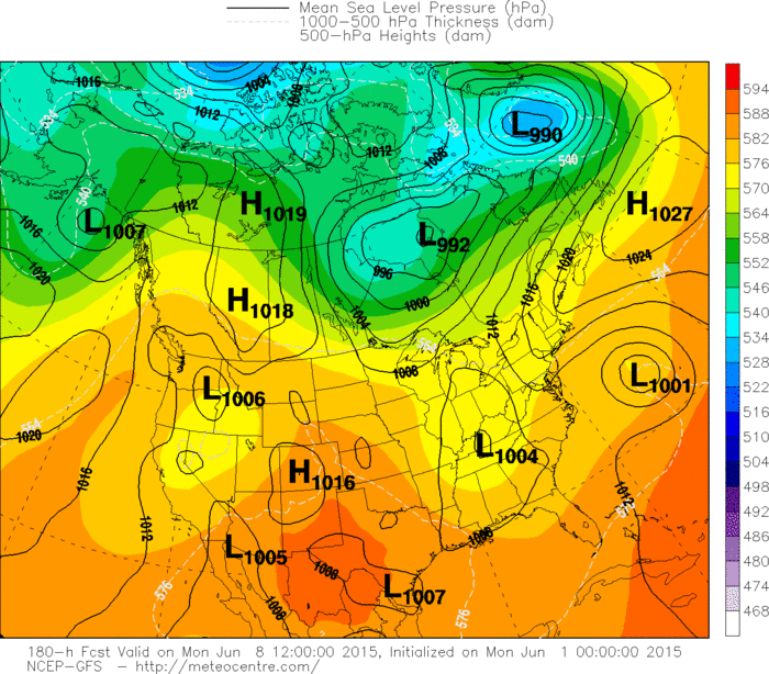
Canadian model for Next Monday - showing a tropical system headed for North Carolina. Below...The GFS Version....other models...not saying much. Be safe.

 RSS Feed
