
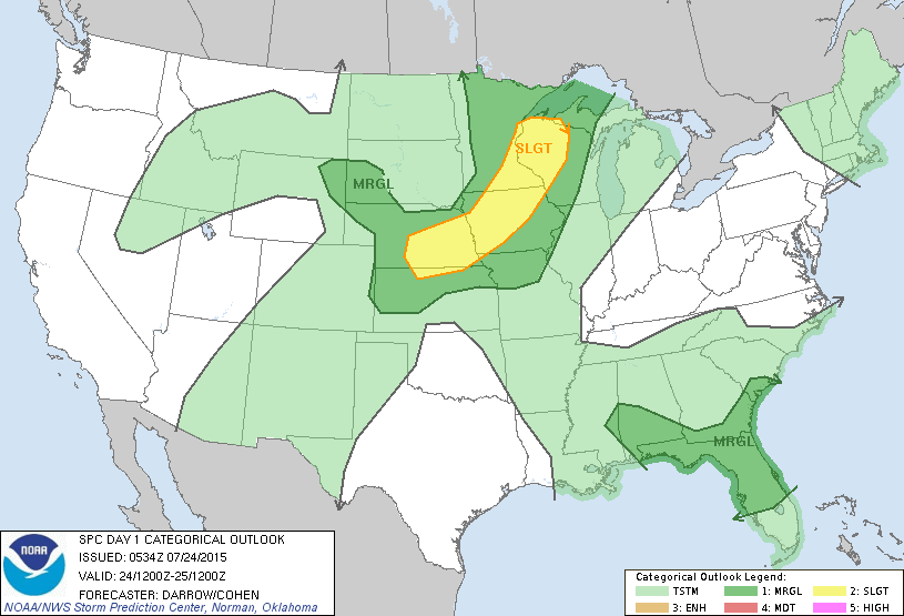
An old front continues to produce thunderstorms in southeast ....and could be the focus of something tropical next week. Heavy Storms in Minnesota should weaken as they cross the Great Lakes and into the Northeast this weekend. Below...today's risk of severe weather...dark green and yellow.
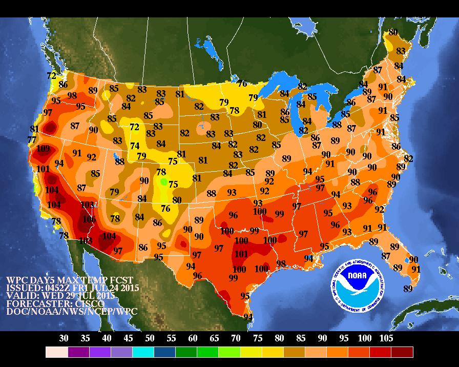
Above...map shows temperatures for mid part of next week.Could be another July heatwave before month goes out.
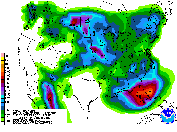
This map shows rainfall for the next 7 days. Florida takes the brunt with as much as 8" !
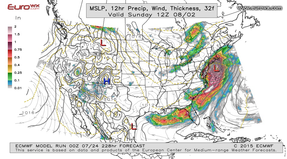
This is the Euro Models - 10 days out - next weekend. The model continues to show a tropical system along the coast and moving up the coast bringing rain and wind all the way up to New England. It's a long-long- shot...but the Euro has a tendency to get these things right well in advance and then it backs off when getting closer. I think this time the model is going to be on to something. Be safe.

 RSS Feed
