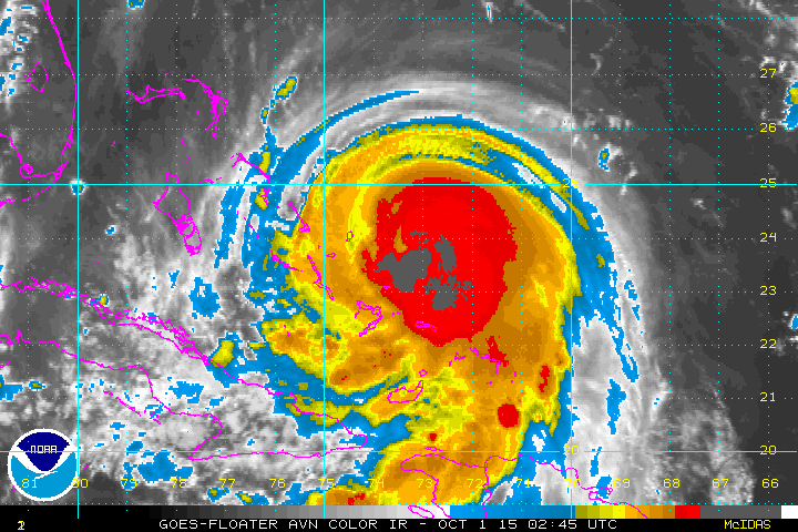
Shot of Joaquin early Thursday. He has 120 mph winds and is moving slowly southwest at 4 mph. The Euro model has been insisting that storm will turn northeast into the Atlantic ...and then the GFS model overnight was targeting Long ISland. The new update from that model is now trending toward the Euro....which could be a miss for
much of the East....but still too early to call the shots.
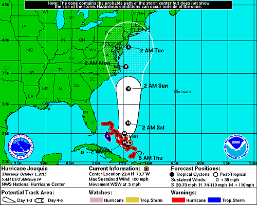
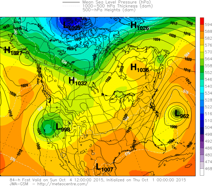
Below....the official track from hurricane center.
much of the East....but still too early to call the shots.
Below....the official track from hurricane center.
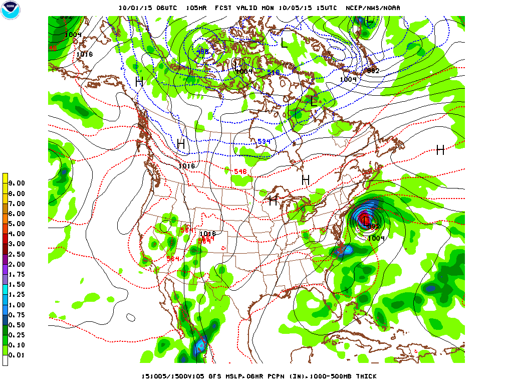
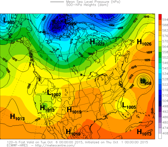
Above....the latest GFS model showing the hurricane to
turn northeast away from the coast.
turn northeast away from the coast.
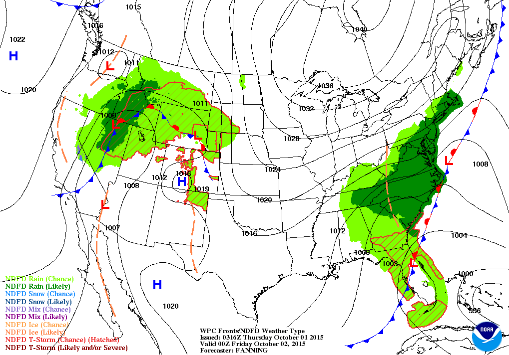
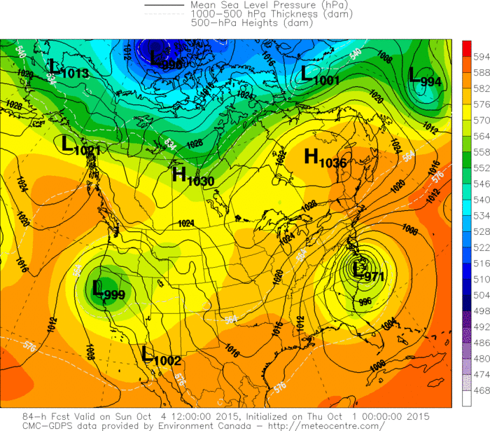
Map above is valid for Thursday evening. Wet weather along east coast due to stalled front. Wet for Intermountain region and Rockies. Below...the models showing their guess for what will happen with Joaquin. Will update through the day. Be safe.


 RSS Feed
